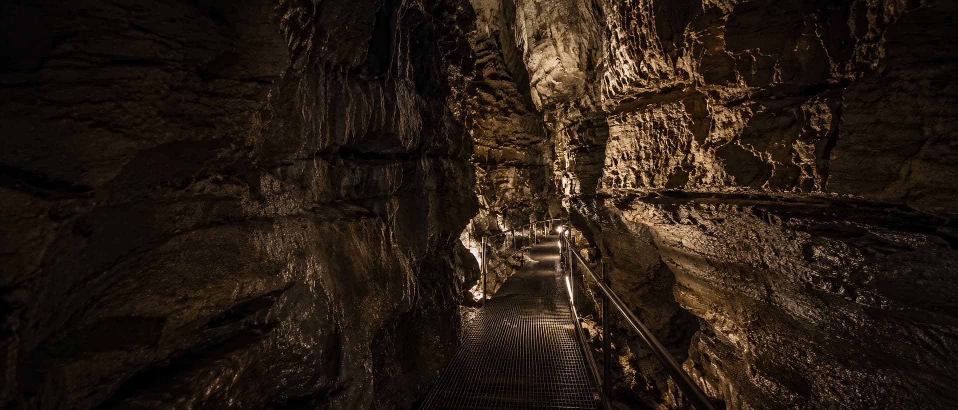
🕳️ Three Lake District caves — all free, no tickets, walk-up. Directions, parking and how to visit each one.
Free · no tickets · open access Family-friendly slate-quarry caverns
🕳️ 6 caves & caverns · All free to visit
Caves in the Lake District
Start with the big three slate-quarry caverns — Rydal Cave, Cathedral Cave and Hodge Close — all free, open access and walk-up. Then three more caves worth knowing, from a Borrowdale hermit's home to a clifftop bivvy for experienced hillwalkers. Directions, parking and honest notes for each.
Caves and slate quarries you can actually walk into
The Lake District's "caves" aren't natural caverns — they're the dramatic legacy of centuries of slate quarrying, and they're some of the most atmospheric places in Cumbria. The big three are Rydal Cave above Rydal Water, Cathedral Cave in Little Langdale, and the flooded Hodge Close Quarry. This is the complete guide to visiting all three — and, lower down, three more caves worth knowing, from Millican Dalton's hermit home in Borrowdale to a sandstone folly in the Eden Valley.
And the thing everyone gets wrong first: they're all free. No tickets, no booking, no opening hours — you just turn up and walk in. People search "Rydal Cave tickets" or "Cathedral Cave reviews" expecting a paid attraction; they're open-access sites on National Trust and common land. They're also genuinely family-friendly — local families visit them all the time. The only real care needed is around the deep water at Hodge Close and the dark connecting tunnel at Cathedral Cave, both covered below.
The big three
The three caves worth the trip
Each links through to a full guide with directions, parking, postcodes and how to visit.
Rydal Cave
Free · Easiest
📍 Near Ambleside · 🚶 30–40 min · 🐕 Dog-friendly
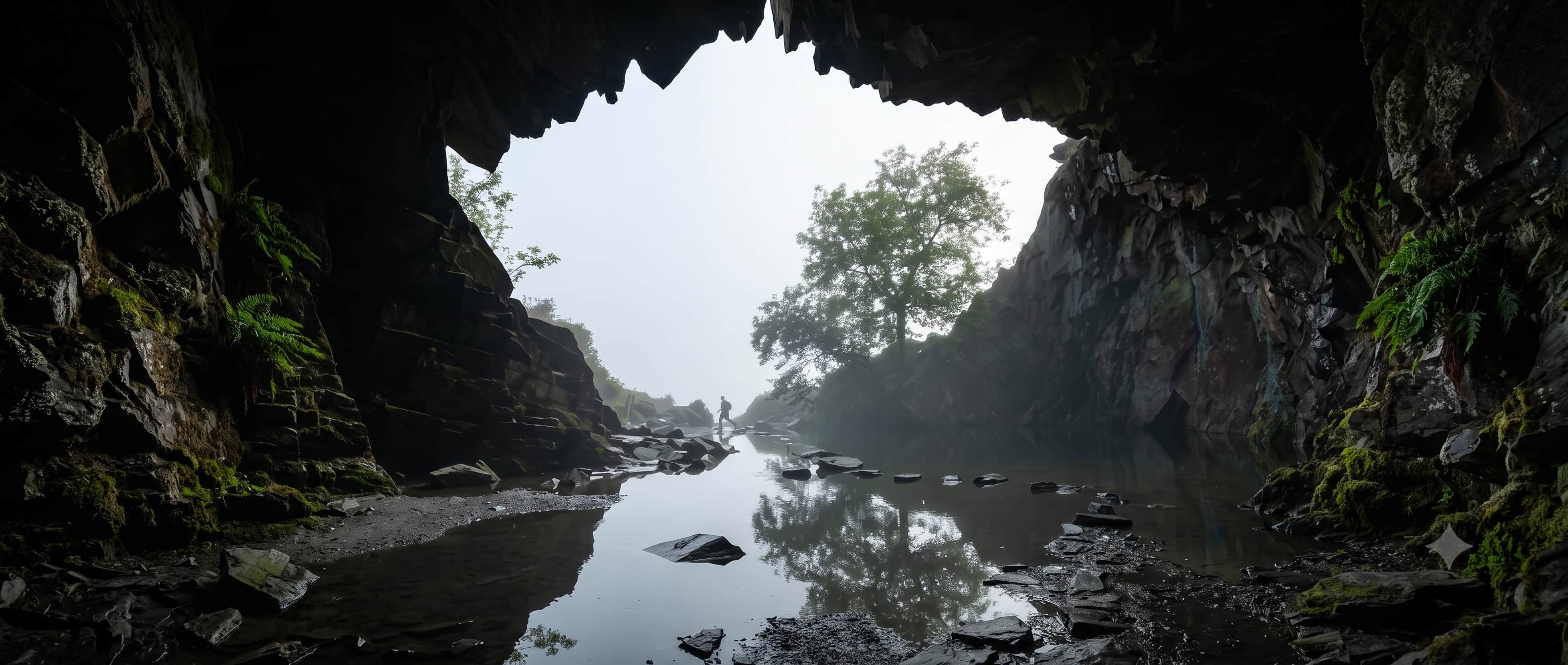
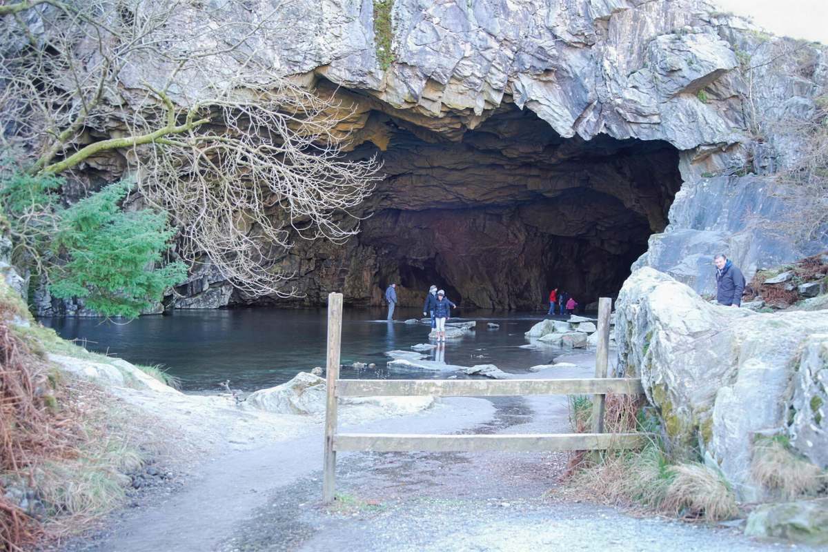
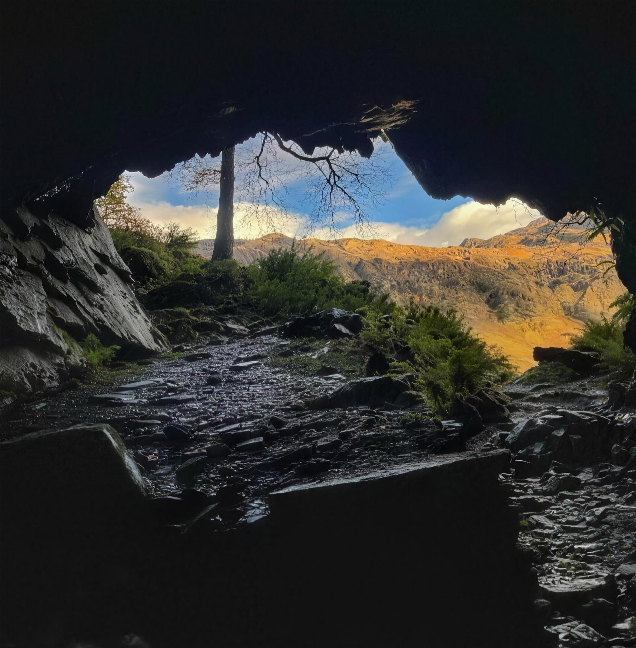
The most popular and accessible of the three — a vast slate cavern above Rydal Water with a shallow pool at its mouth that people stepping-stone across for the classic photo. Reached on the lovely Rydal Water / Loughrigg Terrace walk. The family favourite.
📍 Little Langdale · 🚶 30–45 min in · 🔦 Torch for one tunnel
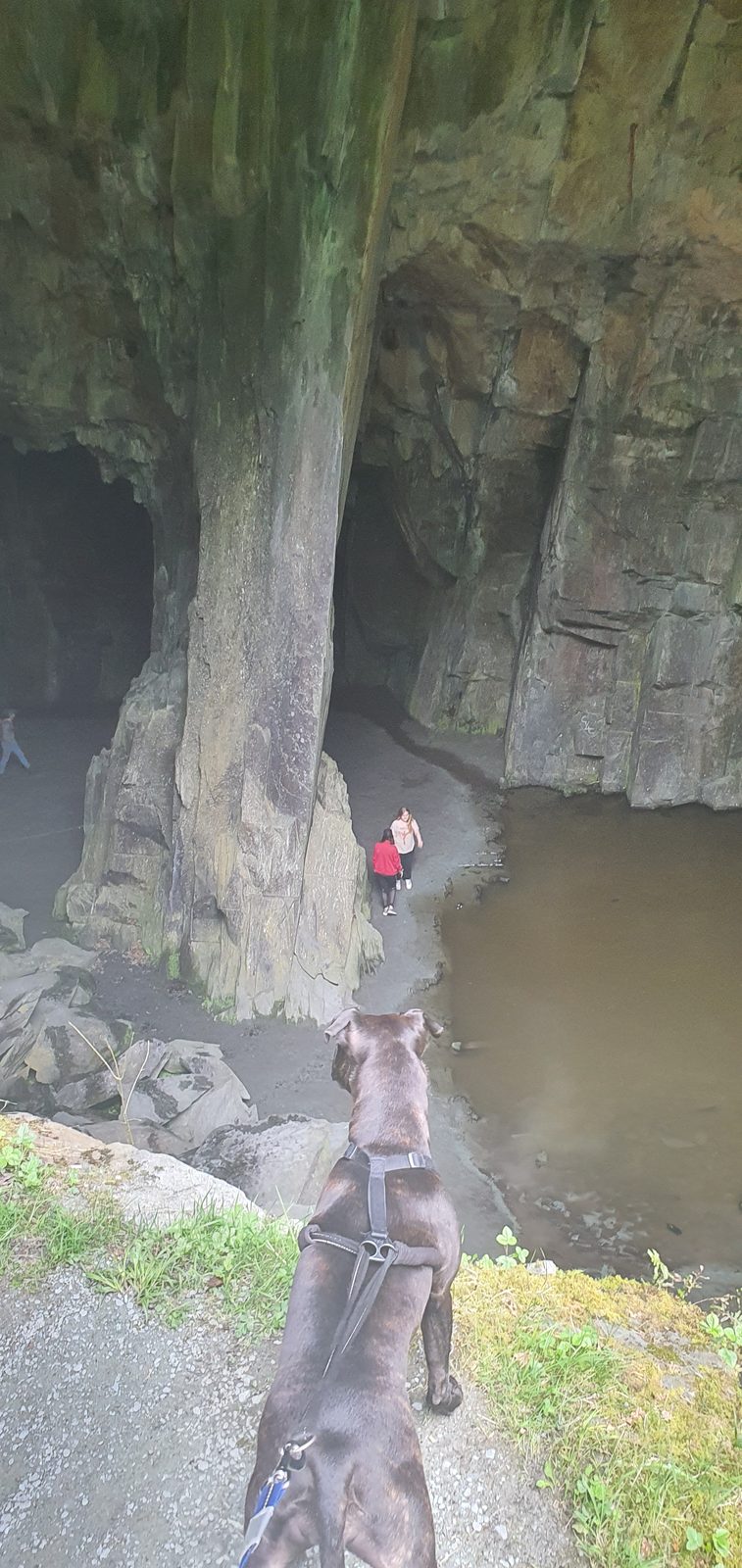
Also called Cathedral Quarry or Cathedral Cavern — a breathtaking 40-foot chamber lit by two natural "windows," hence the name. Reached via the packhorse Slater's Bridge. Note: the main chamber is open, but a recent rockfall has closed the upper tunnels — follow on-site signs.
📍 Little Langdale · 📸 The "skull" arch · ⚠️ Deep pool
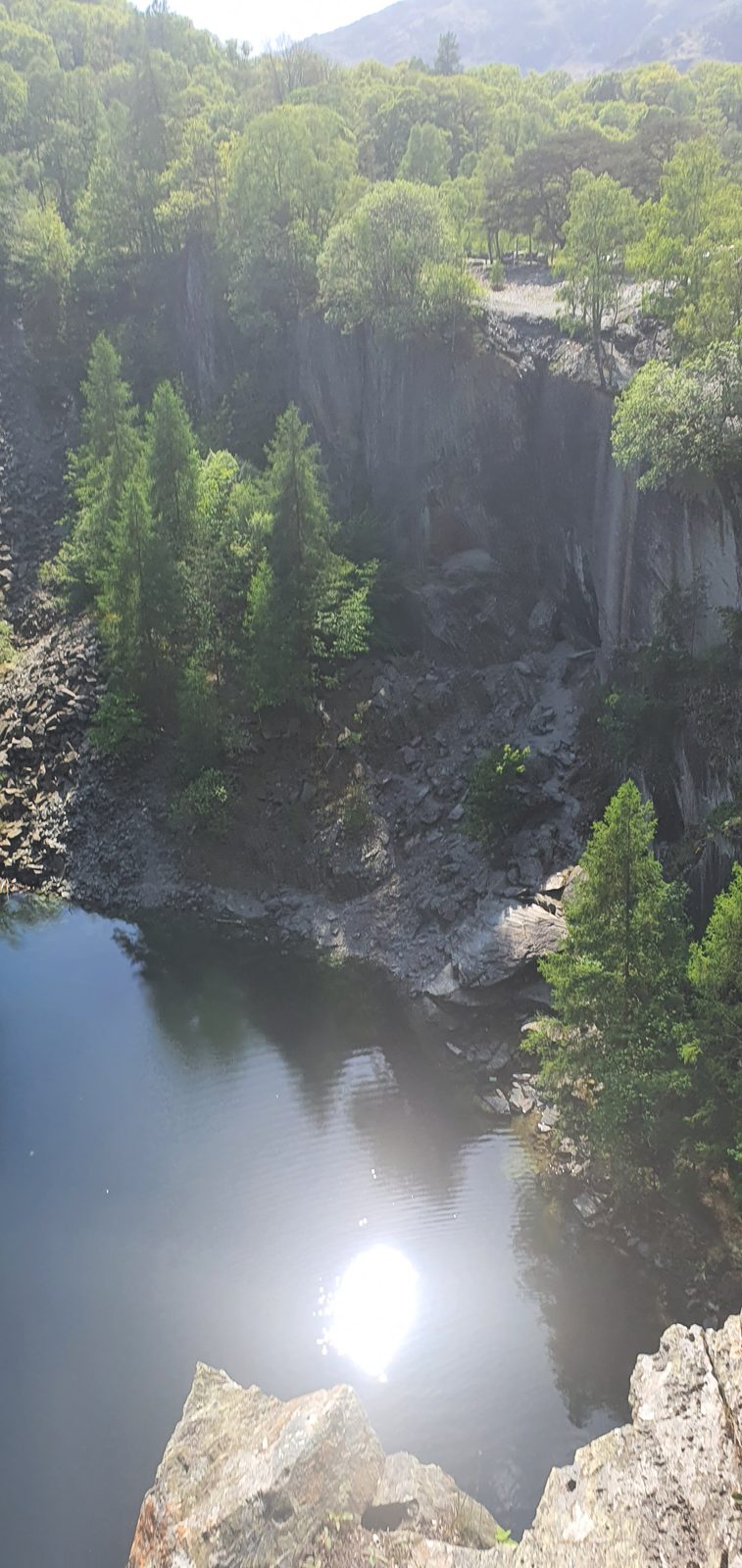
A dramatic flooded slate quarry — a huge arch above a deep green pool. From the right angle the arch and its reflection look like a giant skull. A spectacular, safe photography spot from the edge; the pool itself is very deep and not for swimming. Often combined with Cathedral Cave.
Beyond the big three, the Lakes hide a handful of other caves worth the walk — from the hermit's home on Castle Crag to a sandstone folly above the River Eden, and a famous clifftop bivvy that's strictly for experienced hillwalkers. Here's how to find them, and what to know before you go.
Millican Dalton's Cave
Free · History · Easy–moderate
📍 Borrowdale, near Keswick · 🚶 ~3 miles return from Rosthwaite · 🐕 Dog-friendly · 🔦 Torch handy
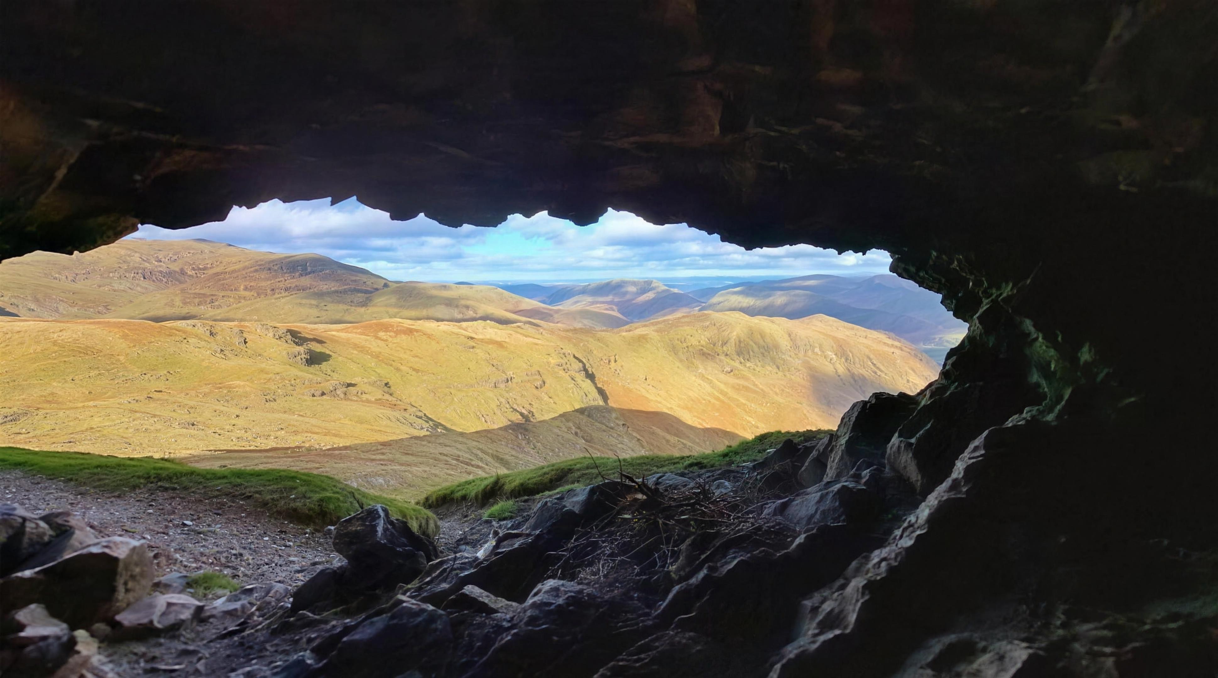
The cave where a man lived for 50 summers. Millican Dalton, the self-styled "Professor of Adventure," made his home in these former slate-quarry caves on the flank of Castle Crag in the early 20th century, working as a mountain guide and famously rafting down to Keswick for coffee and cigarettes. In the upper "sleeping" cave his carved inscription survives: "Don't waste words jump to conclusions."
It's a two-level quarry cave in the woods on the eastern side of Castle Crag, above the River Derwent in the Jaws of Borrowdale — reached on an easy, mostly flat riverside walk from Rosthwaite (~3 miles return / under 3km each way). From the Rosthwaite NT car park, head through the village past Yew Tree Farm (Flock-In tearoom), down to the river, cross New Bridge (or the stepping stones if low), then follow the riverside path north. Watch for an unmarked path forking up to the right into the old quarry workings — the cave is up in the trees and is genuinely easy to miss. The lower entrance is a small outlying cave; take the path up to the right for the main cave, which is dry inside, with the inscription in the upper chamber.
Honest note: the cave itself is an easy family adventure, but there is no safe direct path between the cave and Castle Crag's summit — dangerous ground lies between them. To bag the summit too, return to the main path and take the proper route (steep, loose slate). Don't freelance up the crag from the cave.
Nearest pub / refuel: the Flock-In Tea Room (Nook Farm, Rosthwaite — NT tenant-farm café, on the route); nearest pubs the Riverside Bar at the Scafell Hotel, Rosthwaite and the Langstrath Country Inn, Stonethwaite.
📍 Dove Crag, near Patterdale · 🚶 ~5.5 miles, serious mountain walk · ⛰️ Exposure + scramble · 🌥️ Good visibility essential
This is not a family walk-up — read this first
The Priest's Hole is a high bivvy cave cleaved into Dove Crag at over 600m, reached by a long mountain walk and a final faint, exposed, hands-on scramble. Attempt it only in good visibility and dry, snow- and ice-free conditions. The access path is faint and the cave can't be seen from close up — people get lost in mist. Wet, greasy or icy rock makes the traverse genuinely dangerous, and there are sheer drops on the exposed section; in winter this is a mountaineering objective (axe and crampons), not a walk. Not suitable for young children or anyone uneasy with heights or scrambling.
One of the Lake District's most famous "secret" shelters — a tear-shaped cave high on Dove Crag with a dry-stone wall across its mouth, a visitors' book inside, and a 180° panorama of the northern fells, beloved of wild campers and bivvy-baggers. Despite the name it was almost certainly never a real priest's hiding hole — likely a romantic later name (possibly a hermit's cell). A genuine "priest hole" actually sits in the fireplace of Hartsop Hall, the farm you pass on the way.
From Cow Bridge car park by Brothers Water, follow the path along the lake to Hartsop Hall, then take the fainter right fork climbing alongside Dovedale Beck (keep the beck on your left, don't cross). Climb until the ground steepens then grasses over and head for a large boulder; from there a faint sheep trail curves left and up across the faultline to the cave, visible as a dark tear-shaped shadow on the crag in clear weather. The final approach needs hands on rock for a couple of moves. Allow a full half-day (~5.4–5.8 miles round trip). If you wild camp, pack everything out — litter is a recognised problem here, and the cave fills up, so have a backup plan.
Nearest pub / refuel: the Brotherswater Inn (campsite shop does takeaway breakfast baps; meals evenings/weekends) is closest; also the White Lion, Patterdale.
📍 Eden Valley, near Kirkoswald & Little Salkeld · 🚶 0.93 mi each way from Kirkoswald (~20 min) · 🐕 Dogs on leads · 🏛️ Georgian folly
Worth knowing: this one is in the Eden Valley near Kirkoswald, not the central Lakes — it's outside the National Park. We include it as a bonus day-trip for visitors basing in the north Lakes. Peter field-walked it on 1 August 2026, so the directions and path notes below are from the ground.
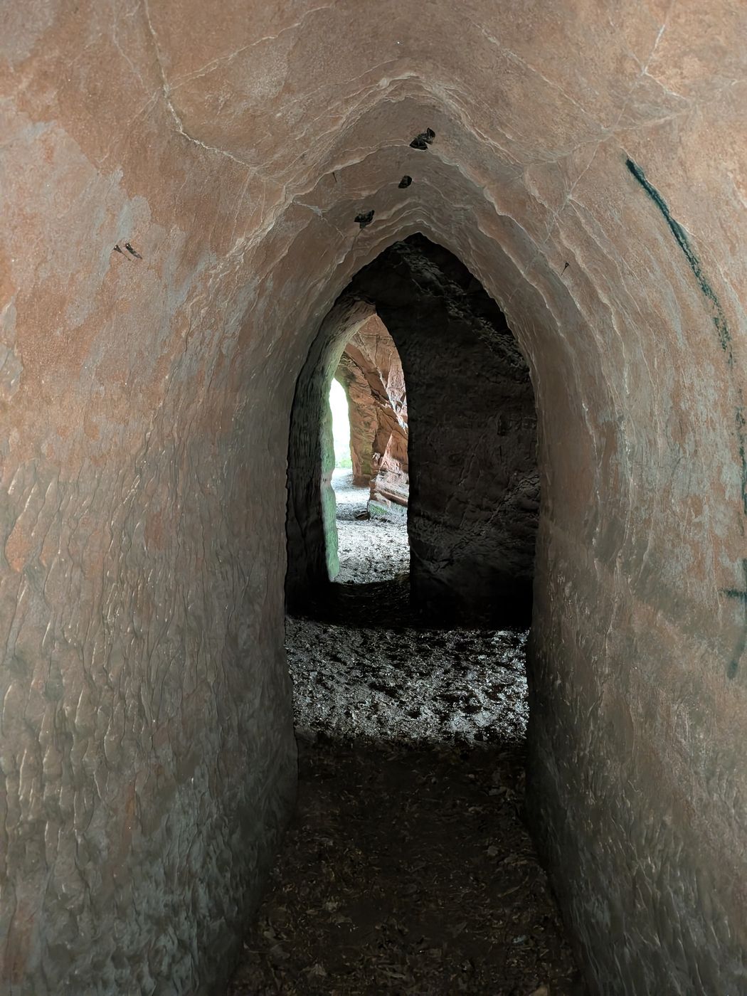
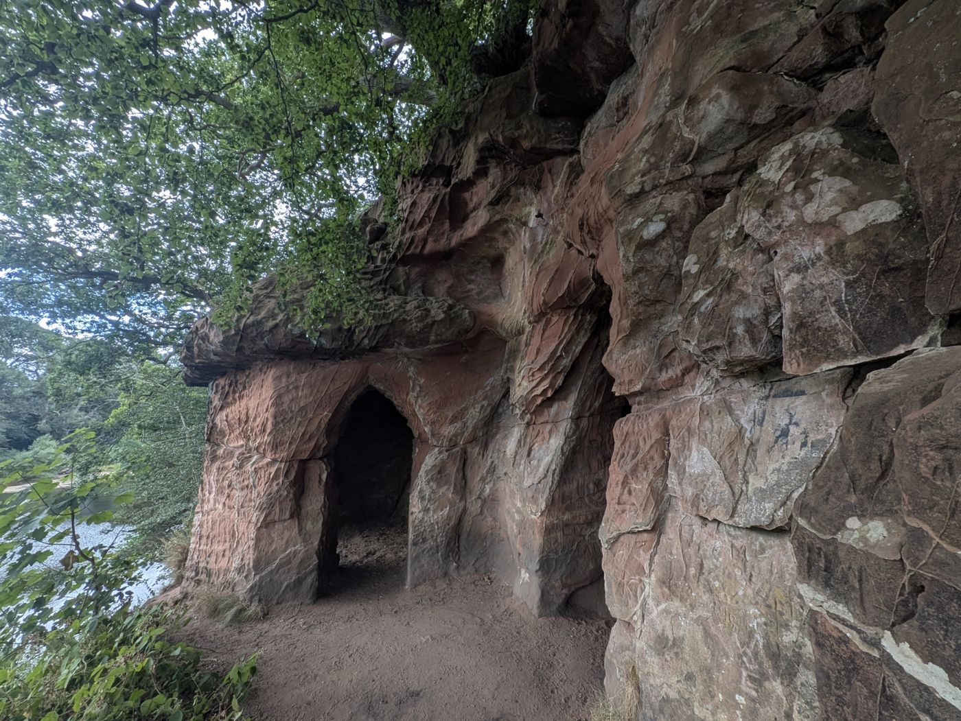
Five chambers cut by hand into the red sandstone cliff above the River Eden, just north of Little Salkeld. They were commissioned by Lieutenant-Colonel Samuel Lacy of Salkeld Hall; their exact purpose isn't known, but they were used for entertaining guests, and ornamental gardens were originally planted around them. The date is uncertain — sources place their creation somewhere between the late 18th century and the 1830s.
Local stories — told for atmosphere, not established fact — say the chambers were used to store wine, that Lacy paid a hermit to live in them, and that he once tried to blow up the nearby Long Meg stone circle with gunpowder, only for a sudden storm to stop him.
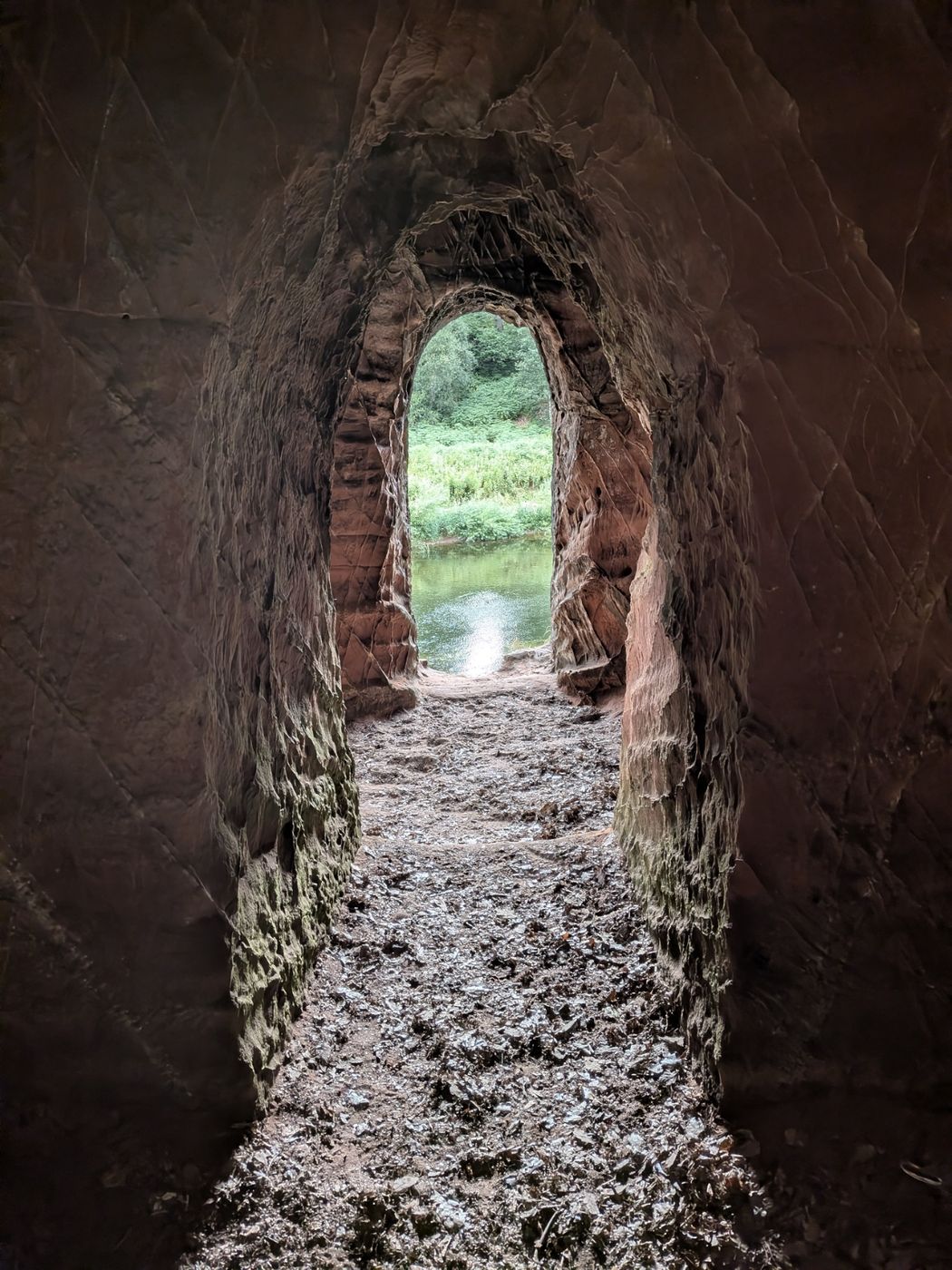
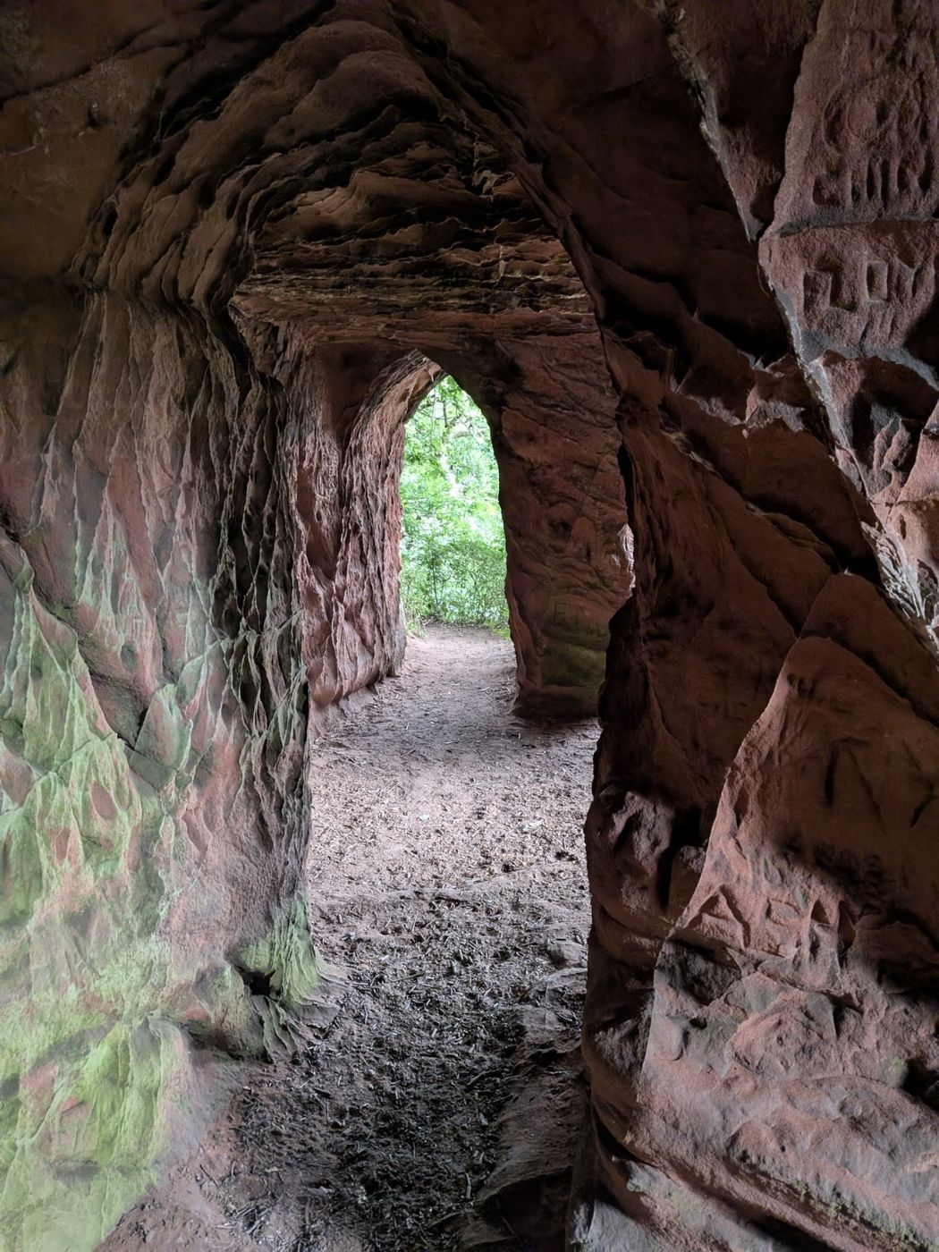
Inside the caves, looking out through a window opening to the Eden.
Getting there — the Kirkoswald approach
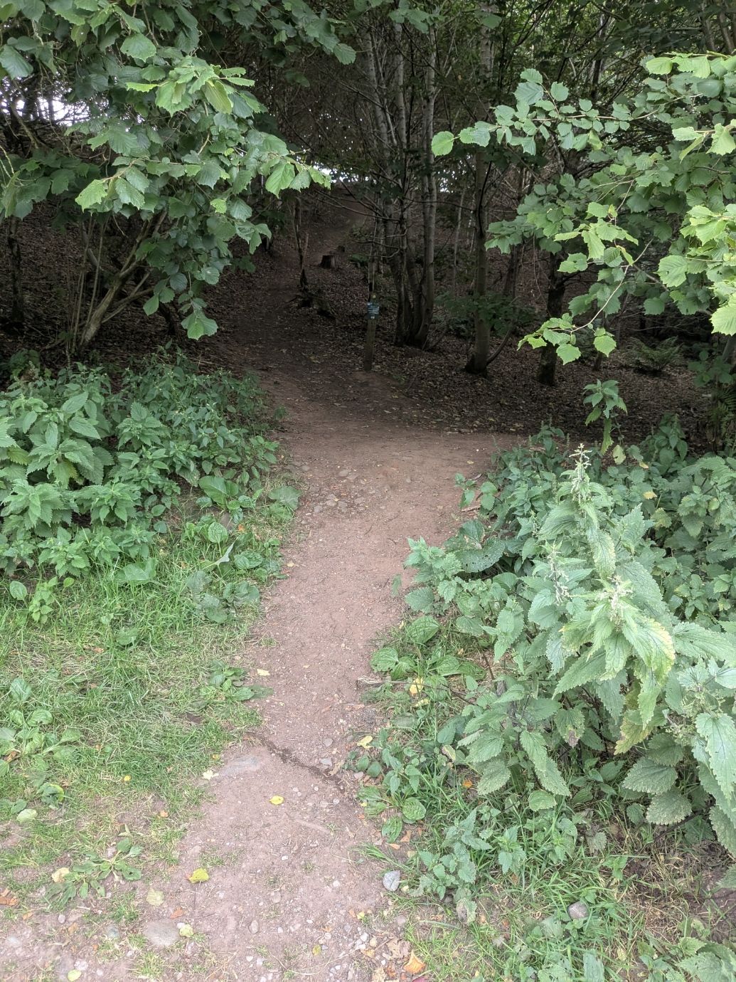
From Kirkoswald, follow the road for about a mile — you'll pass Mains Farm on your right — until it drops into a dip. There's a small parking place on the right, and a gap in the wall where the path starts. There's no postcode for the lay-by, so use these directions or the what3words below.
The path start — the gap in the wall by the parking dip, uncropped so you can recognise it from the road.
The walk & the path
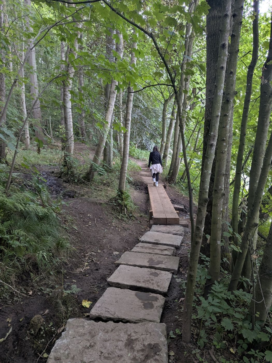
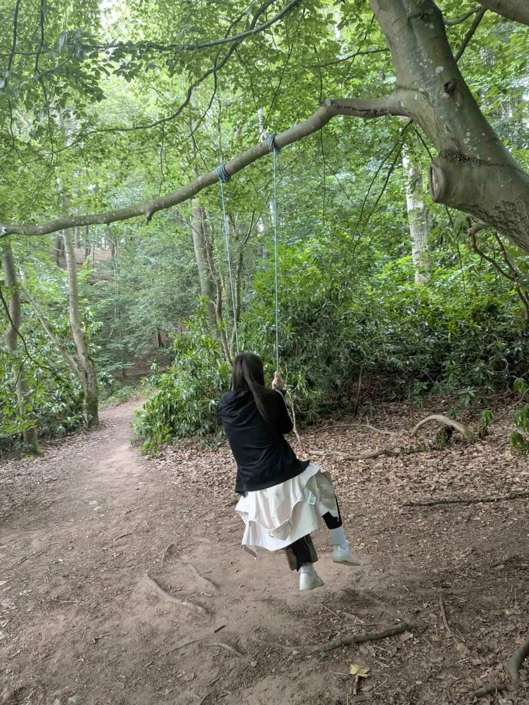
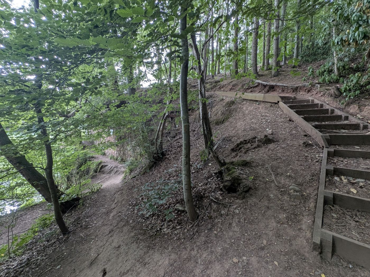
It's 0.93 miles each way — just under a mile — and about 20 minutes at an easy pace (GPS-tracked), so a round trip is just under two miles, or roughly 45 minutes with time at the caves. The route is a riverside woodland path with wooden steps and boarded sections. One stretch runs close to the drop above the Eden and is narrow, with some erosion — take care here, especially with children and after rain. There's a rope swing in the woods along the way, too.
Steps and the narrow section.The rope swing on the way.
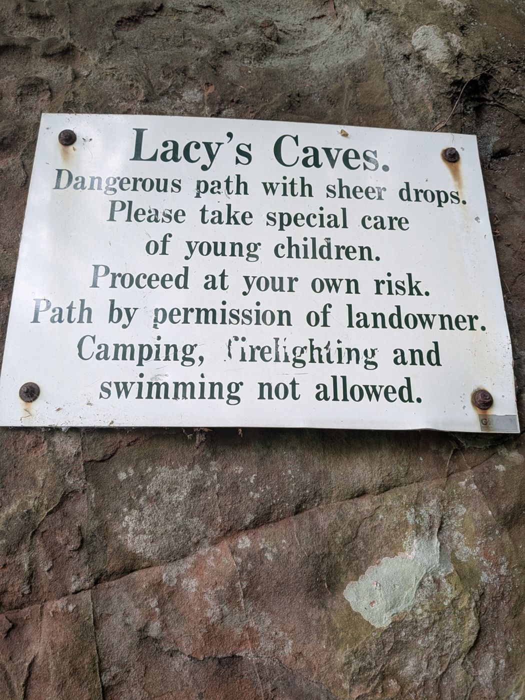
Safety & access — please read: this is a permissive path — you're there by the landowner's goodwill, not on a public right of way, so access could be withdrawn at any time. The sign at the caves asks visitors to take special care of young children, warns of sheer drops, and states that you proceed at your own risk. Camping, lighting fires and swimming are not allowed. The chambers sit on the cliff edge with unfenced drops straight to the fast-flowing Eden — both outside and through the window openings — so keep children close. Peter walked it on 1 August 2026 and it was open then, but being permissive it can change; we post access updates in the What the Fell newsletter.
The sign at the caves — worth reading before you go in.
The caves & the setting
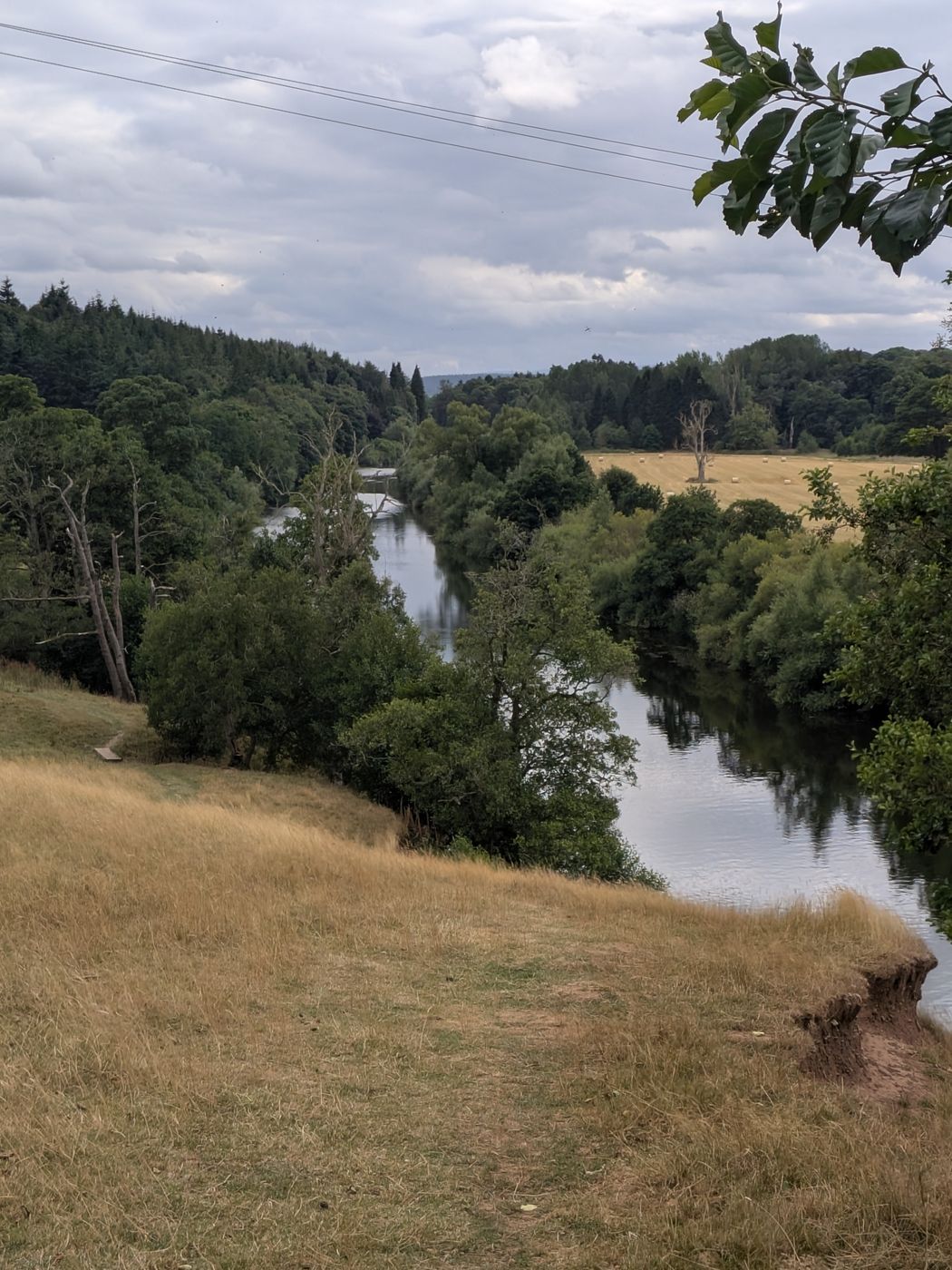
The five linked chambers have window openings that frame the river, with stone benches inside — a genuinely atmospheric spot above a beautiful reach of the Eden.
The entrances in the sandstone.A carved arch inside.
The linked chambers.The Eden from the path.
Getting there
Kirkoswald side — small lay-by in the dip past Mains Farm
0.93 mi each way · ~20 min (just under 2 mi round trip)
Terrain
Riverside woodland; wooden steps, boarded sections; one narrow eroded stretch near a drop
Access
Permissive path · no camping / fires / swimming
Longer alternative — from Little Salkeld & Long Meg: many people reach the caves from the Little Salkeld side instead, as part of a longer circular that also takes in Long Meg and Her Daughters, one of the largest stone circles in England — the two pair well. We haven't field-checked that route, so treat its details as unconfirmed: roughly a 4.75-mile circular, parking around Little Salkeld village, with refreshments at the Watermill or in the village.
The walk-up caves on this page are all free and open. For a guided experience deep inside a working mountain, Honister Slate Mine near Borrowdale runs ticketed underground mine tours, climbs and via ferrata (ages 4+). It's a paid attraction rather than a free walk-up — so it isn't one of the caves above — but it's the best way to see the inside of a Lakeland mountain.
A short drive over the border into the Yorkshire Dales — and, unlike the six free walk-up caves above, this one is a paid, guided, ticketed show cave. We've included it because it's the natural pairing with the Ingleton Waterfalls Trail and Ribblehead Viaduct: one brilliant day out, easily reached from the eastern Lakes.
White Scar Caves
Paid · Guided · Ticketed
📍 B6255, ~2mi from Ingleton · ⏱️ Guided ~80-min tour · 🌡️ ~8°C year-round · 🚗 Drive-up car park
White Scar is a genuine natural limestone cave — not a slate quarry like the Lakeland "caves" above — and it's billed as the longest show cave in Britain. You explore it on a guided tour (around 80 minutes) along lit walkways, past underground streams and waterfalls to the vast Battlefield Cavern, with its forest of stalactites. It's a proper all-weather attraction: perfect for the day the Dales weather turns.
Because it's a managed attraction, it's paid and ticketed — booking is advised in peak periods — with a café and shop on site. The tour involves steps and some low passages, so it's not step-free; wear sturdy footwear and bring a warm layer, as it stays around 8°C and can be wet and drippy underfoot whatever the season.
Honest, like the rest of this page: White Scar is a commercial show cave with an admission charge — not a free wild cave like Rydal or Cathedral. Tickets are £20.50 adult (16+), £15.00 child (free under 3) and £57.50 family (2 adults + 2 children, or 1 adult + 3 children). It's open daily from 10am February–October, and weekends only November–January (excluding school holidays), weather permitting — tour times are shown at the ticket office on the day. Pre-booking is available but not necessary (advance booking only for groups of 30+).
White Scar or Ingleborough Cave — which is better?
It's the question people ask most, because there are two ticketed show caves near Ingleton and they're easy to mix up. Here's the honest difference — and which one fits this day out:
White Scar Caves
Ingleborough Cave
Location
B6255, 2mi from Ingleton
Near Clapham
Getting there
Drive up, car park at entrance
~20-min scenic walk in from Clapham
Tour
Guided ~80 min · longest show cave in Britain
Guided, shorter; separate operator
In this day out?
✅ Yes — 5 min from the falls
❌ Different side — its own trip
Both are worth doing — but only White Scar sits on the B6255 with the Ingleton falls and Ribblehead. Ingleborough Cave is on the far side of Ingleborough near Clapham and makes a separate day. [Peter: if you've visited Ingleborough Cave too, we can add a first-hand line.]
White Scar, the falls and the viaduct sit within five minutes' drive of each other on the B6255 — one varied day out from the Lakes. Do the Ingleton Waterfalls Trail in the morning, White Scar Caves for an underground hour out of the weather, and the Ribblehead Viaduct Walk for the late light and the story of the lost navvy village.
These are family days out, not danger zones — fine unless you do something daft, the same as any fell top. Three things genuinely matter.
Bring a torch
Rydal Cave needs none. At Cathedral Cave the first tunnel is fine in daylight, but one connecting tunnel is over 100m long and genuinely dark — a phone torch is plenty.
Slate gets slippery
Wet slate is slick — sturdy footwear, and take the rocks slowly after rain. The entrance pool at Rydal looks deep in photos but is shallow; it's for paddling and pictures, not swimming.
Deep water at Hodge Close
The Hodge Close pool is brilliant to look at and dangerous to enter — very deep, used for technical diving, with a history of fatalities. Enjoy it from the edge; keep children back. Don't swim or jump.
Yes. The best-known are former slate quarries: Rydal Cave above Rydal Water, Cathedral Cave in Little Langdale, and the flooded Hodge Close Quarry. All three are free, open-access, walk-up sites.
Do you need tickets to visit the Lake District caves?
No. All three are free, with no tickets, no booking and no opening hours — you simply walk in. People often search "tickets" or "reviews" assuming they cost money; they don't.
Are the caves family-friendly?
Yes — they make a brilliant family day out. Rydal Cave is the gentlest. Cathedral Cave needs a torch for one tunnel. At Hodge Close the views are safe from the edge, but the flooded pool is deep and dangerous, so keep children back from the unfenced edges.
Which cave is best to visit?
For an easy family walk, Rydal Cave near Ambleside is the most accessible. For drama, Cathedral Cave in Little Langdale is a 40-foot chamber lit by natural windows. For photographers, Hodge Close Quarry and its "skull" arch reflection is the most striking.
Who was Millican Dalton?
The self-styled "Professor of Adventure" — a mountain guide who lived in a former slate-quarry cave on Castle Crag in Borrowdale each summer for around 50 years in the early 1900s, famously rafting down to Keswick for coffee and cigarettes.
Where is Millican Dalton's cave?
On the eastern side of Castle Crag in Borrowdale, above the River Derwent, reached on an easy, mostly flat ~3-mile riverside walk from Rosthwaite near Keswick. The cave is up in the trees and is genuinely easy to miss.
Where is the Priest's Hole?
High on the north face of Dove Crag above Dovedale, reached by a serious ~5.5-mile mountain walk from Cow Bridge and Hartsop near Patterdale, with a final faint, exposed scramble.
Is the Priest's Hole dangerous?
It's a serious mountain objective, not a family walk-up. The access path is faint and intermittent with exposure and a short scramble, and the cave can't be seen from close up. Attempt it only in good visibility and dry, snow- and ice-free conditions, with proper footwear and hill experience; in winter it's a mountaineering route.
What is a priest hole?
Historically, a hidden chamber built to conceal Catholic priests. Despite the name, the Dove Crag cave almost certainly isn't a true one — the name is romantic. A genuine priest hole survives in the fireplace of nearby Hartsop Hall, the farm you pass on the way.
Where do you park for Lacy's Caves?
The nearest parking is a small lay-by on the Kirkoswald side: from Kirkoswald, follow the road about a mile past Mains Farm until it drops into a dip — the lay-by is on the right, with a gap in the wall where the path starts (what3words ///highly.twisty.rents). From there it's about 0.93 miles — roughly 20 minutes — each way. You can also reach the caves from the Little Salkeld side as part of a longer circular with Long Meg.
Is there an entrance fee for Lacy's Caves?
No — there is no fee or ticket. Note that the riverside path is a permissive path (there by the landowner's goodwill, not a public right of way), with sheer unfenced drops above the River Eden, and camping, fires and swimming are not allowed.
Who created Lacy's Caves?
The chambers were commissioned by Lieutenant-Colonel Samuel Lacy of Salkeld Hall, cut into the red sandstone above the River Eden. The exact date is uncertain — sources place it between the late 18th century and the 1830s — and their original purpose isn't known, though they were used for entertaining guests.
How much does it cost to visit White Scar Caves?
White Scar Caves is a paid, ticketed show cave (unlike the free Lake District caves on this page): £20.50 per adult (16+), £15.00 per child (free under 3), and £57.50 for a family (2 adults + 2 children, or 1 adult + 3 children). Pre-booking is available but not necessary, except for groups of 30+. Prices can change seasonally, so check the official White Scar Caves site before a special trip.
How long is the White Scar Cave tour?
It's a guided tour of around 80 minutes along lit walkways, past underground streams and waterfalls to the Battlefield Cavern. The route includes steps and some low passages, so it isn't step-free — wear sturdy footwear and a warm layer, as the cave stays around 8°C year-round.
Which is better, White Scar Cave or Ingleborough Cave?
They're two different ticketed show caves near Ingleton. White Scar (on the B6255, 2 miles from Ingleton) is the longest show cave in Britain, with a ~80-minute guided tour and a drive-up car park — and it's the one that fits this day out with the falls and Ribblehead. Ingleborough Cave is near Clapham on the far side of Ingleborough, reached by a ~20-minute walk in, and makes a separate trip. For the Ingleton–Ribblehead day, choose White Scar.
Lake District tips in your inbox
What the Fell is our free newsletter — hidden corners, access updates (like the current Cathedral rockfall), weather and the occasional "the lane to Little Langdale is blocked" alert.