The road over the top from Borrowdale to Buttermere — 356 metres at the summit, 1 in 4 at its steepest, and one of the great drives in England. Here is what it is actually like, and what it isn't.
The road
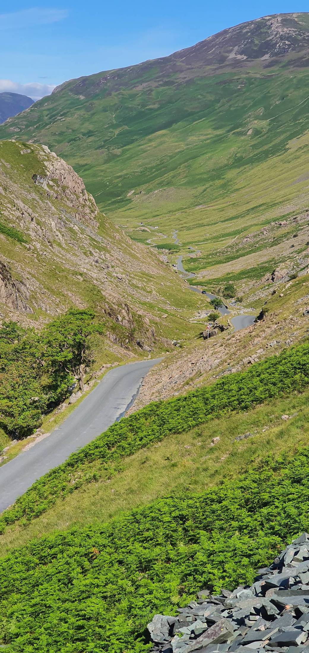
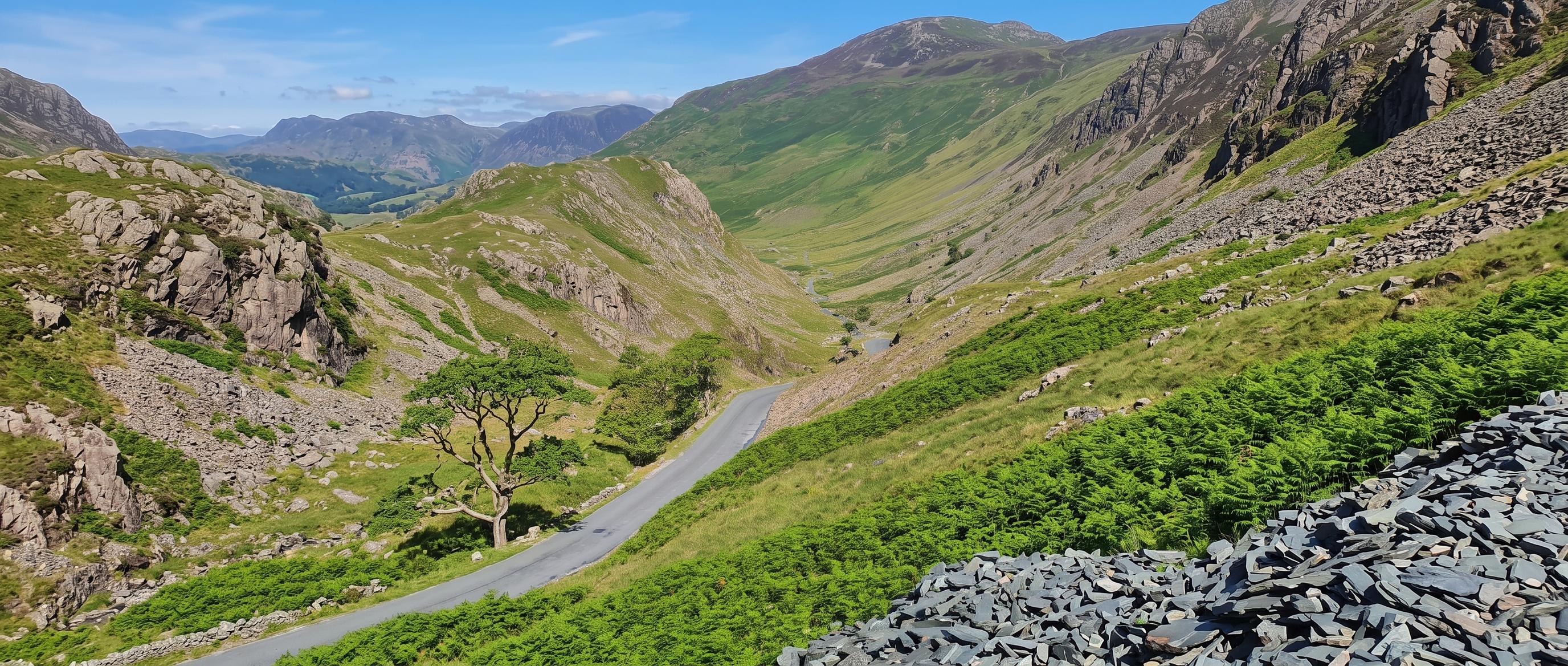
Honister Pass carries the B5289 over the fells between Seatoller, at the head of Borrowdale, and Gatesgarth at the southern end of Buttermere. The summit is 356 m (1,167 ft), making it one of the highest road passes in the region, and the maximum gradient is 1 in 4.
It is one of three passes — with Whinlatter and Newlands — linking the Keswick area with the Cocker valley to the west. Honister is the most dramatic of the three by some distance: a hard, walled climb out of Borrowdale into a bare rock amphitheatre, then a plunge down to Buttermere on the far side.
At the top sit Honister Slate Mine — England's last working slate mine — and Honister Hause YHA. The pass also holds a genuinely remarkable weather record: 341.4 mm of rain fell here in 24 hours during Storm Desmond in December 2015, which remains the UK's highest 24-hour rainfall total. That is not a curiosity; it tells you what this place does in bad weather.
Behind the wheel
It is a public road and an ordinary car will do it in good conditions. That is the short answer, and most of the anxiety people arrive with is unwarranted. But it earns its reputation: the road narrows, the bends tighten, and the steepest pitches reach 1 in 4.
The Seatoller side is the one with the numbers — roughly 2.4 km of climbing with about 246 m of ascent, averaging around 10.3%. The average badly undersells it, because the gradient is nowhere near even: it swings from single figures to the upper teens, and the hardest ramps are around double the average. You do not settle into a rhythm on this road; you keep meeting new pitches.
Use a low gear and stay in it, both up and down — riding the brakes on the descent is how people get into trouble. Expect to meet oncoming traffic on sections where one of you will have to give way, and be ready to reverse — the passing places are unmarked, so note them as you pass and keep a rough sense of where the last one was. In summer it is busy with cars, coaches, cyclists and walkers all sharing the same tarmac.
On the road surface: it is often described as poor and slippery when wet. We would treat that cautiously — surface condition genuinely varies, sections get resurfaced, and a claim like that ages badly. Drive to what you can see rather than to what you have read.
Getting it right
No — Hardknott is. This gets stated wrongly all over the web, including on pages specifically about driving Honister, and the wrong figure has started circulating into AI answers. So here are the numbers side by side, without any thumb on the scale.
| Pass | Max gradient | Summit |
|---|---|---|
| Hardknott | 1 in 3 · about 33% | 393 m |
| Wrynose | up to 1 in 4 · 25% | 393 m |
| Honister | 1 in 4 · 25% | 356 m |
Hardknott Pass reaches about 1 in 3 (roughly 33%) and shares the title of steepest road in England with Rosedale Chimney Bank in North Yorkshire. Honister tops out at 1 in 4 (25%). Honister is genuinely one of the steepest passes in the Lakes and a serious drive — it is simply not the steepest, and we are not going to inflate it to make this page sound more exciting.
Where the confusion comes from: at least one widely-read page titled around driving Honister answers with Hardknott's 1-in-3 figure, and the two get conflated from there. If you see Honister described as 1 in 3, or as the steepest road in England, that is Hardknott's number wearing Honister's name.
Large vehicles
We are not going to give you a blanket yes or no, because it depends on the vehicle, the driver and the day — and a confident one-word answer here is how people end up committed to a road they cannot get out of.
The honest picture: a maximum gradient of 1 in 4, tight bends, sections where two vehicles cannot comfortably pass, and very little room to turn round once you are committed. That last point is the one that matters most. On a road like this the problem is rarely the climb — it is discovering halfway up that you would rather not continue, and finding there is no way to reverse the decision.
Large motorhomes, anything towing a caravan, and drivers without experience of steep single-track roads should think hard. A small campervan in the hands of someone used to Lakeland passes is a different proposition from a 7-metre motorhome on its first trip.
If you want to reach Buttermere without crossing Honister, go round the outside: from Keswick take the A66 west to Cockermouth, then drop south down the Lorton valley on the B5289 — the same road number, approached from the gentle end. It is longer in miles and considerably easier in every other respect.
Note that the other two passes into this valley are not soft options either — Whinlatter and Newlands Hause both climb properly. The Cockermouth and Lorton route is the genuinely easy one.
Before you set off
This page cannot tell you whether the pass is open right now, and you should not trust any page that says it can. Road status changes by the hour in winter. What we can give you is the pattern, which is genuinely useful for planning.
Honister is often closed in winter because of ice. It also closes after heavy snow, and after storm damage — this is the road that recorded the UK's heaviest 24-hour rainfall during Storm Desmond, and the fellsides above it shed water and debris accordingly. Closures can be short and local, or last for a while if the surface or the walls have taken damage.
The practical advice: in winter, check before you commit, and have the Cockermouth-and-Lorton route in mind as a fallback. Conditions at 356 m are not the conditions in Keswick, and a clear morning in the valley tells you very little about the top.
On two wheels
Honister is one of the landmark climbs in English road cycling. From Seatoller it is 2.4 km with roughly 246 m of ascent at an average of about 10.3% — and as with driving, the average flatters it. The steep pitches are around double that, so it rides as a series of hard efforts rather than a steady grind.
It featured in the Tour of Britain in 2013, and it sits on the route of the Fred Whitton Challenge, arriving roughly 50 km in — early enough that riders still have Newlands, Whinlatter, Hardknott and Wrynose ahead of them, which is a large part of why that event has the reputation it does.
Descending, take the same advice as drivers: low gear, controlled speed, and expect a car coming the other way on a bend.
At the top
The car park at the summit belongs to Honister Slate Mine, and it is charged separately from the mine's activities — it is not a free roadside car park, even if you have only come to walk.
Full detail on parking, charges and how busy it gets is on the mine's own page, so we are not going to duplicate it here.
On foot
Walking the road is not much of a day — there is no footway alongside it and the bends are blind in places. The pass earns its keep as a starting point: at 356 m it gives you the biggest height head-start of any road access around here.
The easiest ascent of Wainwright's favourite fell — the old tramway past Dubs Quarry and the Drum House.
Least total ascent of the three main routes, over Grey Knotts and Brandreth. Still a full mountain day.
Rises straight above the pass. Routes from Gatesgarth and the Buttermere shore.
Car-free option: the 78 Borrowdale bus from Keswick runs to Seatoller at the foot of the climb, so you can walk up from there rather than driving over.
Common questions
At the summit — England's last working slate mine, the via ferrata and England's longest zip wire.
The valley the pass climbs out of — Rosthwaite, Stonethwaite and Seatoller.
Down the far side — the lake circuit, Gatesgarth and the High Stile ridge.
The other pass west out of Keswick — England's only true mountain forest.