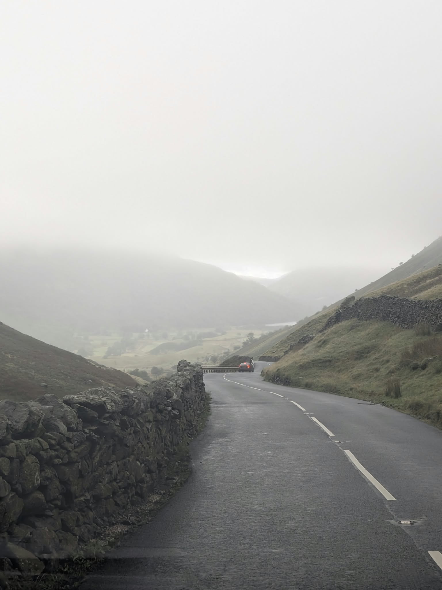
The A592 between dry stone walls dropping from Kirkstone Pass towards Brothers Water and Patterdale in winter light
Free · public road A592 · Windermere to Patterdale The Struggle · 1 in 4

Kirkstone Pass

The highest pass in the Lake District open to traffic — 454 metres on a proper two-way A road, with a 500-year-old inn near the top and a notorious back way up called The Struggle. Here is how to drive it, and which way.

454 m
Summit · 1,489 ft
No. 1
Highest Lakes pass open to traffic
1 in 4
The Struggle at its steepest
~500 yrs
The inn near the summit
Driving it The Struggle The inn Parking & view Cycling Winter & closures FAQ

The road

Where Kirkstone Pass goes

Kirkstone Pass carries the A592 over the fells between the Windermere valley in the south and Patterdale at the foot of Ullswater in the north. At 454 m (1,489 ft) it is the highest pass in the Lake District open to motor traffic — and unlike the district's other famous passes, it is a genuine two-way main road the whole way over.

Three roads meet near the summit: the A592 climbing from Troutbeck and Windermere, the A592 descending north past Brothers Water to Patterdale and Glenridding, and the steep narrow lane up from Ambleside known, with good reason, as The Struggle.

The name comes from the Kirk Stone, a large rock near the summit on the Patterdale side whose silhouette resembles a church steeple — kirk being the old northern word for church. It has watched coaches, carts and now cars haul over this gap for centuries, most of them stopping at the same inn.

Behind the wheel

Driving Kirkstone Pass — the honest guide

Can you drive up Kirkstone Pass? Yes — and if you can drive an ordinary hilly A road, you can drive this one. Of the Lake District's famous passes, Kirkstone is the most approachable by a distance: two-way tarmac with centre lines, no hairpins, and gradients that are long rather than savage. If Hardknott is a test, Kirkstone is simply a big climb.

From the south, the A592 leaves the Windermere valley near Troutbeck and climbs steadily to the summit — a long, open pull with the fells closing in either side. From the north, the road runs down from the summit past Brothers Water to Patterdale, a descent that repays patience: it is the steeper-feeling side, with real drops beside the road and, in season, a steady stream of oncoming traffic, cyclists and sheep.

Treat it as a mountain road all the same. Use gears rather than brakes on the descents, expect the weather at the top to be a different season from the valleys, and give cyclists room — this is one of the most ridden climbs in the north. In summer the summit area gets busy; in winter, see closures below before you commit to it at all.

Towing, motorhomes, coaches: the A592 over Kirkstone is the pass that large vehicles can sensibly use — it is the main road link it appears to be on the map. The Struggle is another matter entirely, which is the next section.
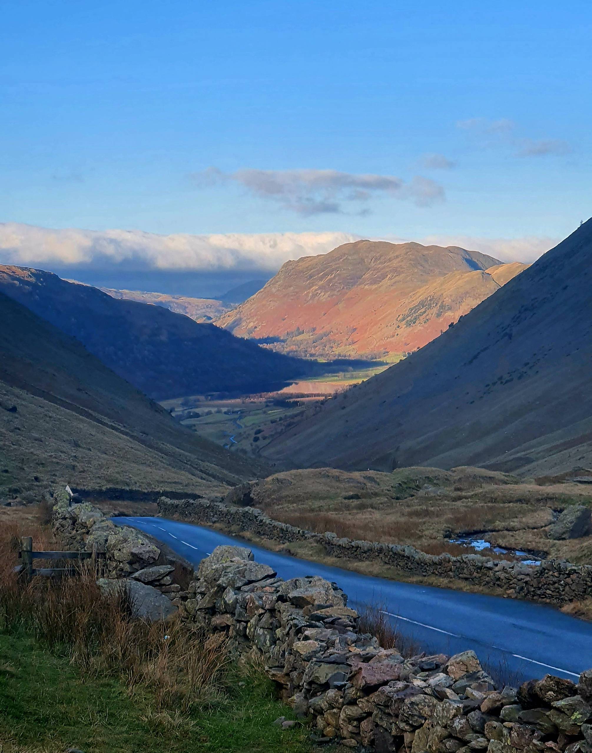
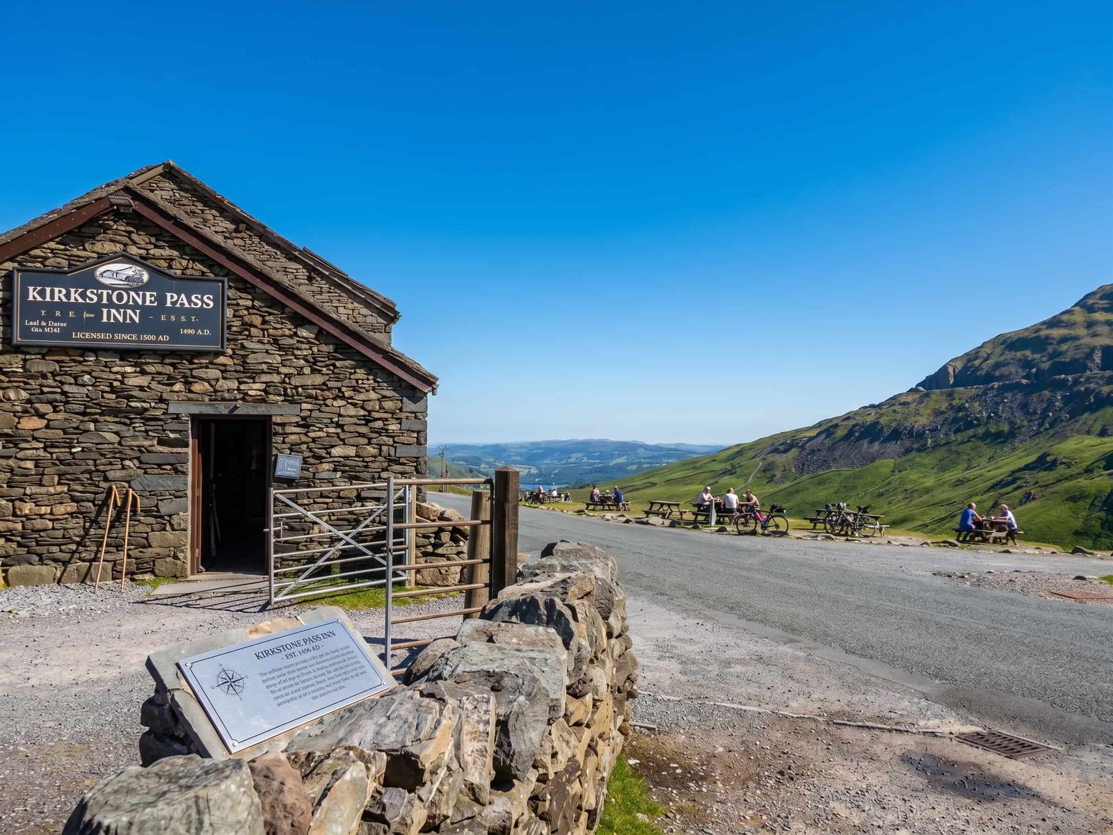
Photo coming — the summit straight

The summit straight with the inn in view. The photo at the top of this page is the northern descent towards Brothers Water; the summit shot follows after the next drive over.

Which way should I go up?

Take the A592. From Windermere or Bowness, follow it north through Troutbeck. From Ambleside, unless you specifically want The Struggle, go out on the A591 towards Windermere and join the A592 — longer on the map, far easier in the metal. The Struggle saves distance and costs nerves.

The back way up

The Struggle — Ambleside's road to Kirkstone

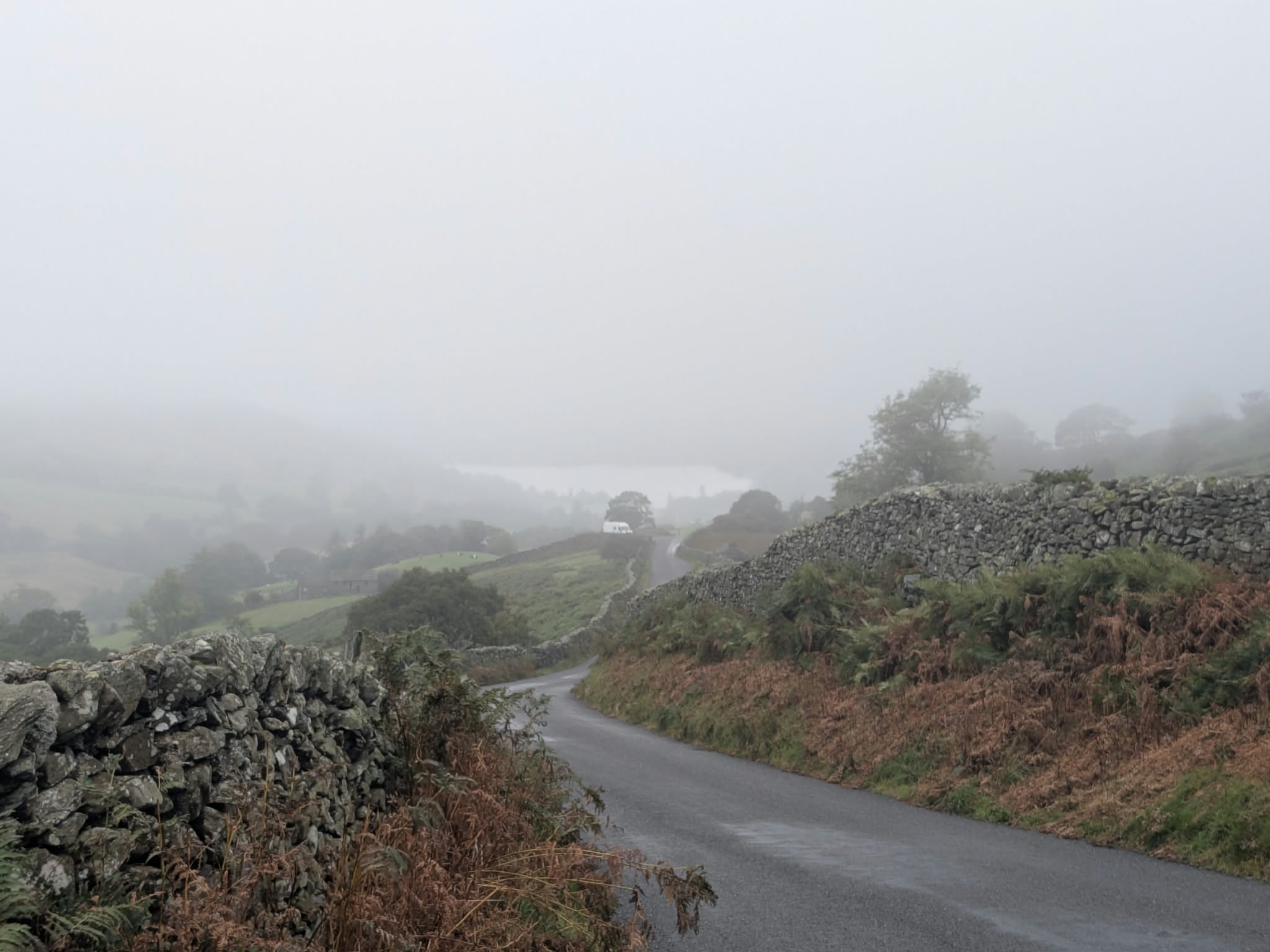
The old road from Ambleside straight up to the Kirkstone Pass summit has been called The Struggle since the coaching era, when passengers routinely got out and walked so the horses could manage it. The name is not marketing. It climbs out of the town in a series of steep, narrow pitches — up to 1 in 4 — between walls, with limited room to pass and gradients that keep coming back just as you think it has relented.

Most drivers should not use it as their route to the pass. Not because it is impassable — it is a public road, and locals and confident drivers use it all the time — but because the A592 goes to exactly the same place without the stress. Where The Struggle earns real affection is on a bike: it is one of the celebrated climbs of the district, a rite of passage from Ambleside's front door to the highest road summit in the Lakes.

If you do drive it: low gear, be ready to give way and reverse, and think twice in the wet — and do not take it downhill in ice under any circumstances. It meets the A592 right by the Kirkstone Pass Inn, which is the most honest reward structure of any road in Cumbria.

The Struggle in numbers: roughly three miles from Ambleside to the summit junction, climbing most of Kirkstone's height in that distance, with the steepest ramps at 1 in 4. The A592 spreads the same climb over a far longer, gentler approach.

At the top

The Kirkstone Pass Inn

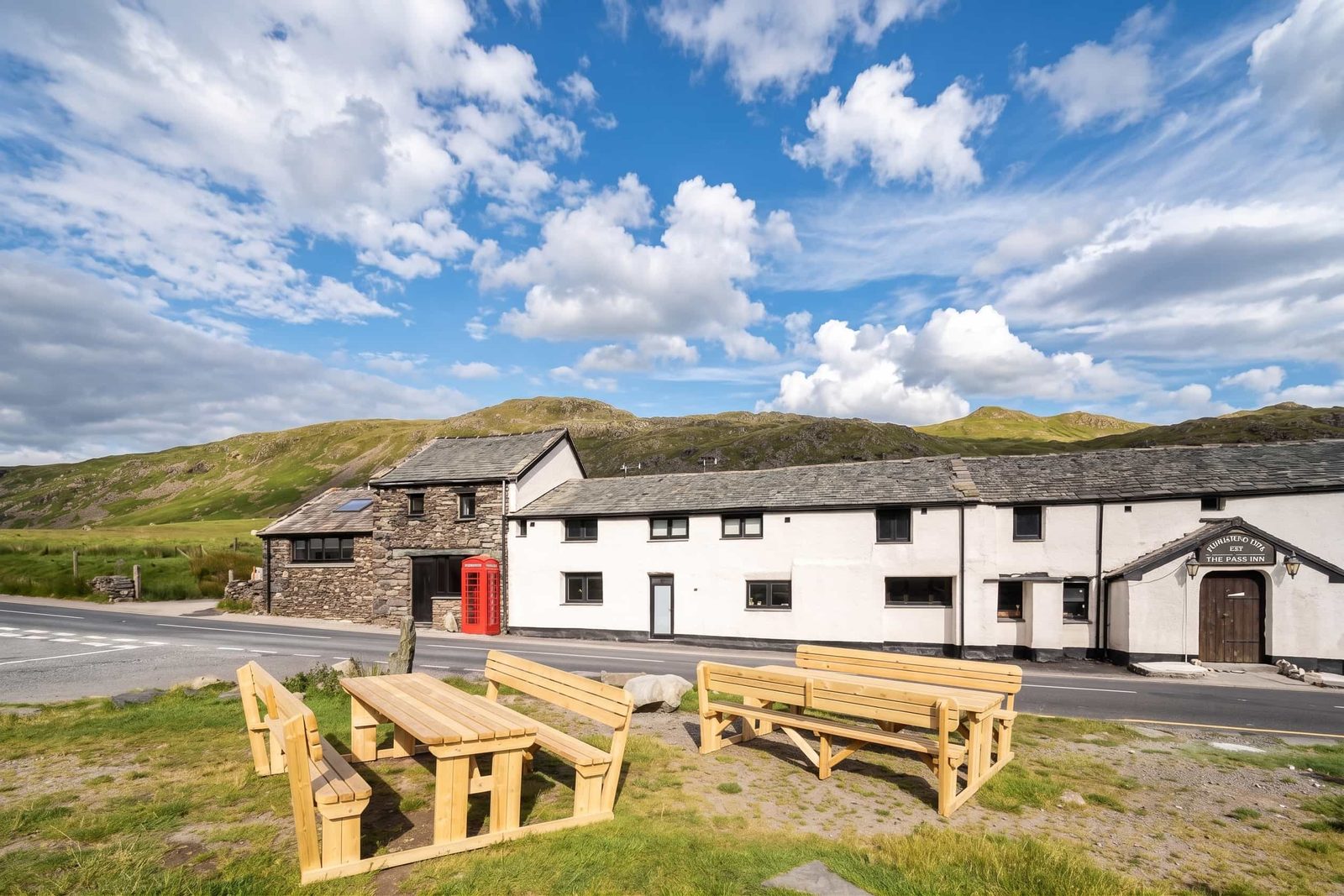
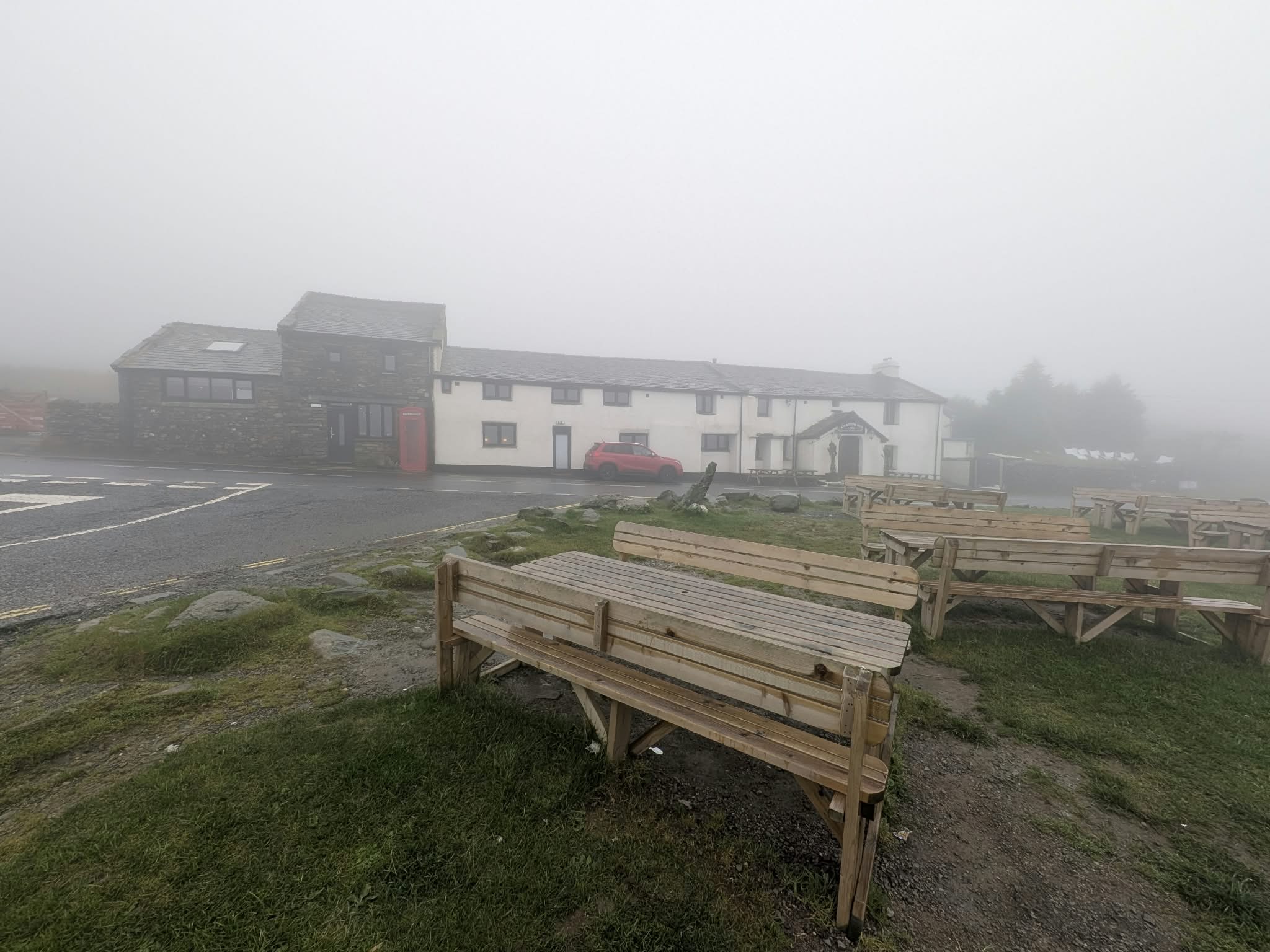
Near the summit, where The Struggle meets the A592, stands the Kirkstone Pass Inn — a coaching inn roughly 500 years old, sitting at around 1,480 ft between Ambleside and Patterdale. It is the highest pub in the Lake District, and one of the highest in England, and for centuries it has been the reward for getting over the top in either direction.

And yes — it is open. The inn stood closed for nearly five years, which is why the question gets asked so often. It reopened in 2026 under lease to Kirkby Lonsdale Brewery, who refurbished it and now run it with their own real ales alongside pies, coffee and cakes — proper summit-of-the-pass fare rather than fine dining, which is exactly as it should be.

For opening hours and what's on, go straight to the inn's own site — a pub at nearly 1,500 feet keeps hours that respect the weather and the seasons, and you should check before making a special trip.

Photo coming — the inn on the summit road

The whitewashed inn against the fellside, shot from the A592. Coming after our next drive over the pass.

Why "Kirkstone"?

The pass and the inn take their name from the Kirk Stone, the church-steeple-shaped rock near the summit on the Patterdale side. Keep an eye out for it on the descent towards Brothers Water.

Worth stopping for

Parking and the view

There is parking at the summit area near the inn, and it is worth using: the view north from the top of the pass — down the trench of the valley to Brothers Water, with the Ullswater fells beyond — is one of the best you can reach on four wheels in the Lakes. On the southern side, the top of The Struggle looks back over the Windermere valley.

The summit is high, bare and frequently windswept — the difference in temperature between Windermere and the top of Kirkstone surprises people in every season. Take a layer, even for a five-minute photo stop.

This is also a walking springboard: Red Screes rises directly above the pass, and starting from 454 m takes a useful bite out of any fell day on either side of the road.

On two wheels

Cycling Kirkstone Pass

Kirkstone is the biggest road summit in the Lakes a cyclist can claim, and there are three ways to earn it: the long steady A592 from the Windermere side, the harder pull up from Patterdale, and The Struggle — the shortest, steepest and most celebrated of the three, straight out of Ambleside at up to 1 in 4.

The Fred Whitton Challenge opens with Kirkstone as its first climb, taken on the steady side with fresh legs — the civilised introduction before the day turns serious at Honister and brutal at Hardknott. Descending any side of Kirkstone, watch your speed: the drops are long, the bends open just enough to tempt you, and the sheep have right of way in practice if not in law.

Lake District cycling routes

Before you set off

Winter, weather and closures

This page cannot tell you whether the pass is open right now, and you should not trust any page that claims to. The pattern is what matters for planning: at 454 m, Kirkstone catches snow and ice earlier and keeps them longer than almost any other A road in England, and it closes in winter weather — sometimes several times in a season. When it is shut, the way between Windermere and Ullswater is the long way round via the A66.

A clear morning by the lake tells you very little about the summit. In winter, check before you commit — and if the tops look wild from the valley, believe them.

Common questions

Kirkstone Pass, answered

Is Kirkstone Pass still closed?
We can't tell you the live status, and you shouldn't trust any page that claims to. The pattern: Kirkstone is a high road — 454 m — and it closes in snow and ice, sometimes repeatedly through a winter. Outside winter weather it is an ordinary open A road. For current status check Westmorland & Furness Council, the highway authority here, and the Lake District Weatherline for conditions on the tops. Always check before travelling in winter.
Can you drive up Kirkstone Pass?
Yes — and of the famous Lake District passes it is the most driveable. The A592 over Kirkstone is a proper two-way main road between Windermere and Patterdale, and any car can do it in normal conditions. The exception is The Struggle, the steep narrow lane up from Ambleside, which reaches 1 in 4 and is a different proposition entirely — most drivers should join the pass via the A592 instead.
Is the Kirkstone Pass Inn still a pub?
Yes. After standing closed for nearly five years, the Kirkstone Pass Inn reopened in 2026 under lease to Kirkby Lonsdale Brewery, who refurbished it. The roughly 500-year-old inn near the top of the pass — the highest pub in the Lake District, and one of the highest in England — serves the brewery's real ales alongside simple food. Check the inn's own site for current opening before making a special trip: it sits at nearly 1,500 feet and hours vary with the seasons.
What is Kirkstone Pass like?
A high, open mountain road rather than a white-knuckle one. The A592 climbs steadily from Windermere or Troutbeck to a bare, often windswept summit at 454 m — the highest pass in the Lake District open to traffic — then drops past Brothers Water to Patterdale and Ullswater. There are long gradients and real weather, but two-way tarmac the whole way. The exception is The Struggle from Ambleside: narrow, 1 in 4 in places, and best left to confident drivers.

Nearby & related