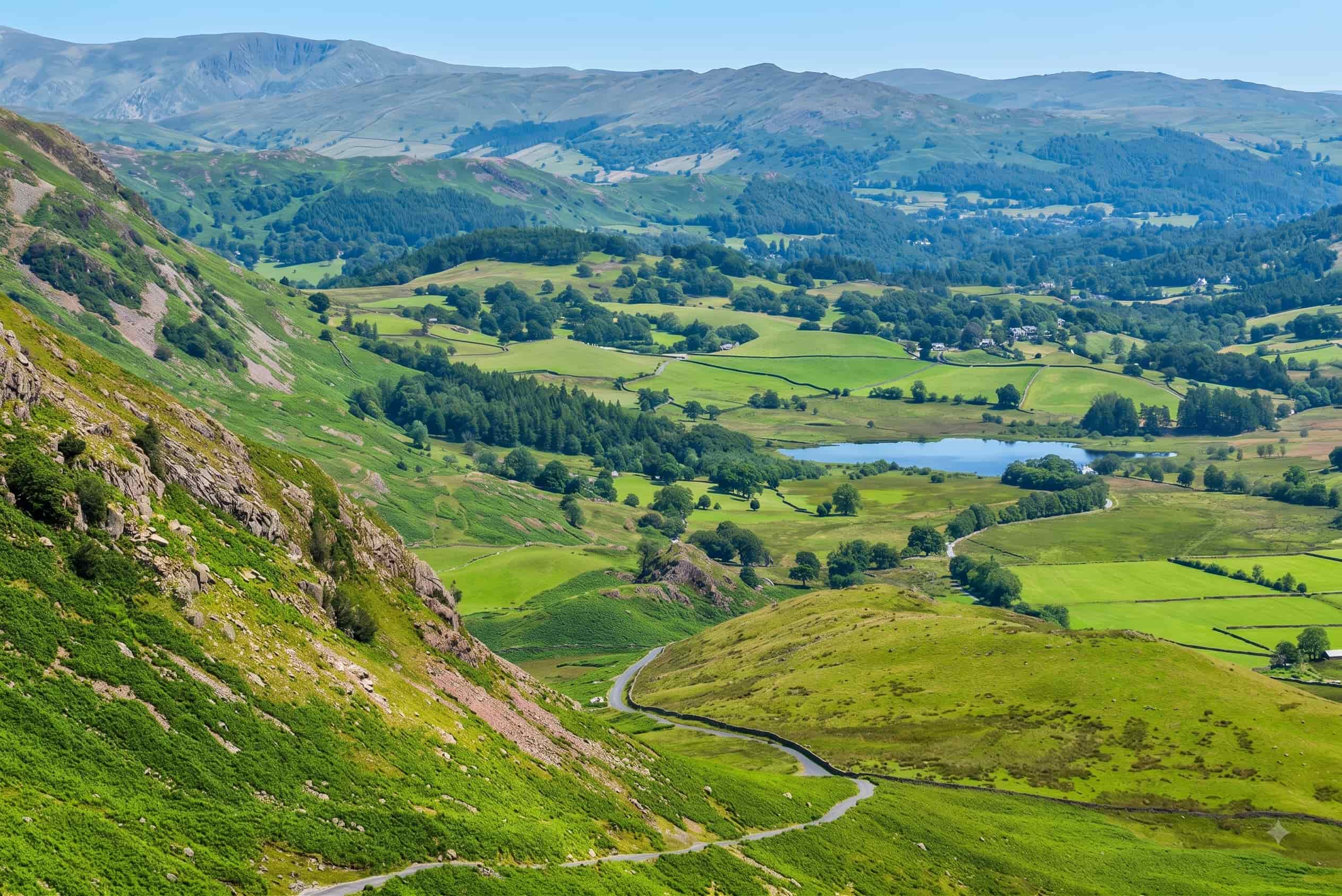
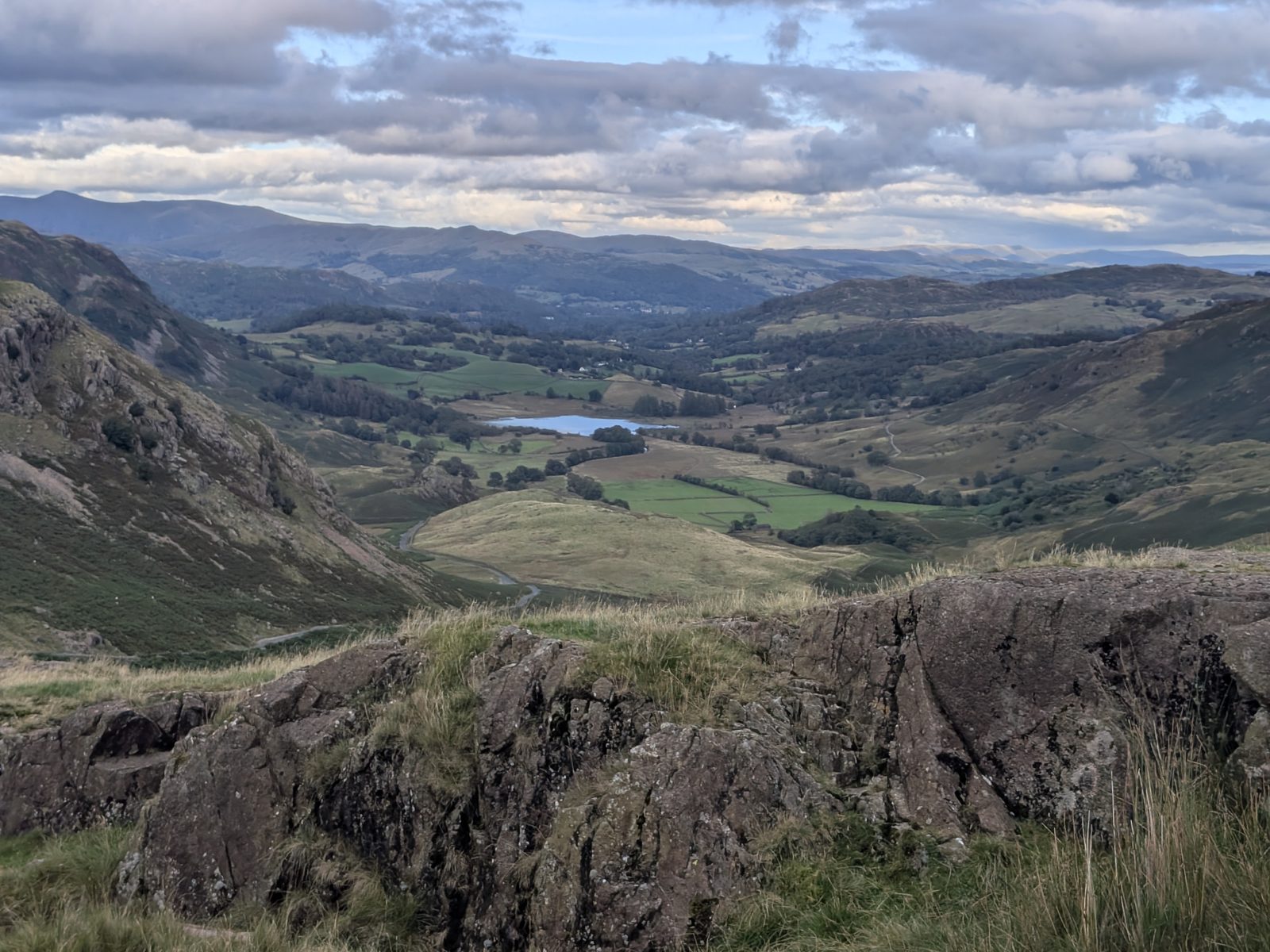
The single-track road snaking down from Wrynose Pass into Little Langdale, Lake District
Free · public road Up to 1 in 4 · single track Little Langdale to the Duddon

Wrynose Pass

Single-track over from Little Langdale to the Duddon Valley — 393 metres at the summit, exactly the same height as Hardknott next door, with the Three Shire Stone at the top. Here is how to drive it, and how to say it.

393 m
Summit · same height as Hardknott
1 in 4
Steepest gradient · 25%
3
Historic counties met at the summit
1 lane
Single track · passing places
Driving it With Hardknott How to say it Three Shire Stone Cycling Winter & closures FAQ

The road

Where Wrynose Pass goes

Wrynose Pass carries a narrow, unclassified road from Little Langdale — the quiet valley south of the Langdale Pikes, reached from Ambleside or Coniston — over a 393 m (1,289 ft) summit and down to Cockley Beck in the upper Duddon Valley. There the road forks: down the Duddon, or straight on and up again over Hardknott Pass to Eskdale.

Wrynose and Hardknott top out at exactly the same height — 393 m apiece — which is a genuinely pleasing fact and a practically important one: doing the classic two-pass run means climbing that height twice, with the deep trench of the Duddon between. The Romans ran their road over both, and today's tarmac follows their logic if not quite their line.

At the summit stands the Three Shire Stone, marking the spot where the historic counties of Cumberland, Westmorland and Lancashire once met — for centuries, standing at the top of Wrynose meant standing in three counties at once.
Behind the wheel

Driving Wrynose Pass — the honest guide

Yes, you can drive it, and an ordinary car will manage it in good conditions. Wrynose is single-track with passing places essentially the whole way, with gradients up to 1 in 4 (25%), blind crests, and stretches where the road is the only flat ground in sight. It is a proper mountain road that asks for concentration rather than heroics.

The discipline is the same as every Lakeland pass, applied constantly: low gear up and down, read the road ahead for oncoming traffic, know where your last passing place was, and be genuinely willing to reverse to it. Never park in a passing place — on a single-track road they are the road working, not spare parking.

Honestly ranked: Wrynose is a notch gentler than Hardknott — the gradients are less extreme and there is no stacked-hairpin section — but only by that comparison. By the standard of anything you drive at home it is steep, narrow and committing, and the descent to Cockley Beck needs as much care as the climb.

Do not bring: caravans, trailers or large motorhomes — there is nowhere for them to pass and nowhere for them to turn. Do not attempt it in snow or ice, when it closes anyway. If the conditions or the description give you pause, the A593 and the coast roads go round; the valley views are still yours.

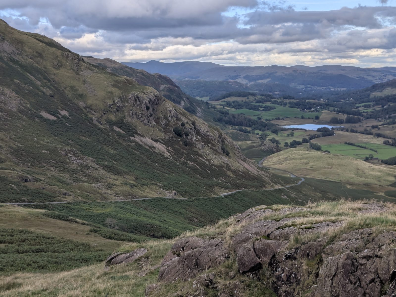
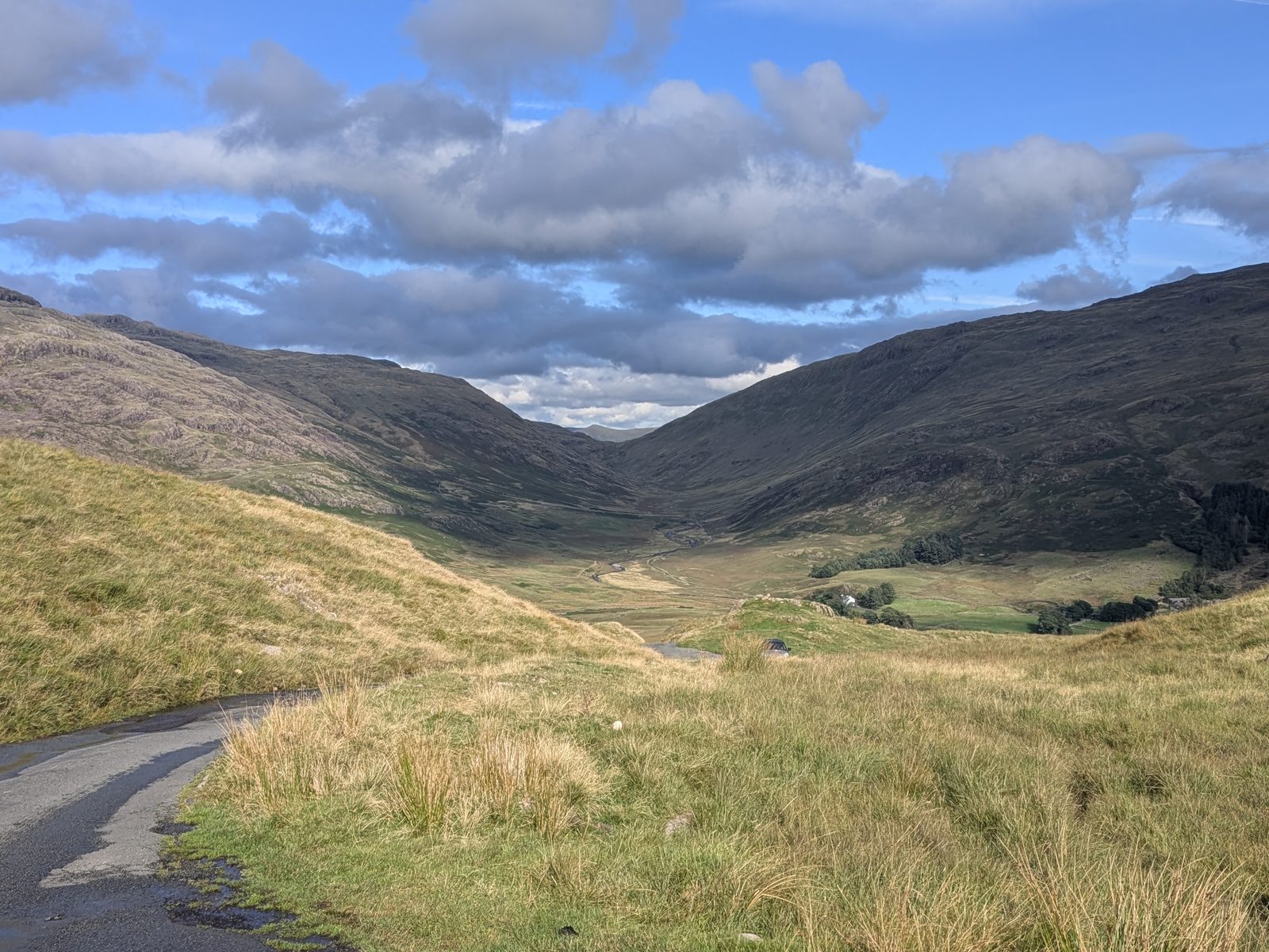
The single-track road descending from Wrynose Pass towards Little Langdale, with passing places visible along its length
The Little Langdale side — single track, passing places, and the valley unrolling below.

One habit worth stealing

Locals count passing places as they go. When two cars meet on Wrynose, the driver who knows exactly how far back their last passing place was is the one who reverses calmly — and the one who doesn't is the reason there is a queue.

The classic drive

Doing Wrynose and Hardknott in one drive

For most people Wrynose is half of something bigger: the classic run from Little Langdale over Wrynose, along the wild upper Duddon to Cockley Beck, then over Hardknott and down into Eskdale — or the reverse. Two summits of exactly 393 m, one of the great drives in Britain, and the only direct road link between central Lakeland and the Eskdale corner.

Go in with honest expectations. The mileage is small and the time is not: almost every yard is single-track with gradients, and meeting traffic — which you will, in season — turns minutes into more. There is no fuel, no services and no reliable phone signal between Little Langdale and Eskdale, and once you are in the Duddon the only ways on are over a pass or the long quiet lane down the valley. Allow a proper chunk of the day, pick decent weather, and it will be the drive you remember from the trip.

Which direction? Taken west-to-east (Eskdale first), you climb Hardknott's hairpins and descend Wrynose's gentler line. East-to-west, you save the harder pass for the finale and meet Hardknott's steepest bends downhill — fine with good brakes and a low gear, but the more demanding order. If it is your first time, Little Langdale first means the easier pass is your warm-up.

Say it like you mean it

How do you pronounce Wrynose?

Two answers, both defensible. Most visitors — and most maps read aloud — say "RY-nohz", like "rye nose" with a silent W. Nobody will misunderstand you. But the traditional local pronunciation is closer to "RAY-nuss", an echo of the name's older forms: it appears in 16th-century records as Wrenosse, and is thought to come from Old Norse — most likely something like "stallion's ridge", from the days when the measure of this road was whether your horse was strong enough to haul over it.

This, incidentally, is why so many people search for the "rhinos pass" — they have heard "RY-nohz" spoken and spelled what they heard. If that is how you got here: welcome, it is Wrynose, and the rhinos are not real but the 1 in 4 is.

What most people say

"RY-nohz"

Rye + nose, silent W. Universally understood.

The traditional local form

"RAY-nuss"

From the old name Wrenosse — Old Norse, likely "stallion's ridge".

At the summit

The Three Shire Stone

The summit of Wrynose is marked by the Three Shire Stone, a slender upright pillar beside the road at the point where the historic counties of Cumberland, Westmorland and Lancashire met. Until the county reorganisations of the twentieth century, this genuinely was the corner of three shires — Lancashire famously reached up here, taking in Coniston and the Furness fells, a fact that still wins pub quizzes.

Today the whole pass lies within Cumbria, but the stone remains one of the Lakes' quietly satisfying landmarks: a photogenic marker at the top of a hard-won climb, with the descent you are about to make visible either way. If you stop — and most people do — pull properly off the road and leave the passing places clear.

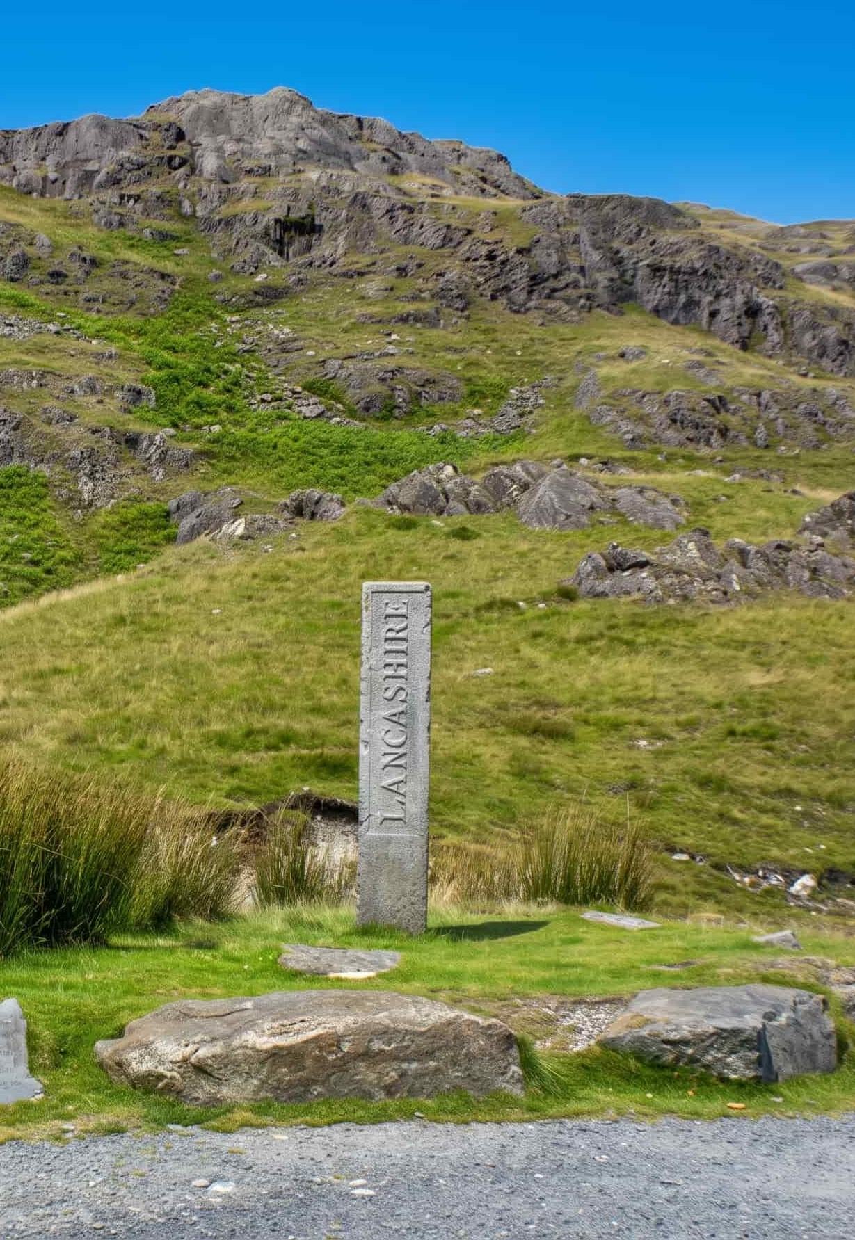
The Three Shire Stone at the summit of Wrynose Pass, inscribed Lancashire, with the fellside rising behind
The Three Shire Stone at the summit — the Lancashire face, where three counties once met.

On two wheels

Cycling Wrynose Pass

On a bike, Wrynose would be a marquee climb anywhere else in England: up to 1 in 4, narrow, with pitches that force you out of the saddle and a descent that asks for cool brakes and cooler judgement. In the Lakes it has the misfortune of being next to Hardknott, and on the Fred Whitton Challenge it comes immediately after it — which is why riders remember Wrynose as cruel rather than celebrated. Climbing a 1 in 4 on legs that have just survived a 1 in 3 is its own category of experience.

Ridden on its own, from Little Langdale, it is a superb hard climb with the Three Shire Stone as the summit prize. The same courtesy applies as on four wheels: single-track road, so call your line early, and give drivers somewhere to be.

Lake District cycling routes

Before you set off

Winter, weather and closures

This page cannot tell you whether the pass is open right now, and you should not trust any page that claims to. The pattern: like Hardknott next door, Wrynose closes in snow and ice — sometimes for days — and a 1 in 4 on a frozen single-track road is not a place any vehicle belongs. The two passes generally close and reopen together, and when they are shut the Eskdale corner is reached the long way, around the coast.

Conditions at 393 m are not the conditions in Ambleside. In winter, check before you commit — and if you crest Wrynose to find Hardknott looking doubtful, the lane down the Duddon Valley is the honourable retreat.

Common questions

Wrynose Pass, answered

Can you drive the Wrynose Pass?
Yes — it is a public road between Little Langdale and the Duddon Valley, open to ordinary traffic apart from winter closures. It is single-track with passing places, reaches gradients of up to 1 in 4, and demands the usual mountain-road discipline: low gear, patience, and a willingness to reverse to a passing place. Ordinary cars manage it every day in summer. Caravans and large motorhomes should not attempt it, and nobody should attempt it in snow or ice.
Is the Wrynose Pass steep?
Yes — gradients reach up to 1 in 4 (25%), on a single-track road with blind crests and tight bends. It is genuinely steep by any normal standard; it only seems moderate because its neighbour Hardknott reaches 1 in 3. Both passes top out at exactly the same height — 393 m — so descending one only ever means climbing the other if you are doing the classic two-pass run.
What is the scary road in the Lake District?
Usually Hardknott Pass — the 1 in 3 hairpins between Eskdale and the Duddon Valley — with Wrynose, its neighbour, a close second, and Honister sometimes mentioned as well. "Scary" is doing a lot of work in that question, though: these are steep, narrow, committing mountain roads, but thousands of ordinary drivers cross them safely every summer. Treated with respect, in good conditions, they are demanding rather than dangerous. Treated casually, or in ice, they are neither.
Can you show me a map of the Wrynose Pass?
Any road atlas or online map shows it — search for "Wrynose Pass" and you'll find the unclassified road running west from Little Langdale, over the 393 m summit at the Three Shire Stone, and down to Cockley Beck in the Duddon Valley, where the road continues over Hardknott Pass to Eskdale. For planning, the key points are simple: it starts at Little Langdale, ends at Cockley Beck, and there is no easier road between them.

Nearby & related