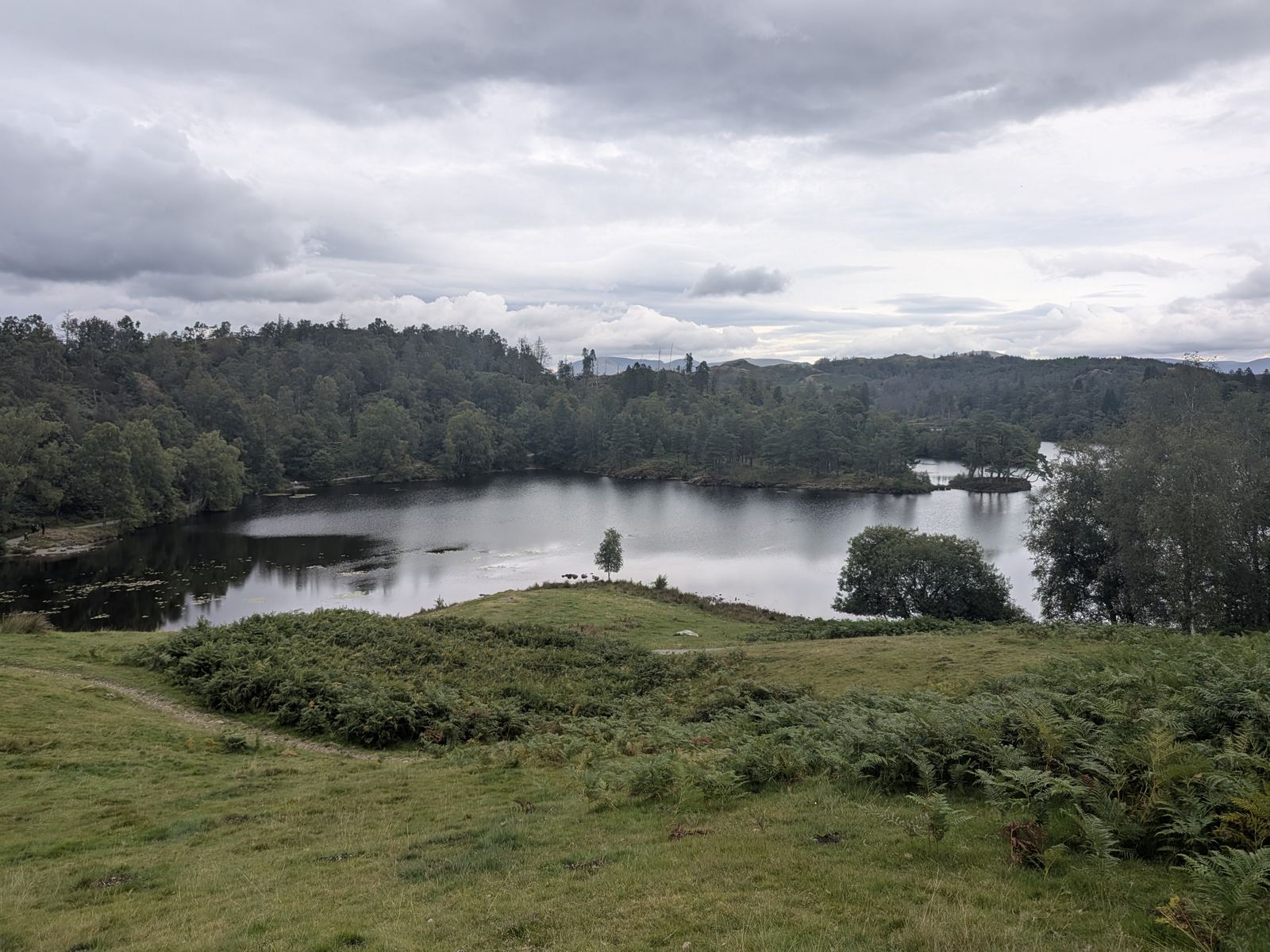
Tarn Hows with its wooded islands and the fells beyond, under a grey summer sky, near Coniston, Lake District
Between Coniston & Hawkshead · National Trust

Tarn Hows

A Victorian landscaped tarn with wooded islands and a fell skyline, circled by a flat surfaced path that almost anyone can manage. Here is the car park, how to pay, what is on site, and what the walk actually involves.
Written and walked by Peter Visited Sunday 30 August 2026
1¾–2 mi
The circuit of the tarn
~45 min
Mostly flat, surfaced path
2 mi
From Coniston, and from Hawkshead
1965
Site of Special Scientific Interest
What it is Car park & getting there Facilities The walk Tom Gill waterfall Swimming When to go Nearby FAQ

What it is

The most-photographed easy walk in the Lakes — and a car park question

Tarn Hows sits in the low wooded hills between Coniston and Hawkshead, about two miles from each. It is a small lake with wooded islands, ringed by larch and spruce, with the Coniston fells and the Langdales on the skyline — and a flat, surfaced path all the way round it. That last part is why it is here: it is one of a handful of Lake District views you can reach with a pushchair, a wheelchair or a grandparent who is not up to a fell.

It looks natural and is not. It was three smaller tarns until the 1860s, when James Garth Marshall of the Monk Coniston estate dammed them into one to feed his sawmill and planted the slopes as an ornamental landscape. The National Trust has owned it since the 1930s, with Beatrix Potter in the story — more on that below.

Because it is easy and famous, the practical questions matter more than the scenery writing. Most of what people want to know is about the car park: how to pay, whether there are toilets, and whether the sat nav will actually get them there. So that is where this page starts.

You will see it spelt Tarn Howes, Tarn How and Tarn Howe. The National Trust sign at the car park says Tarn Hows, and so does the map.

Car park & getting there

The Tarn Hows car park, and how to pay for it

Tarn Hows is signposted off the B5285 — the Hawkshead to Coniston road, also signed as North Lonsdale Road — roughly two miles north-east of Coniston and two miles north-west of Hawkshead. Allow about ten minutes from Coniston and sixteen from Ambleside. The last stretch is a narrow lane, and on a fine weekend or in the school holidays the car park fills by late morning.

Members free

Paying to park

National Trust members park free — scan your membership, or register it in the app where there is no machine. Blue Badge holders park free too, in designated bays. Everyone else pays on a tiered scale by how long you stay, by app or by machine depending on which system is installed at the time. Phone signal at the tarn is poor, so download and set up the app before you travel.

At the time of writing the National Trust lists payment via the JustPark app, location code 80693. The Trust is changing its parking technology site by site, so check the National Trust's Tarn Hows page for the current system and rates before you set off.

/// what3words — main NT car park ///crowns.spades.greet A 3-metre square. More precise than the postcode.
Postcode caveat

Finding it with a sat nav

The postcode usually given is LA21 8DP, OS grid reference SD 326 996. It is a rural postcode and it also covers Glen Mary car park at the bottom of Tom Gill — a different car park, at the bottom of a steep path, with no facilities. Use the what3words square or the grid reference, not the postcode alone.

There is a second, upper car park a little further up the hill with more accessible spaces — if the main one is full, keep going rather than turning round.

/// what3words — Glen Mary car park ///fail.protected.taker The other car park with the same postcode — the Tom Gill end.
Bus & coach

Without a car

The Hawkshead–Coniston bus does not go to the tarn. It stops at Hawkshead Hill, about a mile away, and you walk up the lane from there.

The road is unsuitable for large coaches and there is no coach parking. Coach parties are generally dropped at Coniston or Hawkshead and walk in.

On foot from Coniston, the route in via Monk Coniston on the lakeshore is the best arrival of all — see the walk section.

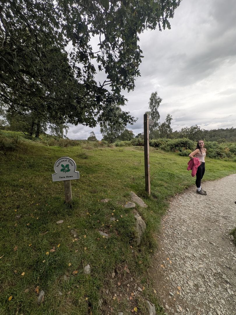
National Trust oak-leaf sign reading Tarn Hows beside a wooden fingerpost at the start of the surfaced path
The National Trust sign where the path leaves the car park — the spelling on the sign is the one we use

Facilities

Toilets, Trampers and the café

For somewhere this popular, the facilities question gets answered surprisingly badly online. The short version: yes, there are toilets. The block is at the rear of the main car park, and it includes an accessible toilet. There is nothing on the circuit itself, so use them before you set off.

The National Trust keeps Tramper all-terrain mobility scooters here, which is a large part of why the tarn matters: the surfaced circuit is one of the few Lake District walks a Tramper can do all the way round. They are collected from the kiosk in the main car park, advance booking is recommended, and the Trust asks for a donation rather than a hire fee.

There is a café — Joey's — at the crossover by the main car park. We saw the board and the queue on our visit, and the National Trust lists it on the Tarn Hows page with its own opening hours. Older guides say there is no café here and only a seasonal ice-cream van; that is out of date. Check the hours before relying on it out of season.

There are picnic spots all round the circuit — the grassy banks above the water on the southern side are the obvious ones, and the ones everybody uses.

The walk, in summary

A flat circuit, forty-five minutes, and a view the whole way

The circuit is about 1¾ to 2 miles and takes most people around 45 minutes at an easy pace — longer with a picnic, and everybody stops for photographs. It is surfaced and mostly level, with one gentle rise on the western side, and it is genuinely pushchair- and wheelchair-friendly, which is rare in the Lakes and is half the reason this place gets searched for. Trainers are fine. Most people walk it anticlockwise, keeping the water on the left.

The view changes the whole way round: the islands from the south bank, the fell skyline from the north end, and the still-water reflections in the north-eastern corner on a calm day. Dogs are welcome and the tarn is popular with them.

The full route is on the Hawkshead walks page

This page is about the place. The Tarn Hows circular walk — the circuit, the Tom Gill variation from Glen Mary, and the longer approach from Monk Coniston on the Coniston Water shore — is written up step by step with the other walks from Hawkshead.

The Tarn Hows walk, and more from Hawkshead
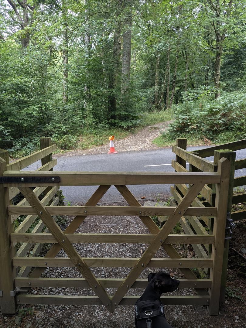
Wooden gate opening onto the lane at Tarn Hows, with a Staffordshire Bull Terrier waiting at the gate
The gate where the circuit crosses the lane — Cass, our Staffordshire Bull Terrier, waiting to be let through

Dogs and the water

On our visit on Sunday 30 August 2026 there were signs at the water's edge warning against letting dogs drink from the tarn because of algae. Algae blooms appear in Lake District waters in warm weather, can be harmful to dogs, and come and go — so check the signage on the day rather than relying on this page, and carry water for the dog. Cass, our Staffordshire Bull Terrier, stayed on the path.

The waterfall

Tom Gill: a short detour, or a proper descent

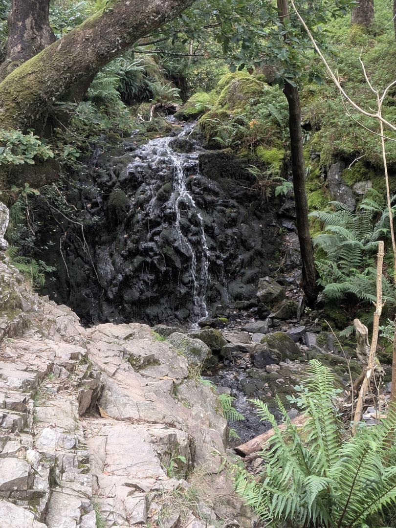
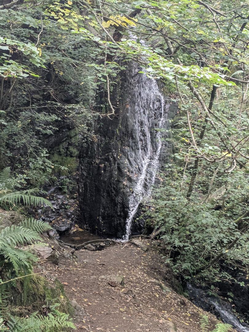
Yes, there is a waterfall. Tom Gill is the beck that drains the tarn at its south-western corner and drops through woodland to the road at Glen Mary. Two very different ways to see it:

Easy

The detour from the circuit

Signed off the trail shortly after the gate at the tarn's outflow — a few hundred metres there and back on a woodland path to the top of the falls. Not surfaced, but short, and fine for anyone steady on their feet.

/// what3words — Tom Gill turn-off, tarn end ///playful.baroness.gained /// what3words — the waterfall ///putty.stumps.permit
Difficult terrain

The full descent to Glen Mary

The path alongside the gill all the way down to Glen Mary car park is another matter. The National Trust rates it difficult terrain: an uneven path with two rocky scrambles, slippery when wet. Do not go down it in the pushchair, and do not frame it to the family as a stroll. Walked upwards from Glen Mary it is the classic way to arrive at the tarn.

Not to be confused with Gill Force in Eskdale, a different place on a different river. For the full picture of falls across the National Park, see our Lake District waterfalls guide.

Tom Gill waterfall dropping over dark rock through woodland below Tarn Hows, with ferns in the foreground
Tom Gill from the woodland path — the beck that drains the tarn
The tall main drop of Tom Gill waterfall in a shaded rocky gully beneath the trees
The main drop, in the gully below the top of the falls
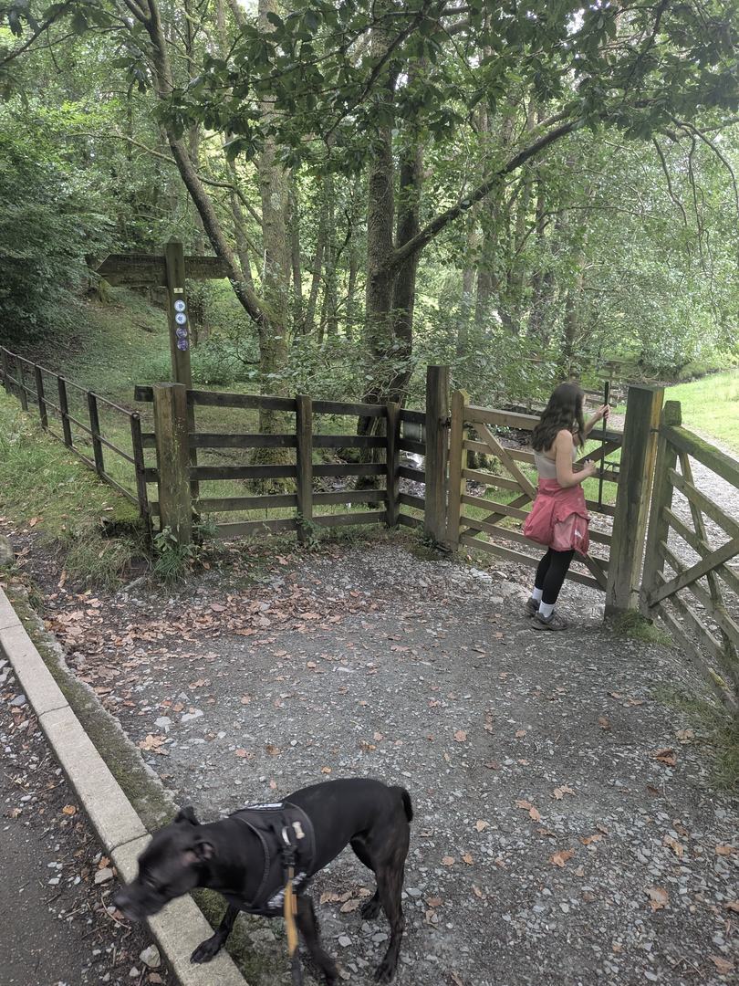
Wooden gate and fingerpost at the Glen Mary entrance to the Tom Gill path, with a Staffordshire Bull Terrier on the gravel in front
The gate at the Glen Mary end, where the steep path up the gill begins — Cass, our Staffordshire Bull Terrier, in front

The question people ask quietly

Can you swim in Tarn Hows?

Two separate things, and it is worth keeping them separate. First, a fact: Tarn Hows is a Site of Special Scientific Interest, designated in 1965 — the National Trust's own history of the tarn records it, and the designation is about the tarn's unusually diverse aquatic and shoreline plants and the mires that feed it.

Second, guidance: the National Trust asks visitors not to swim here. We could not find a current published rule on the Trust's pages, so check the National Trust's Tarn Hows page for the position on the day. On our own visit there was no swimming signage at the water — which tells you about the signage, not about whether swimming is a good idea.

Not here, but these are. If a swim is the point of the day, the Lakes have plenty of established spots with car parks, safe entry and no conservation designation to worry about. They are all in our wild swimming guide.

When to go

Early, late, or in October

Tarn Hows is open dawn to dusk and the car park is the constraint, not the tarn. On a fine weekend or through the school holidays it fills by late morning, the lane backs up, and the upper car park goes not long after. Arrive before ten or after four and none of that applies.

For the photograph everyone wants, the light is at either end of the day, and a still morning gives you the reflections. Autumn colour is the other reason to come: the larches turn gold in October and the tarn is at its most painted-looking. In winter the circuit is still fine underfoot — surfaced paths do not turn to bog — but the café hours shorten.

We went on a grey late-August Sunday and still shared the circuit with a great many people. It is not a place to come for solitude, and it does not pretend to be. Come for the fact that everyone in the party can do it.

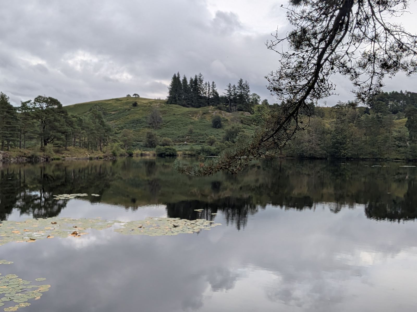
Still water and lily pads at Tarn Hows reflecting cloud, beneath an overhanging pine branch, with the wooded shore beyond
The north-eastern corner on a still afternoon — lily pads, reflections and a pine leaning out over the water

Nearby

What is around the tarn

Tarn Hows takes an hour. The two villages either side of it, and the fells and tarns within a couple of miles, turn it into a day.

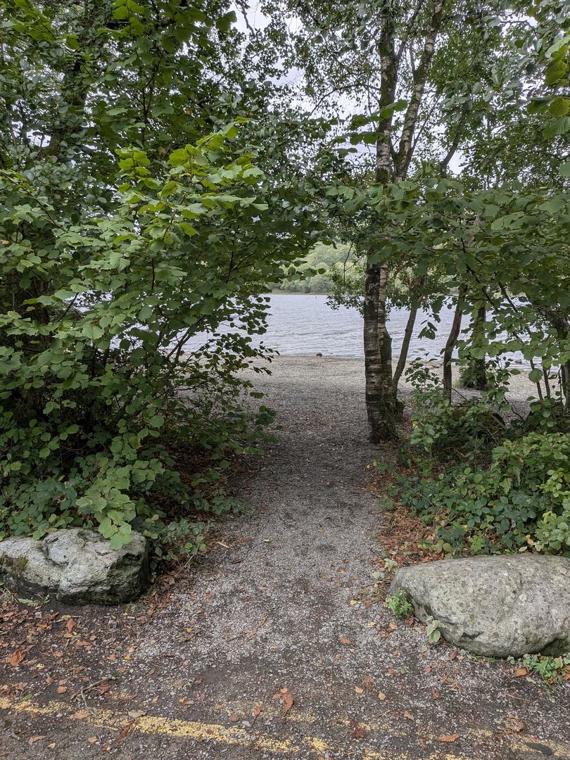
Gravel path leading between trees to the stony shore of Coniston Water at Monk Coniston
The path from Monk Coniston car park to the shore of Coniston Water — the start of the long way in to the tarn

Common questions

Tarn Hows, answered

How long of a walk is Tarn Hows?
The circuit of the tarn is about 1¾ to 2 miles and takes most people around 45 minutes at an easy pace, longer with a picnic or photographs. It is mostly flat on a surfaced path, and it is one of the few genuinely pushchair- and wheelchair-friendly walks in the Lake District. The full route, with the Tom Gill and Monk Coniston variations, is on our Hawkshead walks page.
Is Tarn Hows worth visiting?
Yes, if you know what it is. It is a landscaped Victorian tarn with wooded islands and a fell skyline, reached by a short, flat, surfaced loop — the most accessible great view in the southern Lakes, which is why families, wheelchair users and photographers all end up here. It is not wild, and on a fine weekend it is not quiet. Go early or late and it is very good indeed.
Is there a waterfall at Tarn Hows?
Yes — Tom Gill, on the beck that drains the tarn, a short signed detour from the circuit a few hundred metres there and back. The full descent alongside the gill down to Glen Mary car park is a different proposition: the National Trust rates it difficult terrain, with an uneven path and two rocky scrambles. Not to be confused with Gill Force in Eskdale.
Is there free parking at Tarn Hows?
Free for National Trust members and for Blue Badge holders, who have designated bays. Everyone else pays, on a tiered scale by how long you stay — by app or machine depending on which system the National Trust has installed at the time. At the time of writing the National Trust lists payment via the JustPark app, location code 80693. Phone signal at the tarn is poor, so download and set up the app before you travel, and check the National Trust's page for current rates.
What is the postcode for the car park at Tarn Hows?
The postcode usually given for the main National Trust car park is LA21 8DP, with OS grid reference SD 326 996. Treat the postcode with caution — it is a rural one that also covers Glen Mary car park at the bottom of Tom Gill, so a sat nav can land you at the wrong car park. The what3words address for the main car park is ///crowns.spades.greet, and for Glen Mary it is ///fail.protected.taker.
Are there public toilets at Tarn Hows?
Yes. There is a toilet block at the rear of the main National Trust car park, including an accessible toilet. There are no toilets on the circuit itself, so go before you set off — the loop takes most people the best part of an hour.
Can you swim in Tarn Hows?
Tarn Hows is a Site of Special Scientific Interest, designated in 1965, and the National Trust asks visitors not to swim here. Check the National Trust's own page for the current position before you visit. If you want somewhere to swim, our wild swimming guide covers the Lake District's established spots — this is not one of them.
How do you get to Tarn Hows from Ambleside?
By car it is roughly a sixteen-minute drive: take the B5285 — also signed as North Lonsdale Road — through Hawkshead towards Coniston, and Tarn Hows is signposted off it. From Coniston it is about ten minutes. The road up to the tarn is narrow and unsuitable for large coaches, and there is no coach parking. By bus, the Hawkshead–Coniston service stops about a mile away at Hawkshead Hill, not at the tarn.

Keep exploring

More around Hawkshead and Coniston