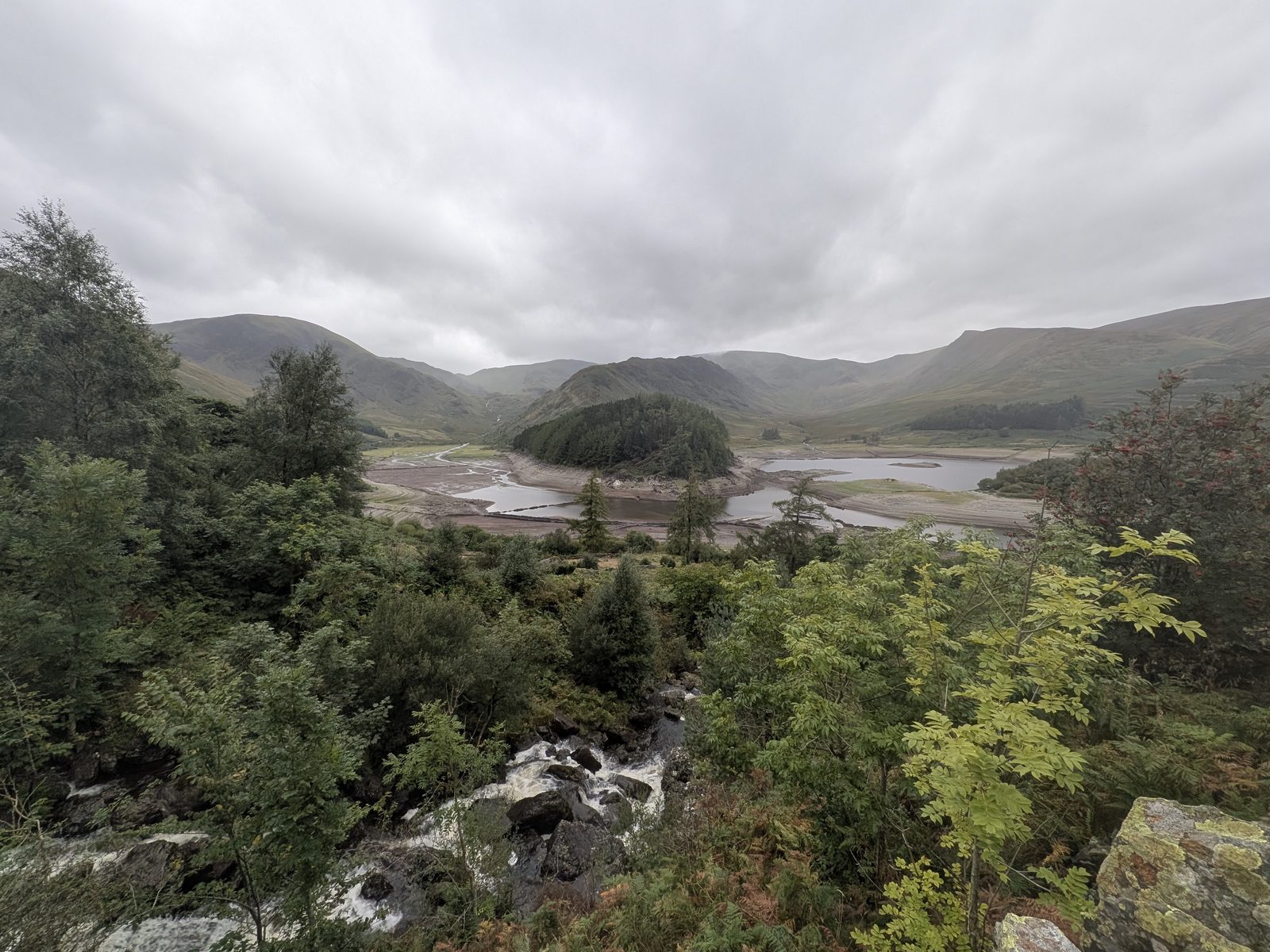
Haweswater from above the head of the reservoir under a grey sky: the wooded island of Wood Howe in the centre with the pale drawn-down bed exposed either side of it, a beck tumbling over rocks in the foreground, and the fells of Riggindale and High Street behind
Mardale, east of Penrith · United Utilities & RSPB

Haweswater

The water has dropped far enough that the drowned village of Mardale Green is out of the reservoir — walls, road and house footings standing on the open bed. Haweswater is the Lake District's highest, most easterly lake, a natural lake raised 29 metres in the 1930s to supply Manchester. People come for the quiet of the far eastern fells, and, in a dry year, for the village.

Written and walked by Peter Visited Friday 12 September 2026
29 m
A natural lake, raised — not made
1935 → 1940
Valley flooded → dam completed
60 mi
Gravity aqueduct to Manchester
2.15 mi
Our walk on the exposed bed, out and back
What it is Is the village visible? Mardale Green High water, low water Getting there & parking The signs Eagles & wildlife Hotel & inn FAQ

What it is

A natural lake raised 29 metres, with a village on the bed

Haweswater is the highest and most easterly of the lakes, in the valley of Mardale on the far side of the High Street fells from everything else. You will read on several walking sites that it is man-made. It is not. There was a natural lake here, and in the 1930s Manchester Corporation raised it by 29 metres — 95 feet — behind a dam at the northern end. The distinction matters, because it is the whole story of this place: the old lake stayed where it was, and the water rose over the fields and the village at its head.

It supplies about a quarter of the North West's drinking water — roughly 400 million litres a day, carried by gravity down a 60-mile aqueduct to Manchester with no pumping. That is why the water goes up and down: this is a working reservoir, drawn on every day, and in a dry year it drops far enough to uncover what was drowned. When it does, the walls, the old road and the house footings of Mardale Green stand out on the bed, and people drive a long way to walk among them.

The rest of the time it is one of the quietest corners of the National Park: one road in, a dead end at Mardale Head, and the passes climbing away from the car park. This page gives you the honest answer on whether the village is showing and how to check before you drive out, where to park and what the signs actually say, the history in the right order, and what we did on the exposed bed ourselves.

It is Haweswater on the map and on United Utilities' boards. You will also see Hawes Water and Haweswater Reservoir — the same place. Mardale is the valley it sits in, and Mardale Green was the village.

The question everyone asks

Is Mardale Green visible right now?

It depends on the level, and this page cannot tell you today's — nobody's page can, honestly, because the reservoir is drawn on every day and refills every time it rains on the fells. What we can tell you is how to check before you drive out, and what you will see at each stage if the water is down. When we walked it, the village was out.

One thing to know when you look it up: United Utilities publishes its reservoir levels weekly, and the figure it gives for Haweswater is Haweswater and Thirlmere combined. It is not a Haweswater number. The Environment Agency's own gauge on the reservoir is the closer guide — the two links are in the card below.

How to check the level before you drive out

Two sources, and read them together. United Utilities' reservoir levels page gives a weekly percentage, but the Haweswater line is Haweswater and Thirlmere together, so a healthy-looking figure can hide a low Haweswater. The Environment Agency gauge on the reservoir itself shows the actual water height and how it has moved over the past few days.

If the gauge trace is falling and has been for weeks, the bed will be showing. If it has jumped after rain, give it time — the level comes back up faster than you would think.

What shows, and in what order

The village sat at the head of the valley, on the higher ground, so it is the first thing out and the last thing back under. The field walls come first, running down off the fellside into the water, then the old road between its walls, then the footings of the houses and farms with their gateposts still standing.

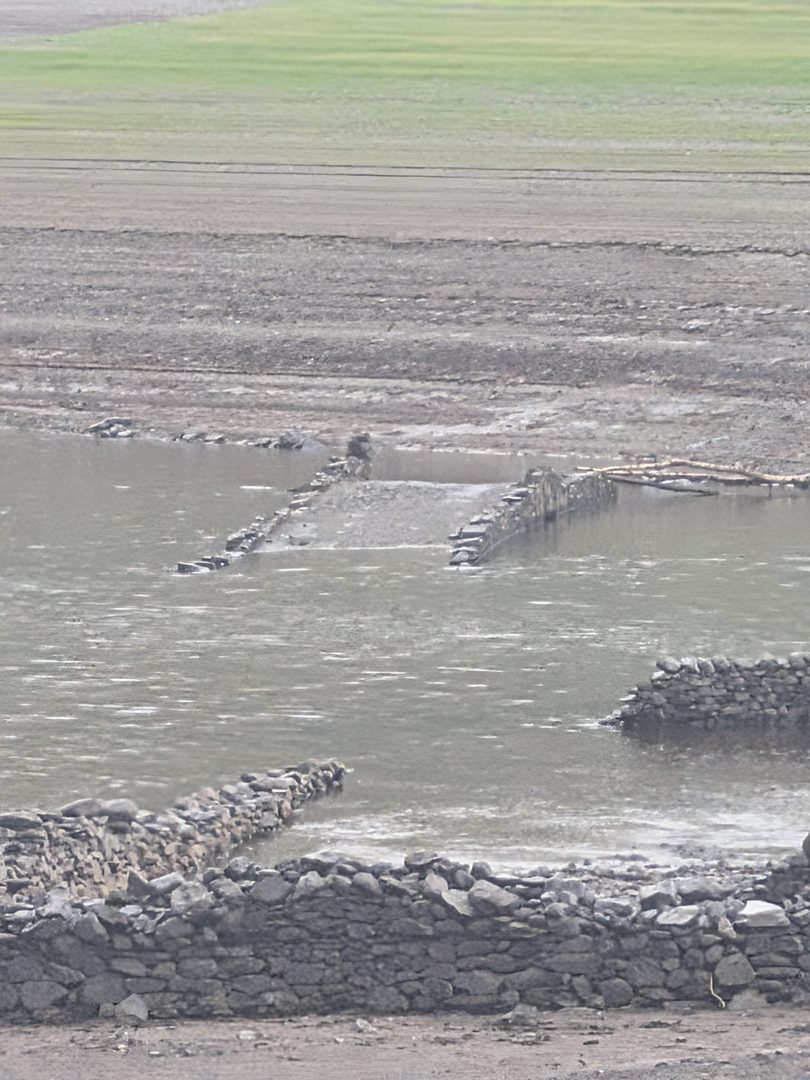
The bridge sits lowest of all. On our visit the road and the house walls were out and grassed over, and only the tops of the bridge parapets were breaking the surface. Beyond the village the bed drops away to the stream, and that is as far as the water lets you go.

The tops of two stone bridge parapets just breaking the surface of grey water on the bed of Haweswater, with drystone field walls emerging from the water in the foreground and bare silt beyond
The bridge, lowest of the village remains: on our visit only the tops of its parapets were out of the water
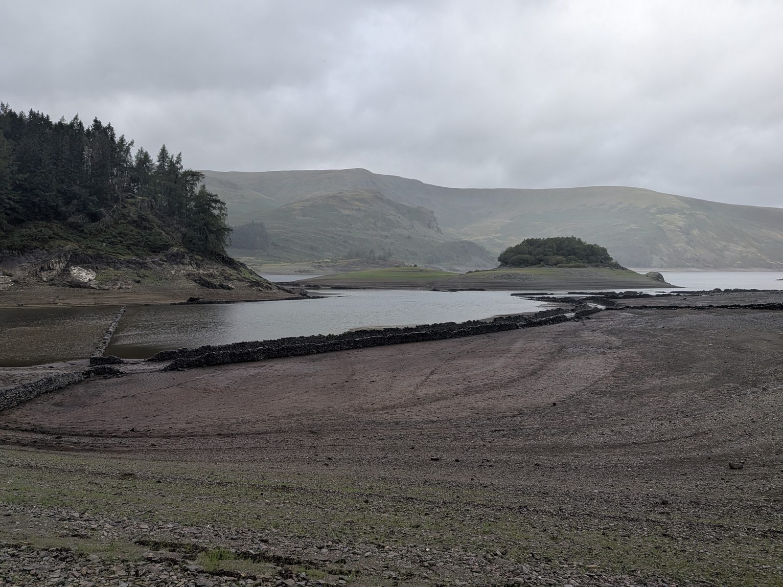
Wide view across the exposed silt bed of Haweswater, with drystone wall lines running towards the water, the conifer-covered promontory of The Rigg on the left and the wooded island of Wood Howe in the middle distance under low cloud
What "low" looks like: the head of the valley with the wall lines out, The Rigg to the left and Wood Howe beyond

The low years, according to a typed record at the Haweswater Hotel

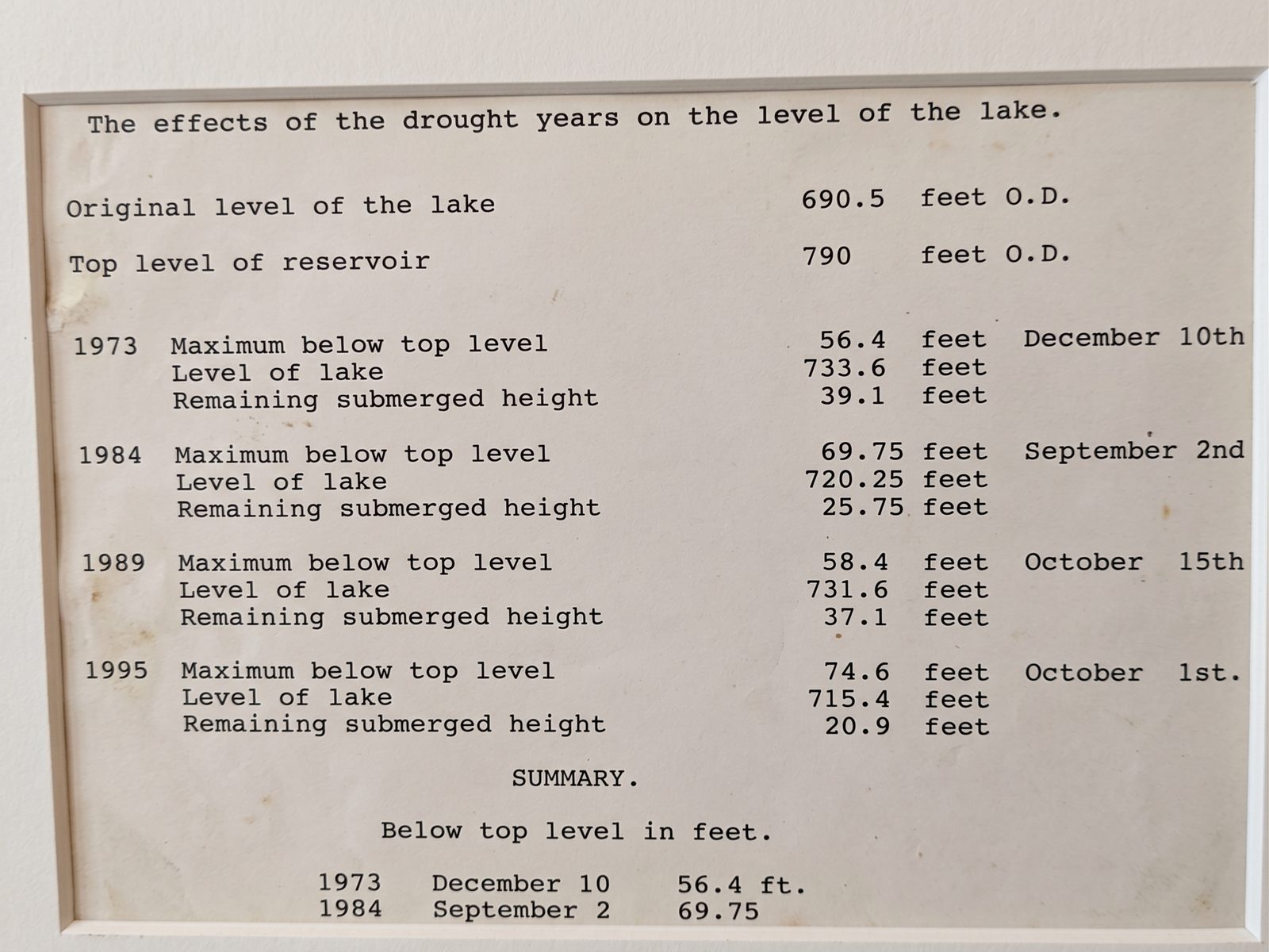
On the wall of the Haweswater Hotel there is a framed, typewritten sheet headed “The effects of the drought years on the level of the lake.” It is undated and unsigned, and it stops at 1995. We are reproducing it here as the hotel's record, not as established fact — we have not corrected its figures against anything, and we do not know who typed it. It is worth having because nothing else we have found sets the low years out like this.

The sheet starts by giving the original level of the lake as 690.5 feet O.D. and the top level of the reservoir as 790 feet. That difference, near enough a hundred feet, is an independent match for the published 29-metre raise — a small check that the sheet was typed by somebody who knew the numbers.

YearMaximum below top levelLevel of lakeDate“Remaining submerged height”
197356.4 ft733.6 ft10 December39.1 ft
198469.75 ft720.25 ft2 September25.75 ft
198958.4 ft731.6 ft15 October37.1 ft
199574.6 ft715.4 ft1 October20.9 ft

As displayed at the Haweswater Hotel. Column headings are the sheet's own. The hotel's record, reproduced with permission; not verified against other sources.

Two things stand out. First, this list does not match the drought years repeated everywhere else — 1976, 1983, 2018, 2021 and 2022 are the ones you will see quoted, and only 1995 appears on both lists. We are not in a position to say which is right. Second, the last column, remaining submerged height, runs a consistent four feet under the simple arithmetic in every row: subtract 690.5 from the lake level and you get a figure exactly four feet higher each time. So whoever typed it was measuring to a datum four feet above the old lake surface. We do not know what that datum was, and we are not going to guess. That internal consistency, across four rows typed years apart, is what makes us take the sheet seriously.

A framed typewritten sheet headed 'The effects of the drought years on the level of the lake', listing the original level of the lake, the top level of the reservoir, and figures for 1973, 1984, 1989 and 1995
The sheet itself, as displayed on the wall of the Haweswater Hotel. Photograph courtesy of the Haweswater Hotel

History

The lost village of Mardale Green

Before the water there were two villages in the valley: Mardale Green at the head of the old lake, with its church, its inn and its farms, and the smaller Measand further down. Both went under. What follows is the story in the order it happened, because the dates get muddled everywhere else.

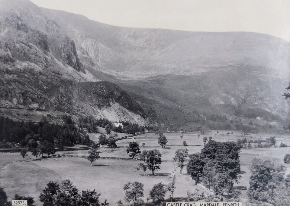
Old black-and-white photograph of Castle Crag, a rocky fellside rising above walled fields and trees on the floor of the Mardale valley
Castle Crag and the Mardale valley before the flooding. Courtesy of the Haweswater Hotel
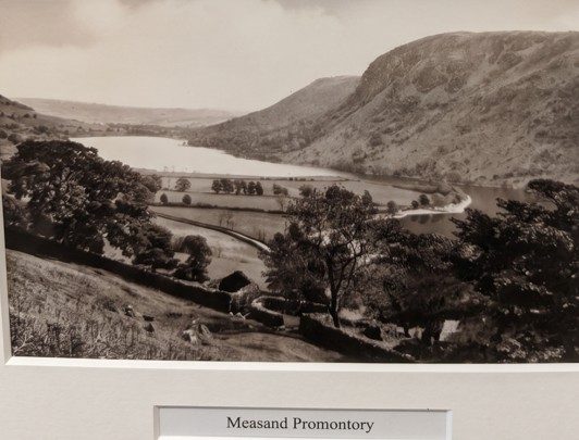
Old sepia photograph of the original Haweswater lake with the Measand promontory reaching into the water, walled fields and trees in the foreground and the fells rising behind, captioned 'Measand Promontory'
The Measand promontory and the old lake, before it was raised. Courtesy of the Haweswater Hotel

1919 to 1940: the Act, the dam and the five-year gap

Manchester got its powers under the Manchester Corporation Act of 1919, and work on the dam began in 1929. You will see two dates for what happened next, and both are right: the valley began to flood in 1935, and the dam was not completed until 1940. Flooding a valley is a process, not an event. The water was allowed to rise behind the dam while it was still being built, so Mardale Green went under five years before the structure holding the water back was finished. Sites that give you one date or the other have each lost half the story.

The dam itself is 36 metres high and was the first of its kind in Britain — United Utilities' board at the viewpoint makes the point that it was built through a decade that took in the Great Depression and the start of the Second World War. Alfred Wainwright was among those who objected to the whole scheme.

The last service at Holy Trinity, 18 August 1935

Holy Trinity held its last service on 18 August 1935. The church seated 75 and the service was all-ticket; far more people wanted to be there than could be. It was the one building in the village that was not simply destroyed — it was taken down stone by stone in April 1937, and 97 sets of remains were moved from the churchyard to Shap.

Most of the rest of Mardale Green was blown up by the Royal Engineers, who used the empty farms and houses for demolition practice. That is why what you find on the bed today is footings and wall lines rather than ruins: the buildings were levelled before the water arrived.

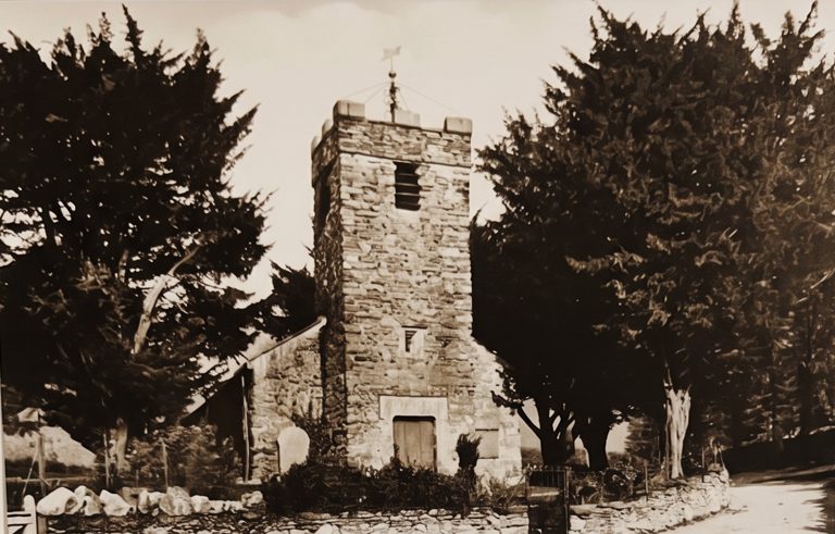
Old sepia photograph of Holy Trinity church at Mardale Green: a squat stone tower with a small turret, half hidden among tall dark trees
Holy Trinity, Mardale Green, among its trees — dismantled in April 1937. Courtesy of the Haweswater Hotel

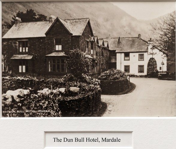
The Dun Bull, and the hotel that replaced it

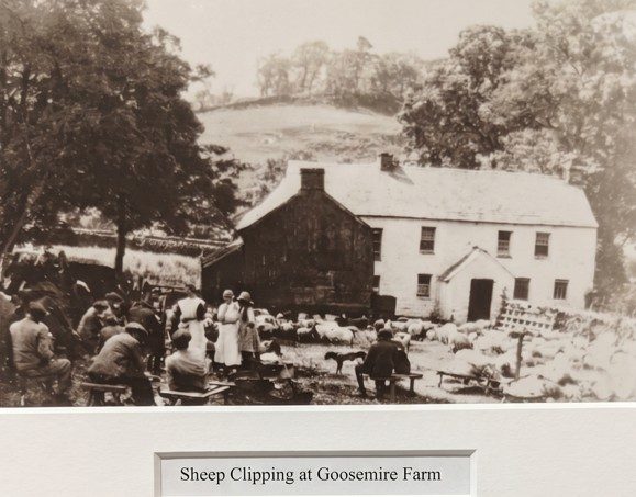
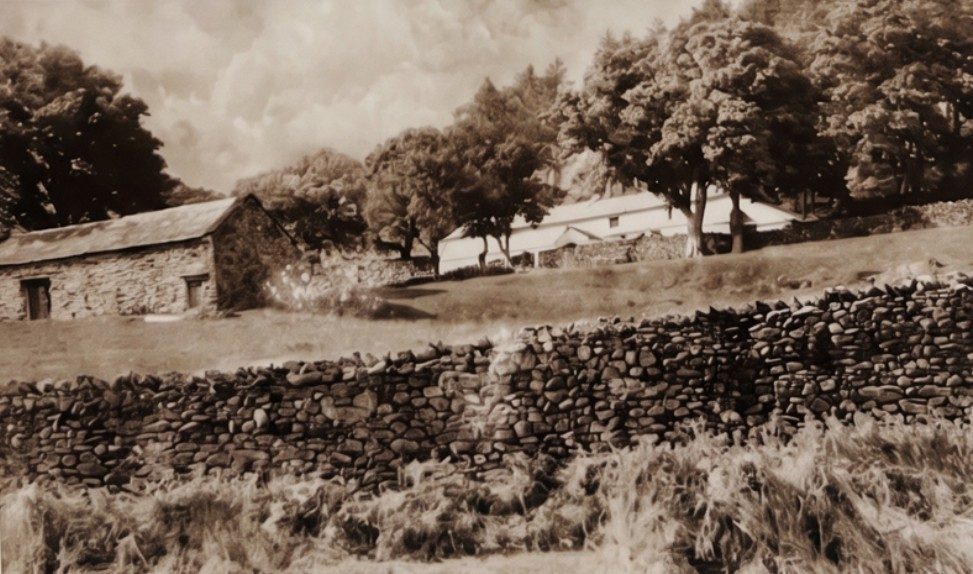
The village inn was the Dun Bull, and it was demolished with the rest. Manchester built the Haweswater Hotel on the new shore road in 1937 to replace it — the date is on the beam in the bar. The farms went the same way as the inn: Goosemire, Low Whelter and the others are names on old photographs now, and a few of those photographs hang on the hotel wall. There is more on the hotel further down.

Old sepia photograph of the Dun Bull Hotel at Mardale: a two-storey stone inn with a whitewashed wing, behind a low garden wall and hedge, captioned 'The Dun Bull Hotel, Mardale'
The Dun Bull Hotel, Mardale. Courtesy of the Haweswater Hotel
Old sepia photograph of sheep clipping at Goosemire Farm, Mardale: a group of people and sheep in a walled yard in front of a whitewashed farmhouse, captioned 'Sheep Clipping at Goosemire Farm'
Sheep clipping at Goosemire Farm. Courtesy of the Haweswater Hotel
Old sepia photograph of Low Whelter farm, Mardale: low stone farm buildings among trees on a fellside, with a drystone wall in the foreground
Low Whelter farm. Courtesy of the Haweswater Hotel

Burnbanks: the village that was built

While one village was being taken apart, another was being put up. Burnbanks, just below the dam, was built to house the 200 men who built it and their families — 66 self-contained bungalows, which for the early 1930s was remarkably modern housing. They are renovated cottages now. You pass through Burnbanks on the way in: there is roadside parking, the Bampton and District Local History Society keeps an information board in the village, and the road through the hamlet itself is a dead end.

The one building that survived

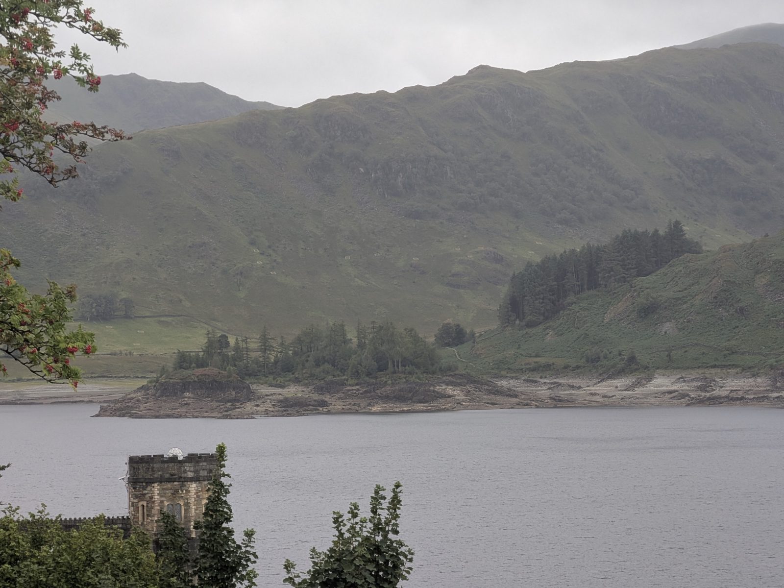
The church's stone and its windows were not wasted. They were reused to build the draw-off tower — the castellated stone tower standing at the water's edge on the road side of the reservoir, between the car park and the dam. So the one building from Mardale Green that is still standing is the one that holds back the water that drowned it.

Accounts differ on where the tower stands — some put it on the western shore. It does not. From the road it is right in front of you, on the near shore, looking straight across the water at Wood Howe — which fits the other account, the one that puts it in line with the natural head of the old lake.

The castellated stone draw-off tower at the water's edge of Haweswater in the foreground, with the grey reservoir behind it, the wooded island of Wood Howe and the exposed pale shoreline beyond, and the fellside rising above
The draw-off tower, built from the church's stone, on the road side of the reservoir looking across to Wood Howe

On the ground

What you can actually do down there: high water and low water

The same car park gives you two completely different places, and which one you get is decided by the water. This is the thing to understand before you plan anything at Haweswater.

Level high

When the valley floor is under the reservoir

The head of the valley is water, right up to the car park wall, and the only way towards it is the shoreline path around The Rigg — the wooded promontory in front of you. The village is a story you are told, not something you see. It is still a fine place to be: the fells stand straight up out of the water and the passes climb away from the road end. But you are looking at a reservoir.

Level low

When you can walk straight out across the bed

Everything changes. The water pulls back from the head of the valley and leaves a wide, flat bed you can walk straight out across: the old road between its walls, the field walls running in every direction, the footings of the farms and houses, and, if it drops far enough, the bridge. You are walking down a village street that has been under a reservoir for most of a century.

The walk we did: Mardale Head to the stream and back

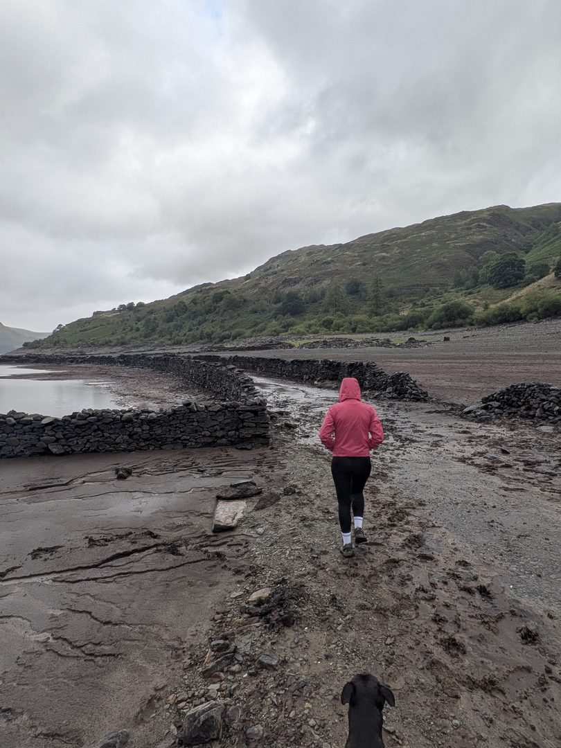
We did not do the circular. We did the thing you can only do when the water is down: from Mardale Head car park, through the five-bar gate — not the walkers' gate beside it, which is for the passes — and straight out across the exposed village floor to the stream, and back the same way. 2.15 miles, an hour and a quarter including a lot of standing about looking at walls. Easy going, and boggy underfoot — the bed is silt with grass coming through, and it holds water in every hollow. Cass, our Staffordshire Bull Terrier, was on the lead the whole way, as the signs ask.

You pick up the old road almost at once and follow it between its walls, past the house footings with their gateposts still standing, out to the stream. That is as far as it goes. Beyond the stream the water deepens and there is nowhere to go, so you turn round with the whole valley in front of you. None of this exists when the level is high — it is a walk that only appears in a dry year.

Ellie in a pink jacket walking away along the old walled village road on the muddy bed of Haweswater, with Cass, a black Staffordshire Bull Terrier on the lead, in the foreground, a pool of water on the left and the fellside beyond
Ellie and Cass, our Staffordshire Bull Terrier — on the lead — heading out along the old village road
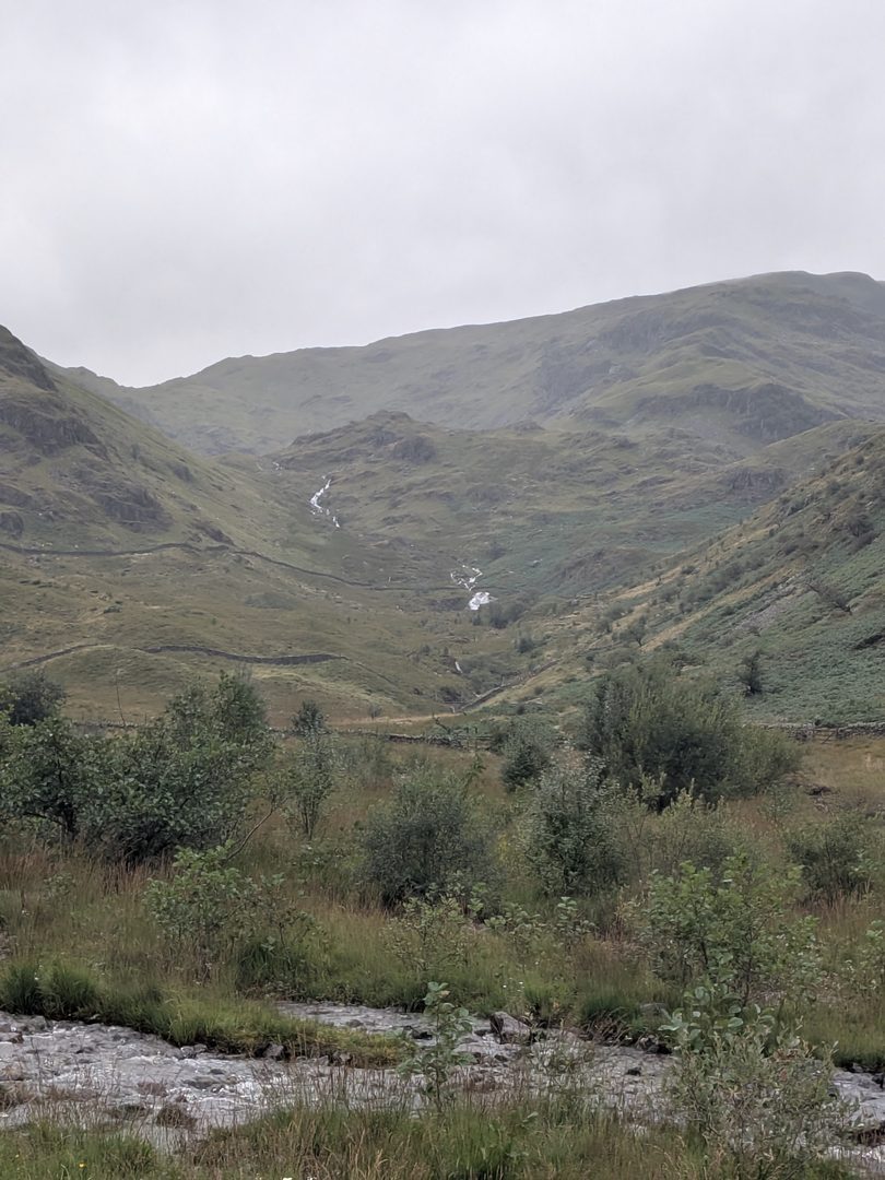
A beck coming down off the fellside at the head of Mardale in a series of small white falls between bracken and trees, seen from the exposed bed of Haweswater
A beck coming off the fell at the head of the valley, from the exposed bed

The Rigg and Wood Howe: which is the island

Two lumps of woodland stand out of the head of the reservoir and they get confused. The Rigg is the long, conifer-covered promontory on your left as you walk out — it is joined to the fell, and the shoreline path runs round it. It is not an island. Wood Howe is the island: the rounded, wooded knoll further out, sitting in the water in the middle of the valley. It is a natural knoll that became an island when the valley flooded. Nobody built it, whatever you may read.

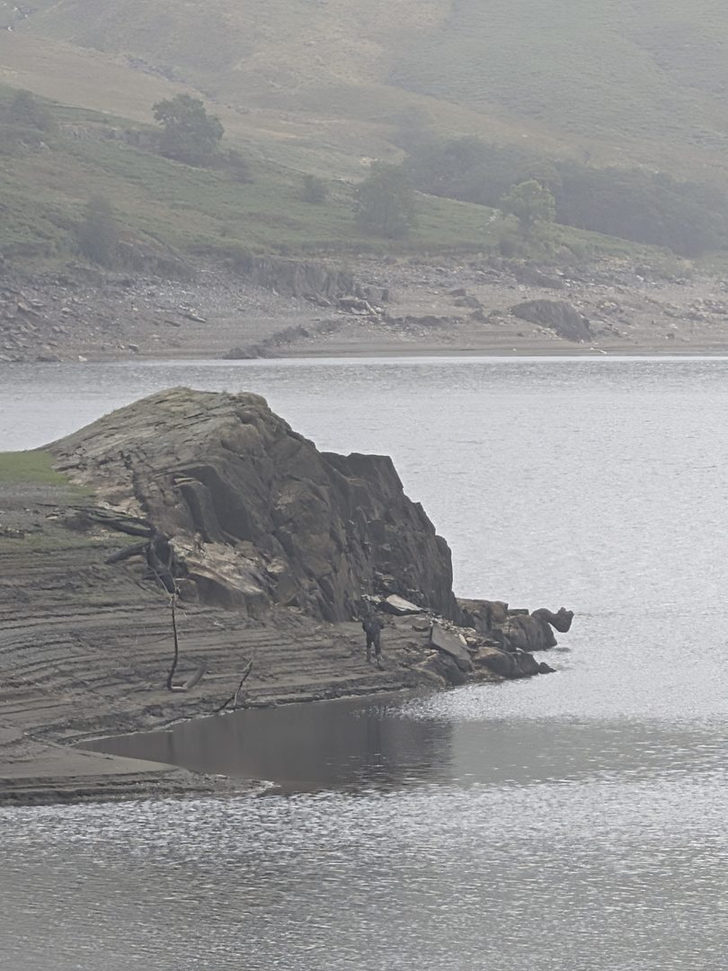
A bare, dark rock outcrop running out into the grey water from the exposed shore of Haweswater, with the pale drawn-down shoreline and the fellside beyond under low cloud
Bedrock, not masonry: an outcrop on the drawn-down shore. The knolls and points here are the valley's own

Underfoot

Proper footwear, whatever the weather is doing. The bed is boggy and uneven, the walls are loose stone, and the level comes back up after rain, so a bed that is walkable this week may not be next week. That is all we are going to say; we are not going to tell you it is fine, because we do not know what the water will be doing when you go.

Getting there & parking

Getting to Haweswater, and where to park

There is one road in and it is a dead end, so you come back the way you went. From Penrith, head out through Askham, then Helton and Butterwick to Bampton. In Bampton turn right past the Mardale Inn — that is the name on the sign; on Google Maps it is listed as The Mardale Inn at St Patrick's Well — and follow the lane to Burnbanks. The road through the hamlet itself is a dead end, so keep left for the reservoir road.

Your first sight of the dam is from the roadside just after Burnbanks, and there is a viewing area with United Utilities' interpretation board and the 1955 plaque. From there the road runs the length of the eastern shore, past the Haweswater Hotel, and ends about three miles beyond the hotel at Mardale Head. That is the car park, and the passes and the bed all start from it. The same stretch of road is one of our Lake District cycling routes, so expect bikes as well as walkers on it.

Road end

Mardale Head car park

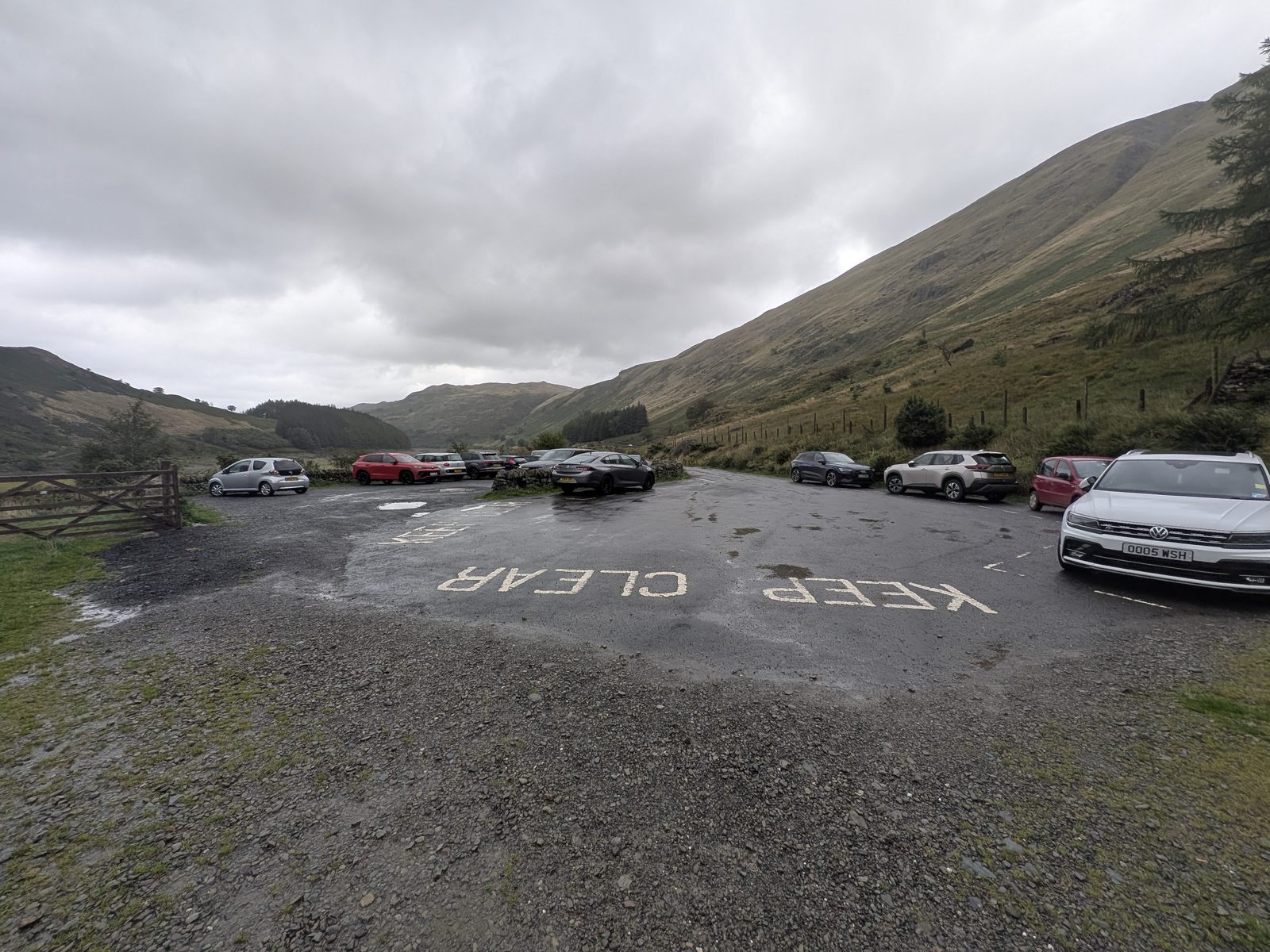
A rough surface with a painted turning area at the end of the road, room for roughly 20 to 30 cars around its edge and along the verge. On the day we visited it was free — no machine, no signs about charges. We are reporting what we saw, not a permanent arrangement: United Utilities own it, and their Haweswater page is where any change would show first. When it is full, the laybys on the last mile are the fallback.

/// what3words — Mardale Head car park ///expand.spenders.dated A 3-metre square. There is no useful postcode at the road end.

The dam viewing area

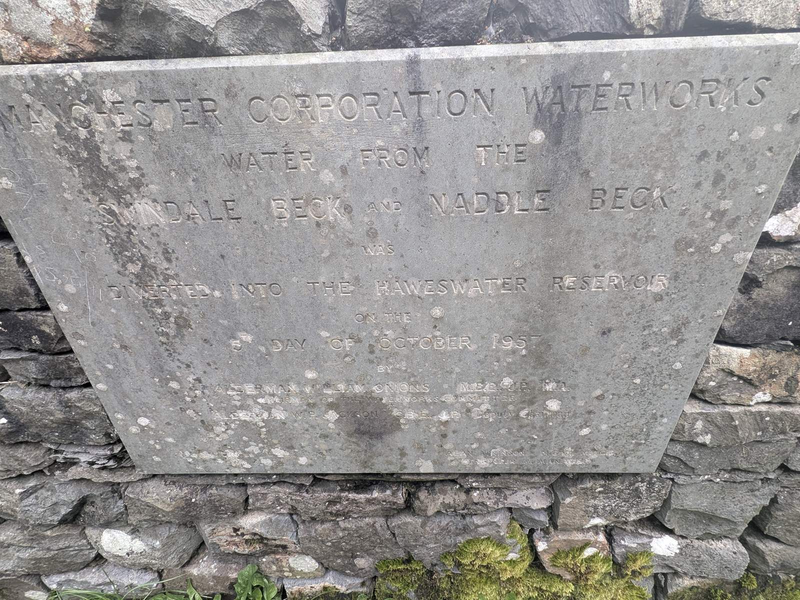
Your first view of the dam, from the roadside just after Burnbanks. United Utilities' interpretation board is here — the one with the rules on it — and so is the 1955 Manchester Corporation Waterworks plaque set into the wall, recording Swindale Beck and Naddle Beck being diverted into the reservoir. Worth ten minutes on the way in.

/// what3words — dam viewing area ///lyricism.proved.bottom A 3-metre square. More precise than the postcode.

Laybys and the gate

Three laybys in the last mile before Mardale Head, each with a view down over the reservoir from above — the best places to see how far the water has dropped before you commit to the walk. A gate about a mile up the road from the car park has parking too, and there is roadside parking at Burnbanks by the dam.

Mardale Head car park at the end of the Haweswater road: a rough surfaced area with KEEP CLEAR painted on the turning space, cars parked around the edge, a wooden gate on the left and the fellside rising steeply on the right under grey cloud
Mardale Head car park on the day we visited — free, no machine, cars parked around the edge
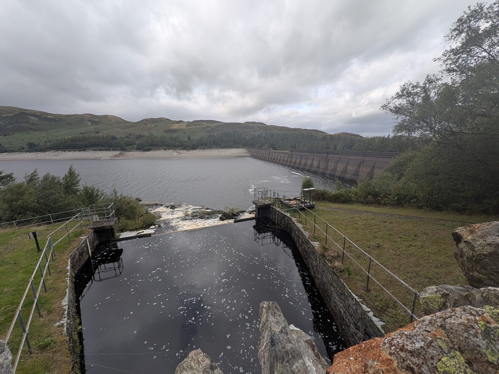
Looking along the top of the Haweswater dam from the viewing area, with the concrete spillway channel and railings in the foreground, the long straight line of the dam wall stretching away and the reservoir beyond under a grey sky
The dam from the viewing area just after Burnbanks — 36 metres high, the first of its kind in Britain
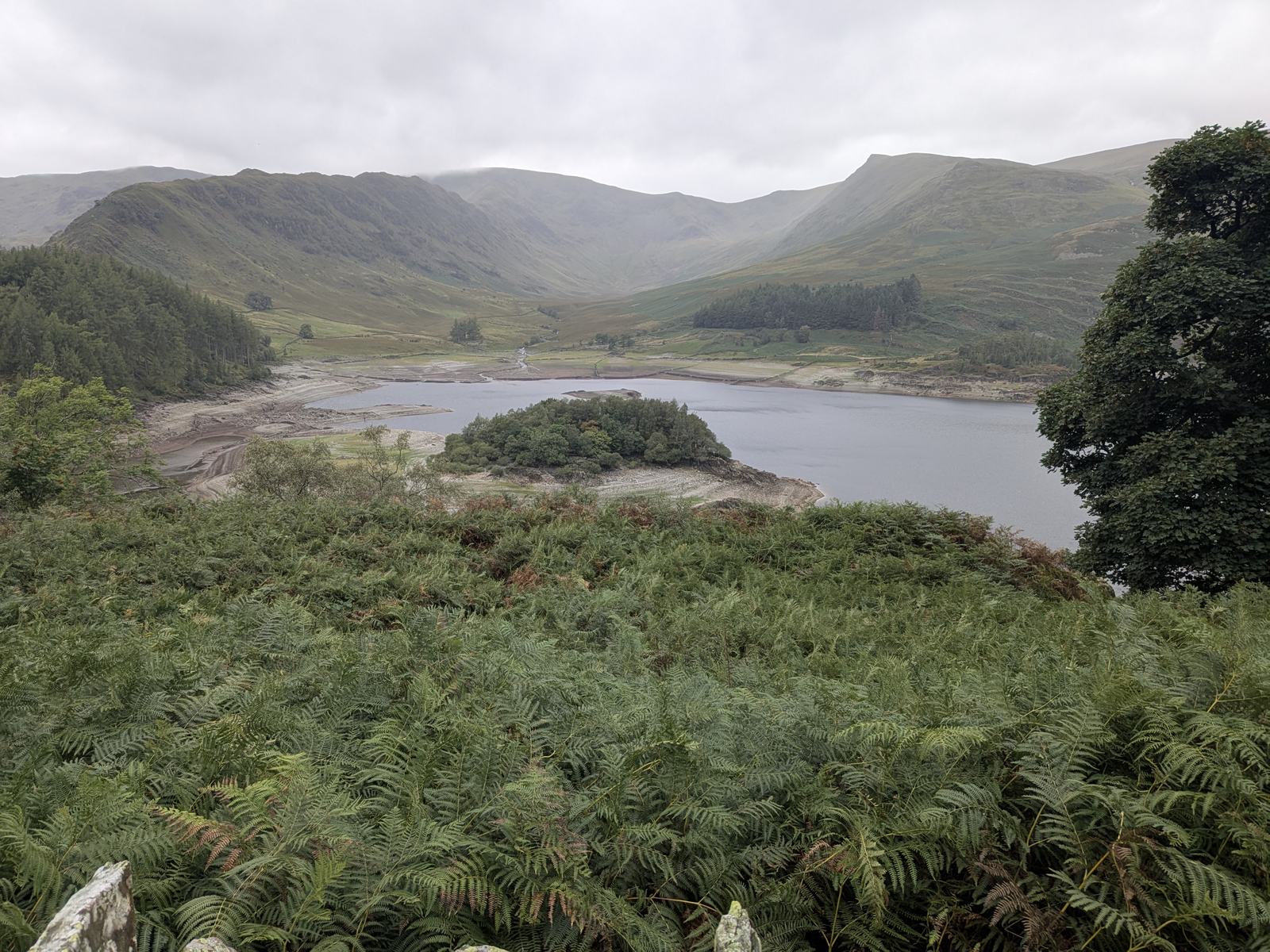
Haweswater from a roadside layby above the eastern shore, looking over bracken to the reservoir with the wooded island of Wood Howe, the exposed pale shoreline, and the fells of Riggindale and High Street closing the valley under cloud
From one of the laybys on the last mile: the best place to judge the level before you commit

Rules on the ground

What the signs at Haweswater actually say

People ask whether you are allowed on the bed, whether you can camp, whether the dog has to be on a lead. Rather than guess, here is what the signs say. The signage at Mardale Head is all together at the car park, on the post by the two gates — a five-bar gate onto the old village floor, and a walkers' gate a few yards from it for the rest of the walks — with United Utilities' big board back at the dam viewpoint. This is what was posted on the day we went — not a claim that nothing else applies, and not a rule we have invented.

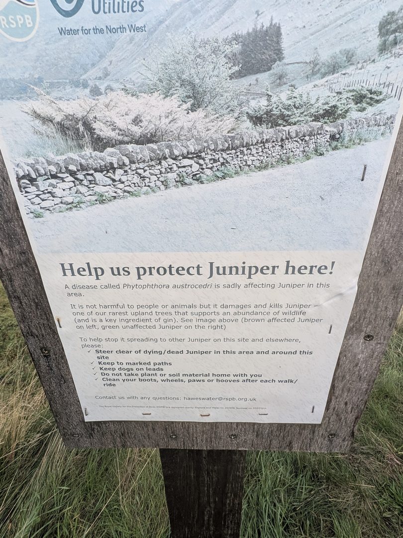
The juniper board at the car park

A joint RSPB and United Utilities board headed “Help us protect Juniper here!”. A disease called Phytophthora austrocedri is killing juniper in the valley — one of the rarest upland trees, and the board notes it is not harmful to people or animals. It asks you to:

  • steer clear of dying or dead juniper
  • keep to marked paths
  • keep dogs on leads
  • not take plant or soil material home
  • clean boots, wheels, paws and hooves after each walk or ride
The RSPB and United Utilities juniper board on a wooden post at Haweswater, headed 'Help us protect Juniper here!', with a photograph of a drystone wall and juniper bushes above the text and a list of requests to visitors below
The juniper board at the car park, on the post by the two gates

The United Utilities board at the dam

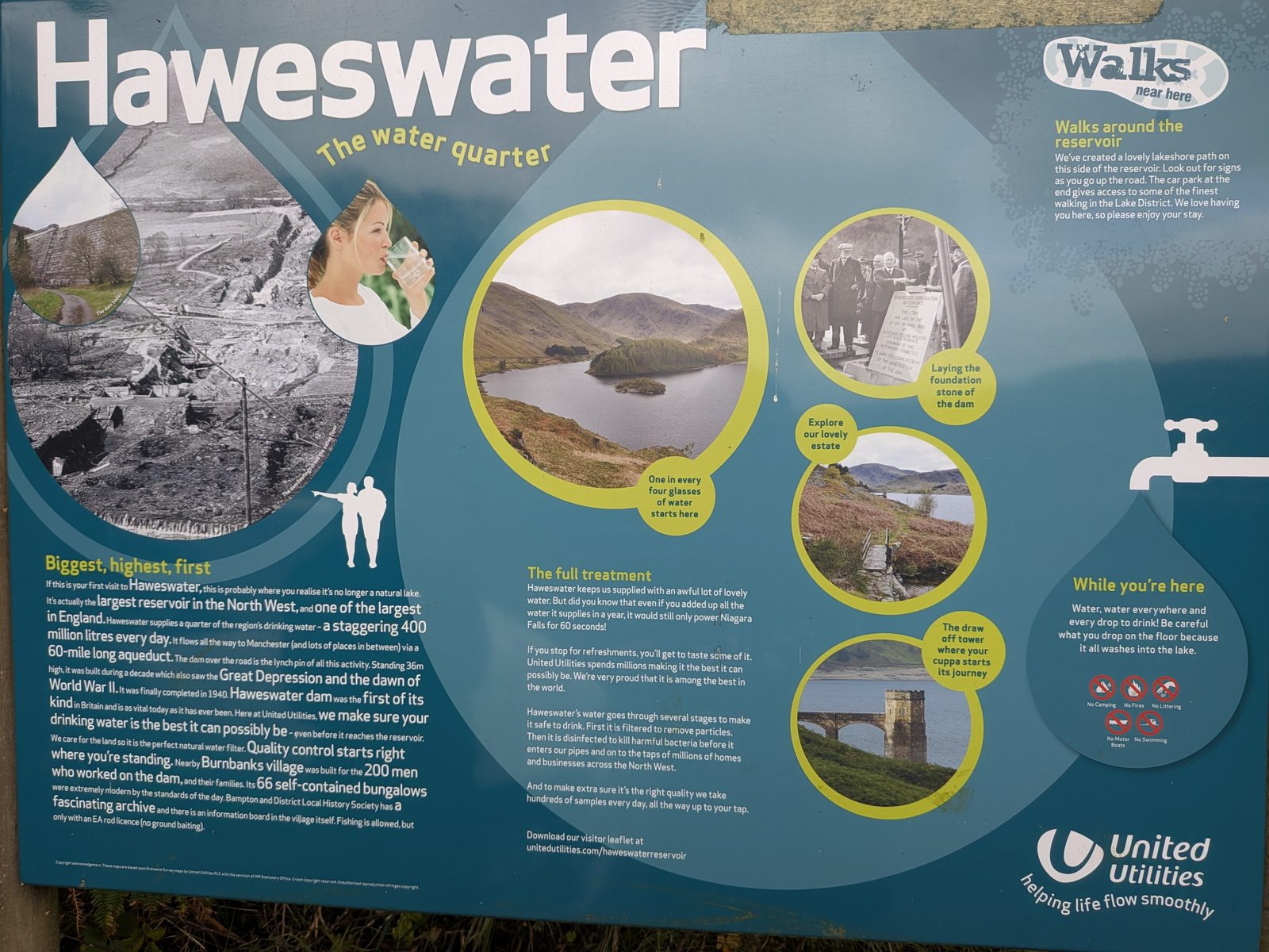
The big “Haweswater — the water quarter” board at the viewpoint. Under While you're here it carries five symbols:

  • no camping
  • no fires
  • no littering
  • no motor boats
  • no swimming

It also says fishing is allowed with an Environment Agency rod licence, no ground baiting, and that there is a lakeshore path on the road side of the reservoir with the car park at the end giving access to the fells.

United Utilities' blue interpretation board at the Haweswater dam viewpoint, headed 'Haweswater — the water quarter', with old photographs of the dam under construction, a view of the reservoir, a 'Walks near here' panel and a row of no-camping, no-fires, no-littering, no-motor-boats and no-swimming symbols
The United Utilities board at the dam viewpoint — the five symbols are bottom right

The no-barbecues notice at the car park

On our visit, the signs on the post by the gates at the car park also included a no-barbecues notice. We read it on the day rather than photographing it, so it is reported here as seen, not as a standing rule. Between the boards that is the list — camping, fires, barbecues, motor boats and swimming out; dogs on leads, paths kept to, boots cleaned.

The waterworks furniture still in place

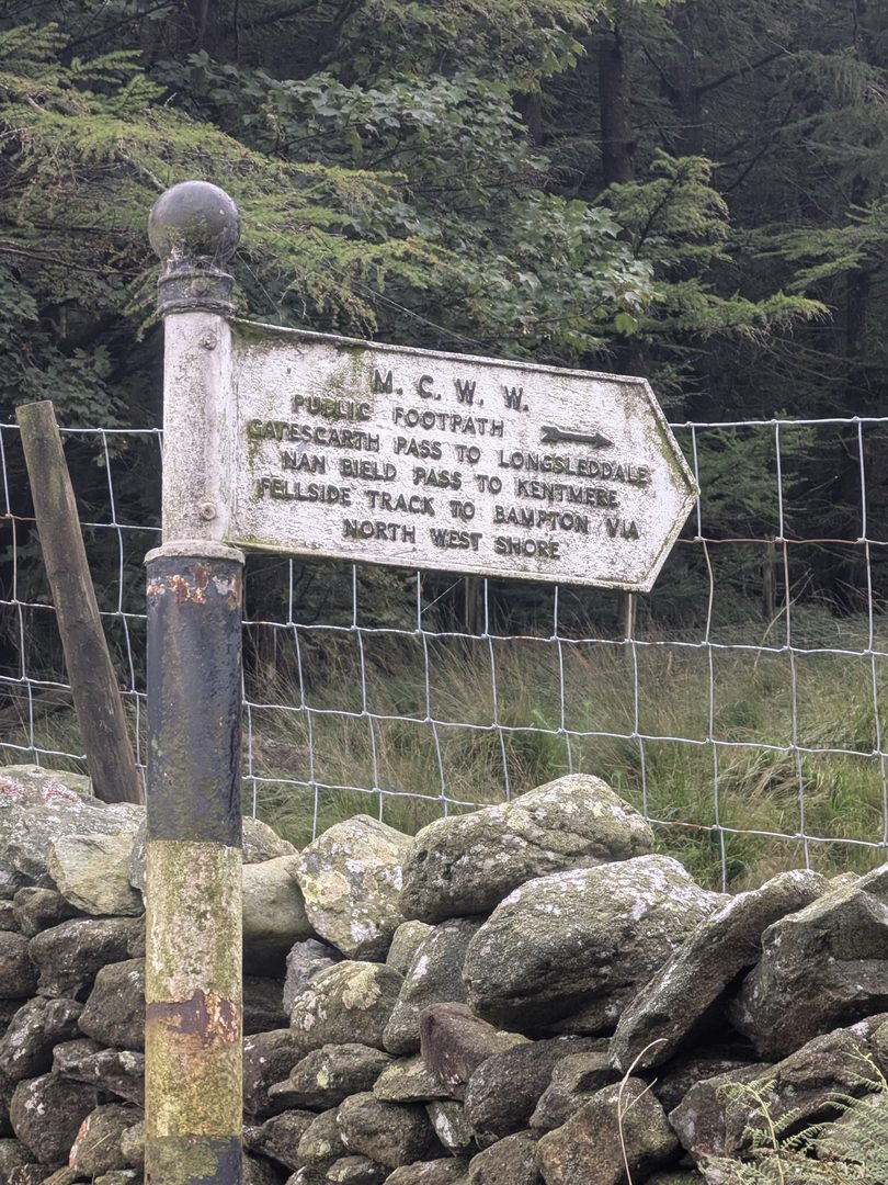
Manchester's initials are still on the valley. At the car park, on the post by the two gates, there is a cast-iron M.C.W.W. fingerpost — Manchester Corporation Water Works — pointing walkers to Gatescarth Pass for Longsleddale, Nan Bield Pass for Kentmere, and the fellside track to Bampton by the north-west shore. Those routes go through the walkers' gate; the five-bar gate beside it is the one onto the village floor. At the dam viewpoint the 1955 plaque records, in capitals, that water from Swindale Beck and Naddle Beck was diverted into the Haweswater Reservoir in October that year, in the names of the aldermen who chaired the Waterworks Committee. Both are original, and both are still doing their job.

A white cast-iron M.C.W.W. fingerpost on a black post beside a drystone wall and wire fence at Haweswater, its arm lettered 'Public footpath — Gatescarth Pass to Longsleddale, Nan Bield Pass to Kentmere, fellside track to Bampton via north west shore'
The M.C.W.W. fingerpost at the car park, on the post by the two gates — the passes go through the walkers' gate, the village floor through the five-bar gate beside it
A weathered stone plaque set into a drystone wall, lettered in capitals: Manchester Corporation Waterworks — water from the Swindale Beck and Naddle Beck was diverted into the Haweswater Reservoir on the day of October 1955, followed by the names of the aldermen
The 1955 plaque at the dam viewpoint, recording Swindale Beck and Naddle Beck being turned into the reservoir

Wildlife

Are there golden eagles at Haweswater?

No. There have been no golden eagles at Haweswater since 2015, and there are none anywhere in England. A lot of pages leave that vague, because the eagle is the thing Haweswater was famous for. It was, and it is worth knowing the story — but if you are coming to see one, you will not.

Golden eagles came back to the Lake District from Scotland on their own and first bred at Haweswater in 1969, in Riggindale — the side valley opening off the head of the reservoir, under High Street. It was the only place in England where they nested. The RSPB staffed a viewpoint in Riggindale for years so that people could watch them. The last male arrived in 2001–02. His mate died in 2004 and he was alone in the valley from then until he was last seen in November 2015. He is presumed dead. England has had no resident golden eagle since.

Wild Haweswater

The valley is now run as Wild Haweswater, a landscape-restoration partnership between the RSPB, who manage the site, and United Utilities, who own the land. Juniper is among the species grown at the nursery at Naddle Farm for restoration planting across the valley — which is why the disease on the car park board matters as much as it does. Their site has the detail on what is being restored and where.

Eat, drink, stay

Eating, drinking and staying at Haweswater

The Haweswater Hotel

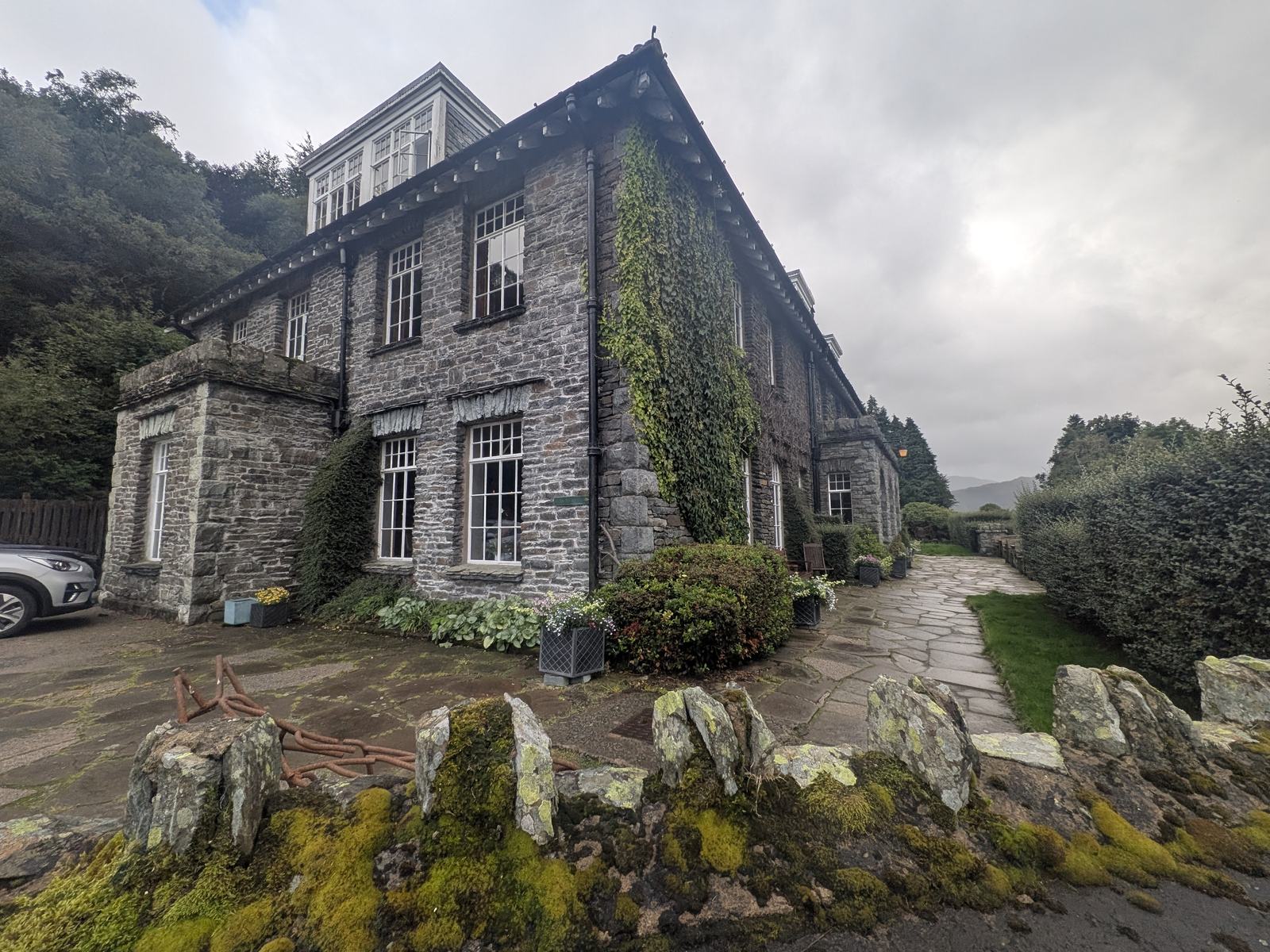
On the shore road between Burnbanks and Mardale Head. Manchester built it in 1937 to replace the drowned Dun Bull — the date is on the beam — and it has a proper bar, with the old photographs of Mardale Green and the drought sheet on the walls. It gets busy in midsummer, so do not count on a table without asking; we are not giving opening hours because they change, and the hotel's own site has them.

The Haweswater Hotel from outside: a long two-storey stone building with rows of white-framed windows, a slate roof, creeper on the walls, a flagged terrace and a low stone wall in front, under a grey sky
The Haweswater Hotel, built by Manchester in 1937 to replace the Dun Bull
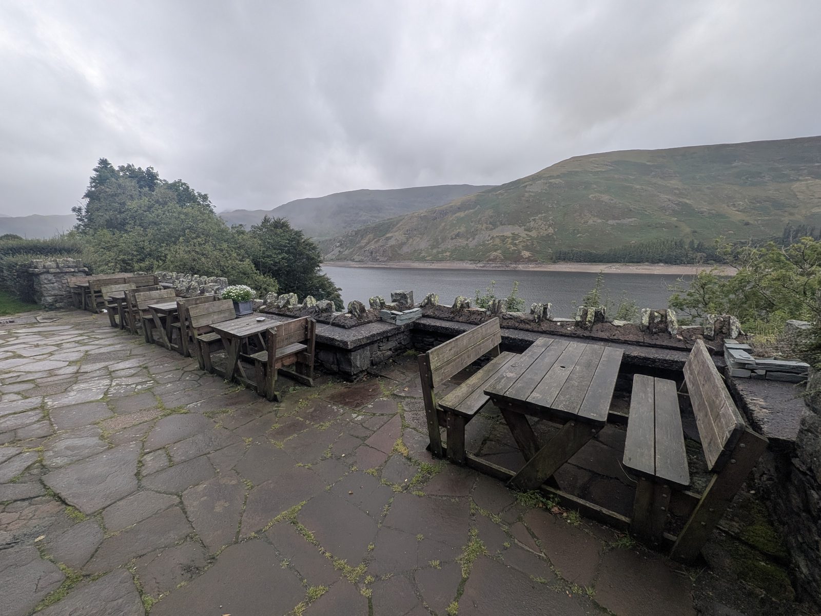
The flagged terrace of the Haweswater Hotel with wooden picnic benches, looking down the length of the reservoir to the fells at its head under low cloud
The terrace, and the view down the water that comes with it

The Mardale Inn, Bampton

The village pub in Bampton, on the corner where you turn for the reservoir — you pass it on the way in and again on the way out. The sign says Mardale Inn. One line is all it needs: it is there, it is the last pub before the reservoir road, and its own site has the rest.

It is also, by its own account, a community pub — bought and owned by more than five hundred local shareholders, which made news around here when it happened. The pub describes itself as small, serving food and drink sourced locally where it can, with six recently refurbished bedrooms for anyone who wants to stay in the valley rather than drive out of it.

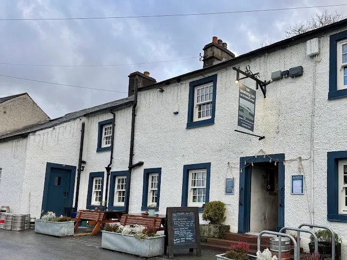
The Mardale Inn at Bampton: a long whitewashed pub with blue-painted window frames and doors, picnic benches and planters outside, a chalkboard by the door, under a grey sky
The Mardale Inn at Bampton — the last pub before the reservoir road.

Elsewhere

Other villages under reservoirs

Mardale Green is not the only one, and if the drowned village is what brought you here there are three others worth knowing about. In the Lake District itself, Thirlmere — Manchester's earlier reservoir — took the hamlets of Armboth and Wythburn; there is more on that on our guide to the sixteen lakes. In the Peak District, Ladybower covers the villages of Derwent and Ashopton. In mid-Wales, Lake Vyrnwy covers the old village of Llanwddyn. Each has its own story; this page is Haweswater's.

The longer walks

Walking around Haweswater

The full circuit of the reservoir is 17.1 km with 556 m of ascent, five to six hours, and graded hard — it is not the lakeside stroll the name suggests. The passes to Longsleddale and Kentmere and the way up to High Street all start from the same car park. We will write those up properly on their own page; until then, the Penrith walks page and the fells guide are the places to start.

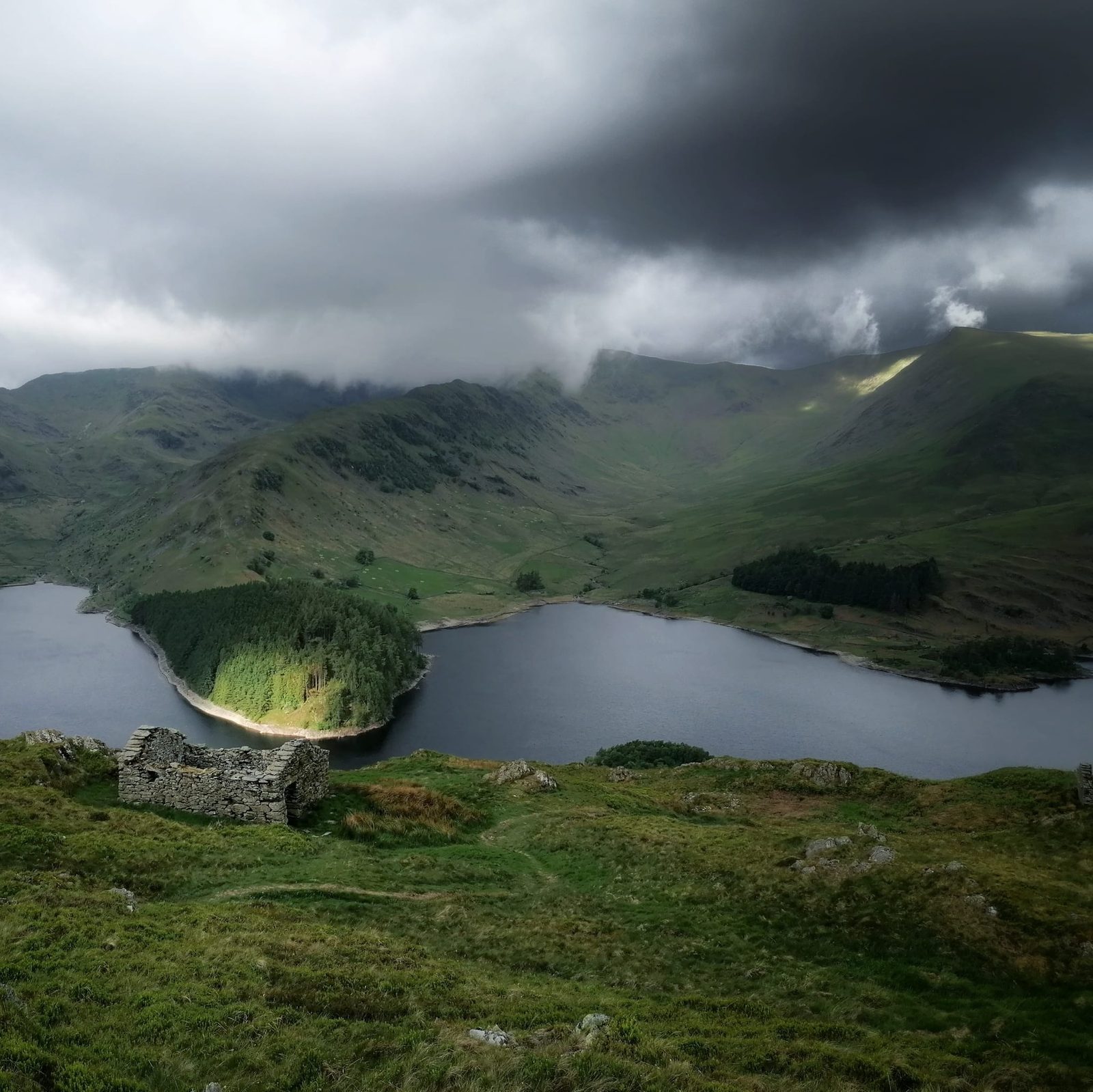
A roofless stone ruin on the green fellside above Haweswater, looking down on the reservoir and a wooded promontory, with sunlit fells and storm cloud beyond
A ruined stone building on the fellside above the reservoir. A photo by Glen Morton.
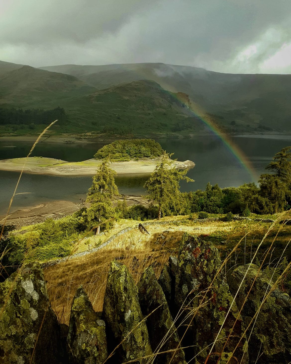
A rainbow over Haweswater seen past rocky ground and small pines, with the exposed shore of a wooded promontory in the water
A rainbow over the reservoir. A photo by Glen Morton.
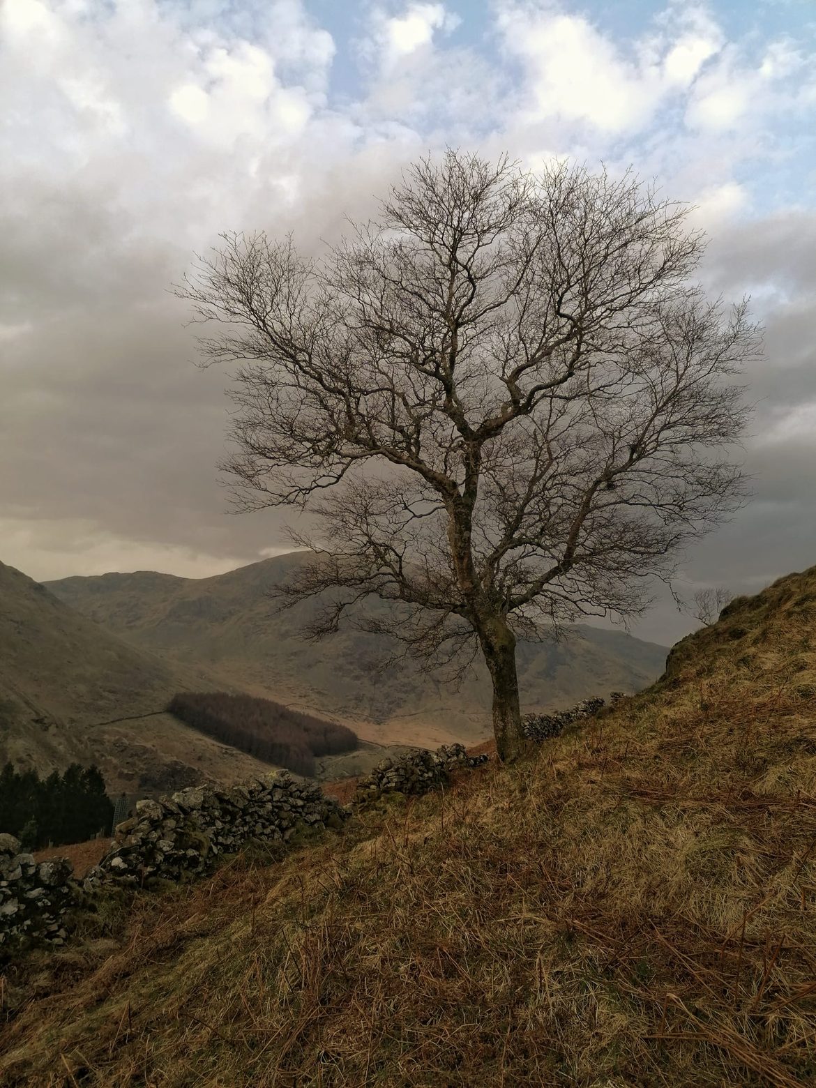
A lone bare tree on a steep bracken-covered fellside above the Haweswater valley, with a drystone wall below it
A lone tree above the valley. A photo by Glen Morton.

FAQ

Haweswater, answered

Is Mardale Green visible?
Only when the reservoir is low, and nobody's page can tell you today's level — it is drawn on every day and refills after rain on the fells. Check the Environment Agency gauge on the reservoir before you drive out; if the trace has been falling for weeks, the bed will be showing. The field walls and the old road appear first, then the house footings, and the bridge last of all. When we walked it the village was out and only the tops of the bridge parapets were breaking the surface.
Is there a village under Haweswater?
Yes — Mardale Green, at the head of the valley, and the smaller hamlet of Measand further down. Both went under when Manchester Corporation raised the natural lake by 29 metres, flooding the valley from 1935. Most of the buildings were blown up by the Royal Engineers beforehand, so what remains on the bed is footings, gateposts, field walls, the old road and the bridge rather than standing ruins. The church was taken down stone by stone and its stone reused to build the draw-off tower, which is still standing.
Why was Mardale Green flooded?
To give Manchester drinking water. The Manchester Corporation Act of 1919 gave the city the power to dam the valley and raise the natural lake by 29 metres; work began in 1929, the valley started to flood in 1935 and the dam was completed in 1940. Haweswater now supplies about a quarter of the North West's drinking water — roughly 400 million litres a day — by gravity down a 60-mile aqueduct. Mardale Green was simply in the way of the water.
Can you park at Haweswater Reservoir?
Yes. The main car park is Mardale Head, at the dead end of the road along the eastern shore, with room for roughly 20 to 30 cars — what3words ///expand.spenders.dated. On the day we visited it was free, with no machine and no signs about charges; that is what we saw, not a permanent arrangement, so check United Utilities before you rely on it. There are also three laybys in the last mile, parking at a gate about a mile back from the car park, the dam viewing area at ///lyricism.proved.bottom, and roadside parking at Burnbanks.
Is Mardale Head car park open?
It was open and unrestricted when we visited, and we are not aware of any closure. It is owned by United Utilities, so their Haweswater page is where a closure or a change to parking would be announced. Because the road is a dead end, if the car park is ever shut the laybys on the last mile are the only alternative — there is nowhere else to go at the road end.
How long does it take to walk around Haweswater Reservoir?
The full circuit is 17.1 km with 556 m of ascent, five to six hours, and graded hard — not a lakeside stroll. The walk we did is different: when the level is low you can walk from Mardale Head out across the exposed village floor to the stream and back, about 2.15 miles and an hour and a quarter, easy going but boggy underfoot. That walk only exists in a dry year.
Are there golden eagles at Haweswater?
No. Golden eagles first bred at Haweswater in 1969, in Riggindale, and it was the only place in England where they nested. The last male was alone from 2004, when his mate died, and was last seen in November 2015; he is presumed dead. England has had no resident golden eagles since, and the RSPB no longer staffs the Riggindale viewpoint.
Is Haweswater low? What is the current water level?
We do not publish a figure, because it would be wrong by the time you read it. Two sources: United Utilities' reservoir levels page gives a weekly percentage, but its Haweswater figure is Haweswater and Thirlmere combined, so it can look healthy while Haweswater is low. The Environment Agency gauge on the reservoir shows the actual water height and which way it is moving. Read the two together.
Can I sleep in my car in the Lake District?
Not at Haweswater: the United Utilities board at the dam says no camping, and an overnight in the car at Mardale Head is camping by any reasonable reading. Elsewhere in the Lake District it comes down to who owns the land and what that car park's own signs say; there is no general right to sleep in a vehicle in the National Park.
Which lake has a village under it?
In the Lake District, two. Haweswater covers Mardale Green and Measand, and Thirlmere — Manchester's earlier reservoir — covers the hamlets of Armboth and Wythburn. Both were natural lakes that were dammed and raised. Beyond the Lakes, Ladybower in the Peak District covers Derwent and Ashopton, and Lake Vyrnwy in mid-Wales covers Llanwddyn.
Is Mardale located in the Lake District?
Yes. Mardale is the valley that Haweswater fills, on the far eastern edge of the Lake District National Park, on the other side of the High Street fells from the central Lakes. Mardale Green was the village at its head. You reach it from Penrith — 15.6 miles via Askham and Bampton — on a dead-end road that finishes at Mardale Head car park.
Keep exploring

More around Penrith and the eastern fells