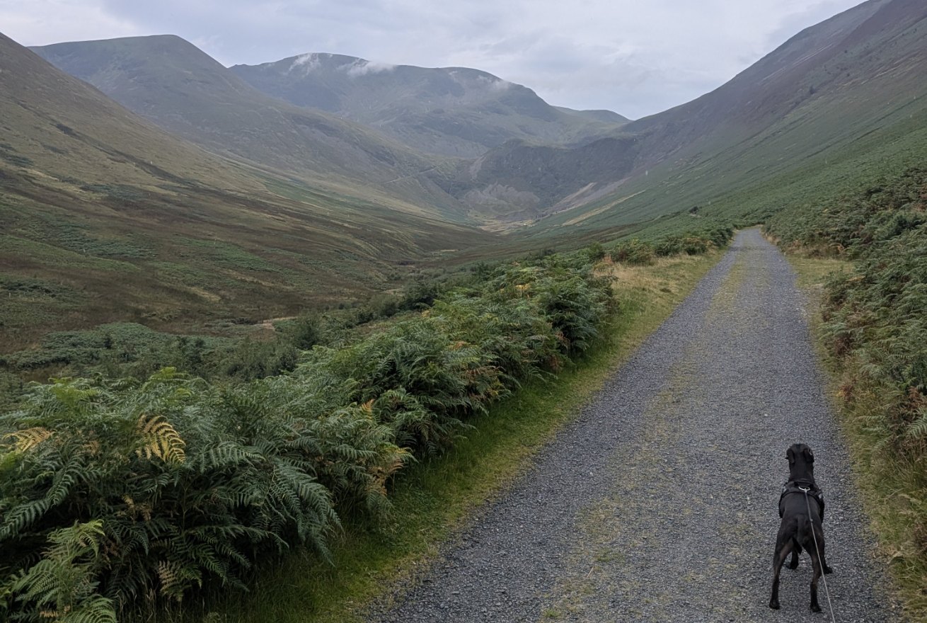
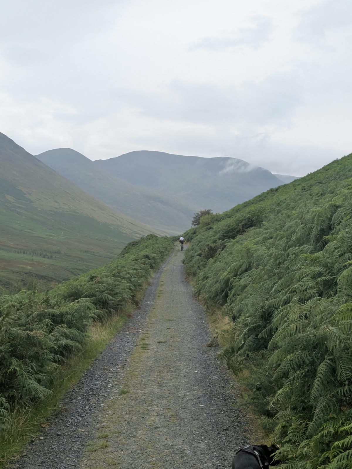
Cass, a black Staffordshire Bull Terrier, on the wide gravel track into Coledale with the valley opening ahead
The walk from Braithwaite

Force Crag Mine

A ruined mine and its mill standing at the head of Coledale, reached on a wide, well-surfaced track from Braithwaite. Easy walking, one climb at the start, and an industrial ruin at the end of it that most visitors to the Lake District never see.

Written and walked by Peter Walked 26 August 2026, with Cass A Cumbrian family guide, written in Penrith
~5.2 miles

Out and back from Braithwaite

~240 m

Ascent from the village

2–2.5 hrs

Allow, with time at the mine

Easy

Wide track · one climb

The walk Map Parking By bus The route The fells around you At the mine Going inside Where to eat FAQ

An easy walk with a payoff

The walk to Force Crag Mine

Force Crag Mine stands at the head of Coledale, the valley running south-west from Braithwaite. It is reached on the mine's own access track — wide, well surfaced and, once the first climb is behind you, close to flat the whole way in. That combination is unusual: most walks that end at something this dramatic make you earn it with a summit. This one does not.

From the village it is roughly 8.3 km (5.2 miles) there and back, with around 240 m of ascent and a moving time of about 1 hour 40 minutes. Allow two to two and a half hours in practice, because you will spend longer at the mine than you expect to. The track is fine in trainers, and the mine buildings come into view from a long way off, which keeps children walking.

It is also a genuine alternative for anyone already parked at or heading for Whinlatter Forest, which sits directly across the valley. Flat, wide, and with a ruin at the end of it rather than a viewpoint. Grisedale Pike is the obvious "one day" upgrade from here, and you can see the whole of its Sleet How ridge from the track — but this walk does not go up it.

Not to be confused with the Coledale Round — sometimes called the Coledale Horseshoe. That is a long, hard day over five or more summits on the fells above this valley. The walk on this page stays on the valley track and climbs nothing.

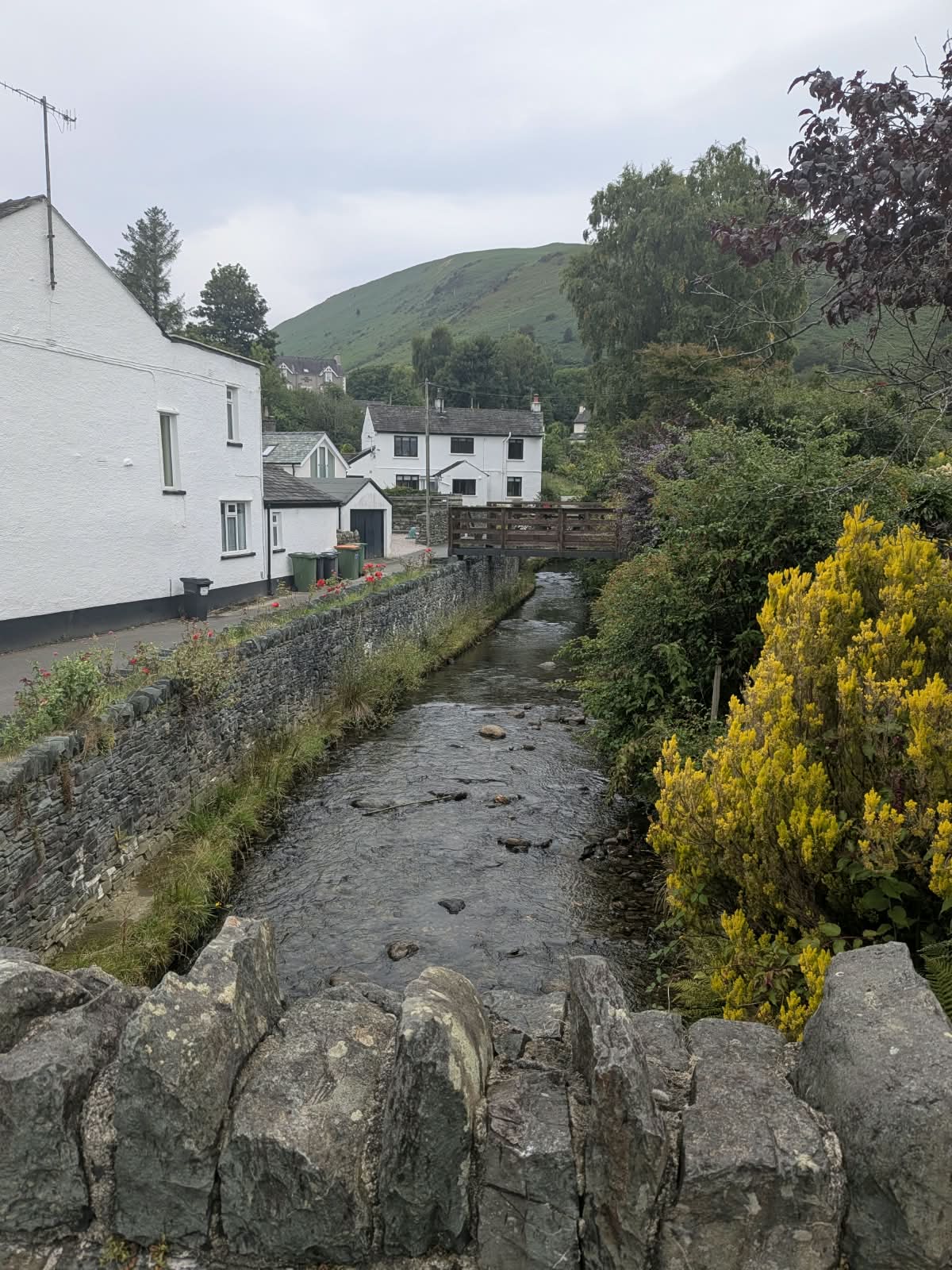
Coledale Beck running between stone walls through Braithwaite village, with a wooden footbridge and whitewashed cottages
Braithwaite village, where the walk starts and finishes.

Map

Force Crag Mine walk map

Parking, the mine buildings at the valley head, and the High Force workings on the fellside above them. The route between them is the single track shown on the ground — there are no turnings to get wrong.

Interactive map © OpenStreetMap contributors — tap a pin for the place. Pin positions are approximate, plotted from published grid references; tell us if any need nudging.

The bit everyone asks about

Parking in Braithwaite

Braithwaite is a small village with a lot of walkers arriving in it, and parking is the thing that catches people out. Here is what is actually true, and what is not settled.

First choice

The walk-start pull-in

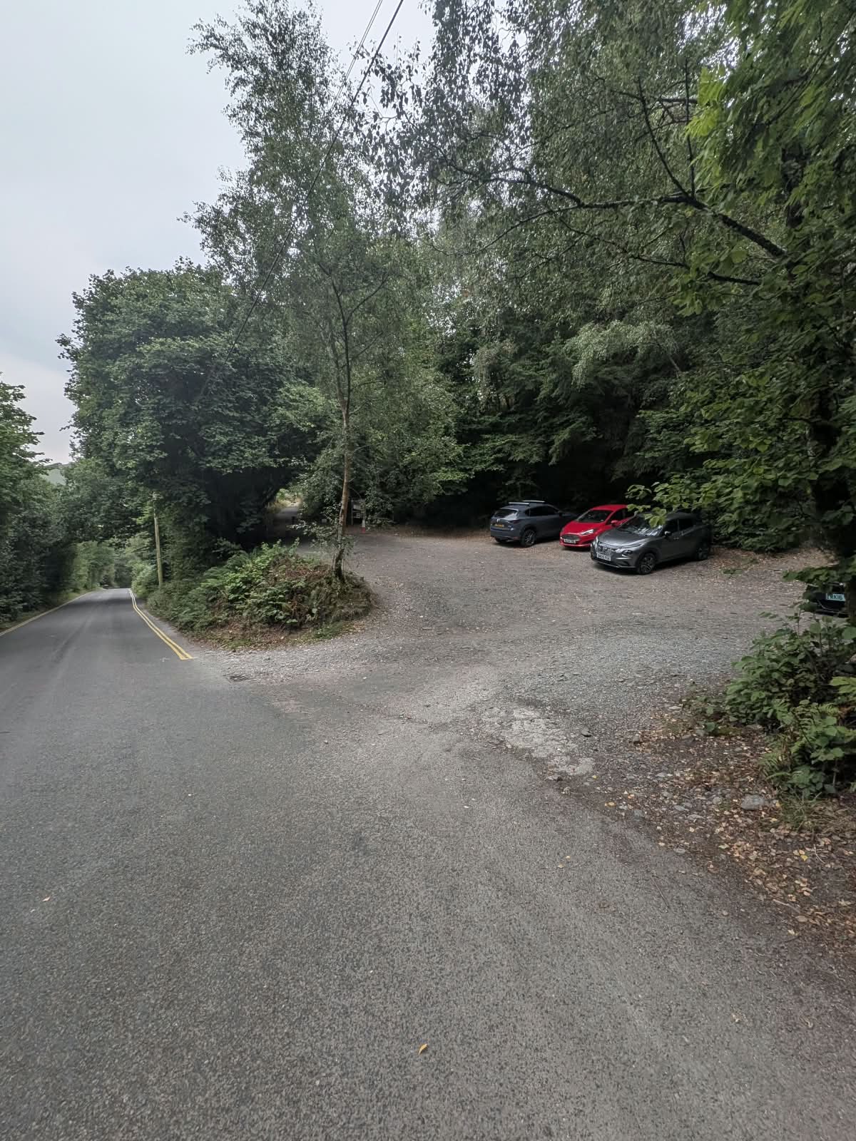
An informal gravel area off the Whinlatter road (B5292), reached by a sharp left turn. Free. Room for five or six cars. The National Trust information board for the mine is here, and the track starts at it.

It fills early — local advice for a busy day is to be there by around 7am. It does turn over reasonably quickly, though, because most people parked here are on a short walk rather than a full fell day.

///jeeps.startles.hushed

Informal gravel parking area off the Whinlatter road with space for several cars, surrounded by trees
The parking pull-in off the Whinlatter road — room for five or six cars.
Weekends & holidays only

Braithwaite CofE Primary School

The village primary school opens its grounds to parking — and this is the detail almost everyone gets wrong, to the point that locals correct each other on it: weekends and school holidays only. Not on a term-time weekday.

There is a suggested all-day donation, payable by cash in the letterbox by the front door, or online through the school's JustGiving link. No overnight stays or camping. We are deliberately not quoting the amount here — check the school's own page for the current figure.

It is a nicer place for your money to go than a machine, too.

Braithwaite CofE Primary School
Read the sign

The old road

The old road across from the village has long been used for free parking. A new sign has appeared on it recently, and what the restriction actually is now is not clear — accounts locally do not agree, and we have not been able to settle it.

We would rather tell you it exists and that the position has changed than pretend it is unrestricted or leave it out. Read the sign before you walk away from the car.

Parking at Whinlatter instead? The Forestry England visitor centre across the valley has a large car park with a charge, and is a reasonable fallback if Braithwaite is full — though it puts a road walk between you and the start of this track. Charges change, so check the current tariff with Whinlatter Forest before relying on it.

You can do this walk without a car

This is worth knowing, because the parking above is the weak point of the whole day — and Braithwaite is on the bus network. Both services are Stagecoach and both stop in the village at Croft Terrace.

The 77 / 77A, the Honister Rambler, is the interesting one. It is a seasonal circular from Keswick running in both directions, and it takes in Portinscale, Braithwaite, Whinlatter, Buttermere and Borrowdale. That puts Braithwaite and Whinlatter on the same loop — so you can come out from Keswick, walk to the mine, cross to Whinlatter Forest afterwards, and ride home, with no car and no parking problem at either end. Being seasonal, it does not run all year and the dates move, so check before you plan around it.

The X5 is the year-round option — Workington, Cockermouth, Keswick and Penrith, stopping at Braithwaite and Thornthwaite.

Timetables and fares change too often to publish here. Check current times with Stagecoach.

Stagecoach — timetables and tickets

The two services

X5
Year-round. Workington – Cockermouth – Keswick – Penrith.
77 / 77A — Honister Rambler
Seasonal circular from Keswick, both directions, via Portinscale, Braithwaite, Whinlatter, Buttermere and Borrowdale.
Braithwaite stop
Croft Terrace

Step by step

The route from Braithwaite

Out and back on the same track. Directions below are given walking away from Braithwaite; on the return everything is simply reversed.

  1. 1

    Out of the village

    From the Royal Oak, cross the bridge and head to the end of the road at the rear of the pub. Turn left onto the Whinlatter road, the B5292.

  2. 2

    Past Hope Memorial Camp

    About 250 yards along, Hope Memorial Camp is on your right. It is a children's and youth camp, not a public campsite — we mention it only because it is the landmark that tells you the turning is close.

  3. 3

    The sharp left into the parking

    Shortly after the camp, a sharp left turn on the left-hand side opens into the informal gravel parking area — five or six cars, and the National Trust information board for the mine. ///jeeps.startles.hushed

  4. 4

    The climb — and it is the only one

    The track climbs immediately. This is the only real ascent of the walk, and it is over early. It curves around the lower flank of Grisedale Pike, which is the steep ground on your right.

  5. 5

    The view back over Braithwaite

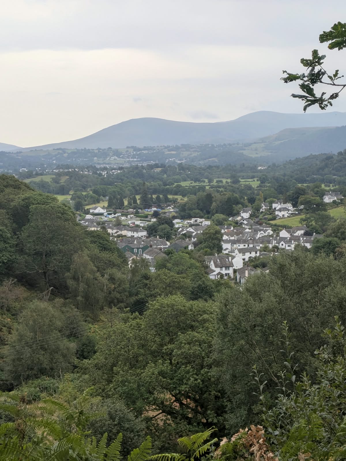
    The gradient eases and the track levels out. Views open back over Braithwaite and away towards Keswick. Worth turning round for — it is the best view of the outward leg, and you get it again on the way home.

    View over the rooftops of Braithwaite towards distant fells, with a campsite in the middle distance
    Looking back over Braithwaite as the track climbs.
  6. 6

    Along the side of Coledale

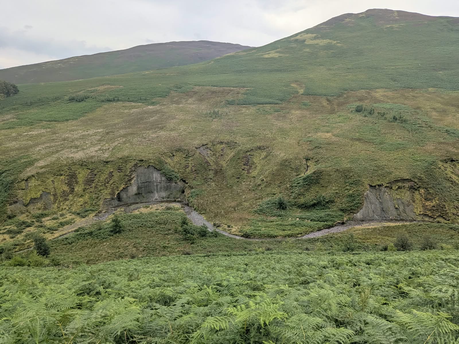
    From here the track runs almost flat along the northern side of Coledale. The fellside rises on your right; on your left the ground drops away to the beck running down the valley floor. It is wide enough for bikes as well as walkers, and there is nothing to navigate.

    Gravel track running between bracken into Coledale with a cyclist ahead in the distance
    The track is wide enough for bikes as well as walkers.
    View along Coledale from the track edge with bracken in the foreground and cloud on the fell tops
    Coledale opening up ahead.
  7. 7

    The mine comes into view

    The buildings become visible from a considerable distance, sitting at the head of the valley beneath the dark cliffs of Force Crag itself. This is the stretch that keeps children going: the thing you are walking to is in sight for the last mile or more.

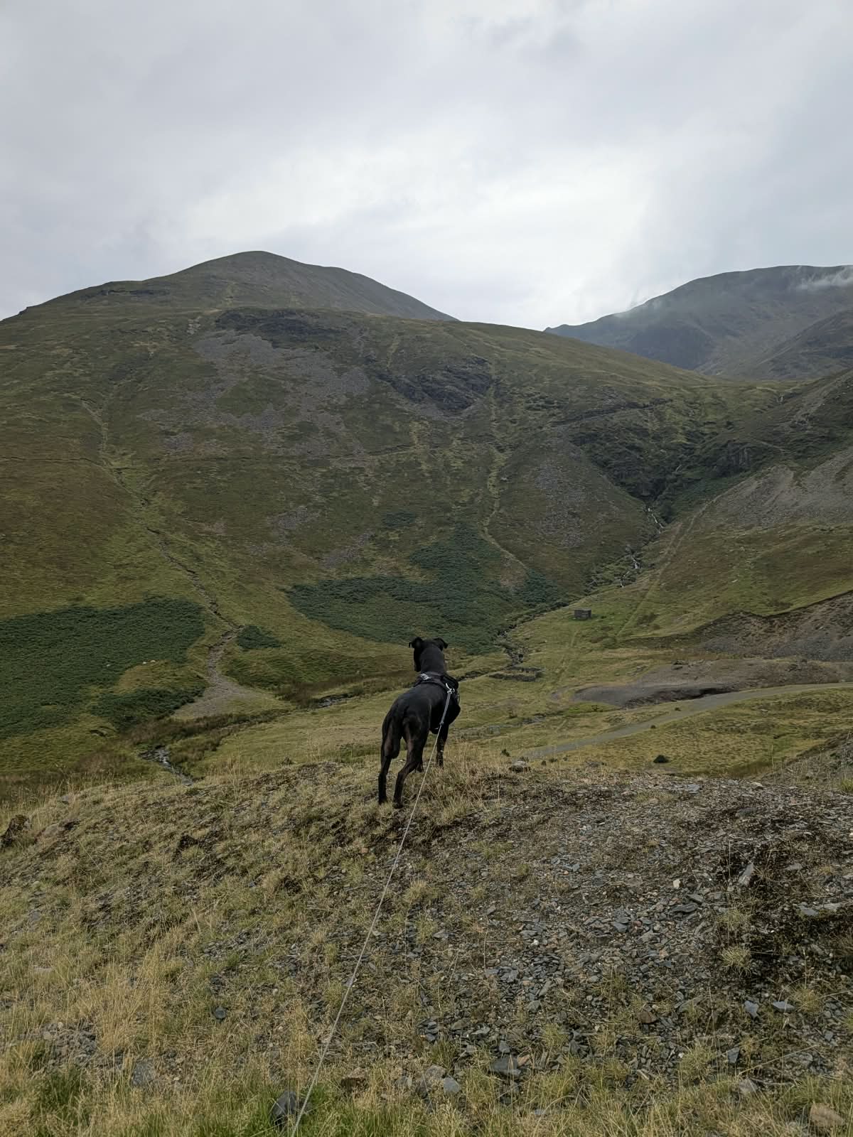
    Cass, a black Staffordshire Bull Terrier, standing on rough ground looking down towards the head of Coledale
    Cass, our Staffordshire Bull Terrier, taking in the view towards the mine.
  8. 8

    Return the same way

    Back down the same track. It is downhill in the places that were uphill, and the whole return is quicker than the way in. See below for the alternative, which is not the same standard of path.

The alternative return — read this first

There is an option to cross the beck in the valley and return on a path down the opposite side, which brings you back into Braithwaite. It exists, and some people prefer it. But it is not the equivalent of the main track, and we are not going to present it as though it were:

  • The path is significantly smaller than the main track.
  • It was boggy in late August, after a spell without much rain. Draw your own conclusions about what it is like in a wet week.
  • Boots needed. Trainers are not adequate on this side.

The main track from the Whinlatter side is wide, well surfaced and genuinely fine in trainers. If you came in trainers, go back the way you came.

Orientation

The fells around you

Given once, walking out from Braithwaite. On the return they swap sides, so we will not repeat it.

Fell Where it is What you see
Grisedale PikeRight, north-west sideDrops its Sleet How ridge straight down to the track. The steep ground on your right for most of the way in.
BarrowLeft, near the startLow and rounded.
Stile EndLeft, after BarrowThe next rise along the same side.
OutersideLeft, further inDeeper into the valley, still on the same side.
Force CragHead of the valleyThe crag directly above the mine — and what the mine is named after. The dark cliffs behind the buildings.
Crag Hill (Eel Crag)Beyond and above the valley headA separate summit, higher and further back towards Coledale Hause. Not the cliffs behind the mine.

Barrow, Stile End and Outerside are all on the same side — your left, walking out. They are often described as being on opposite sides of the valley, and they are not.

The reason you walked in

At the mine

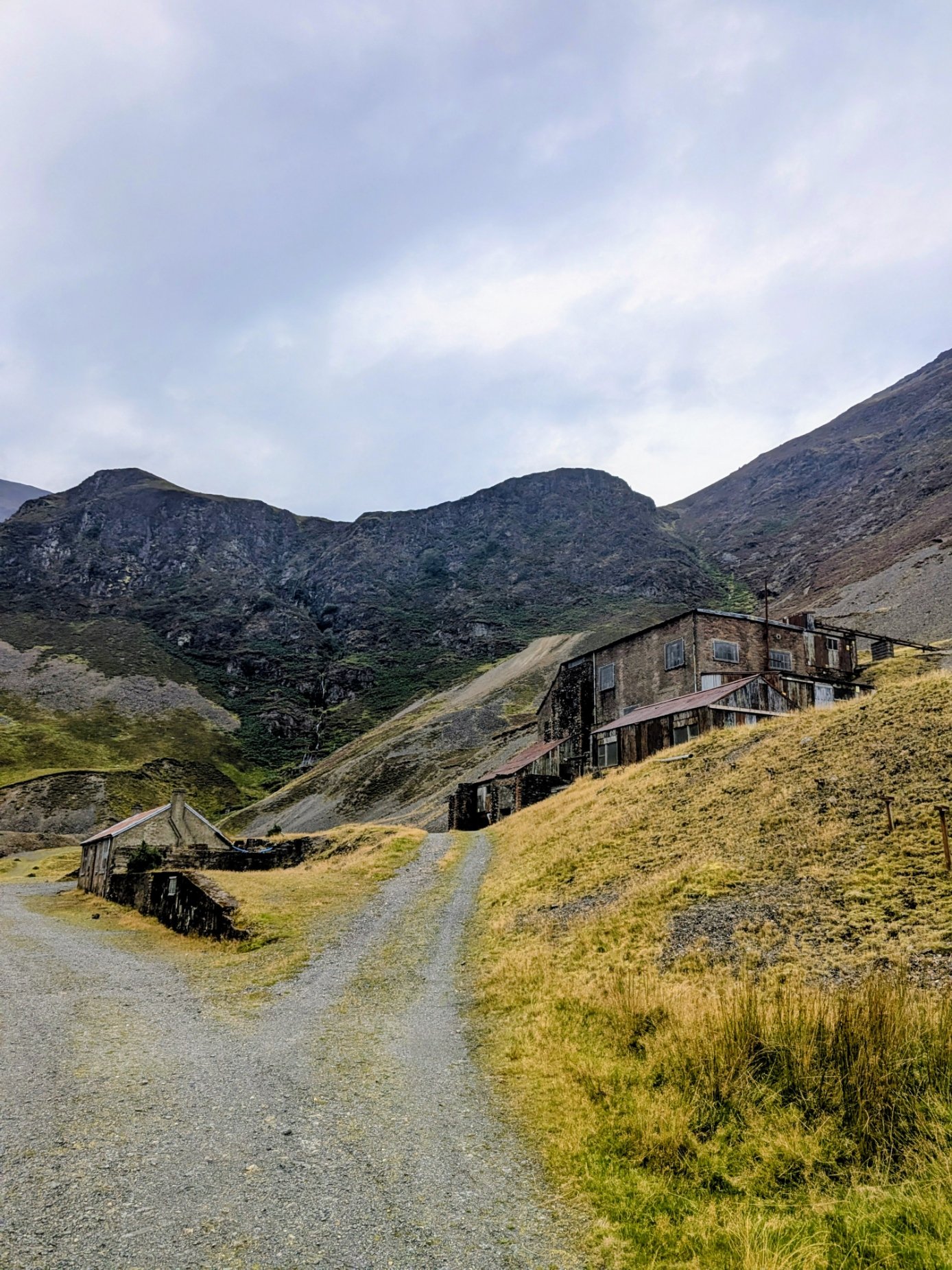
What stands at the head of Coledale is a working industrial site that stopped and was left. The mill is the large building against the crag, and it is the important one: Historic England rates it the best-preserved barytes mill in the country, with its ore-refining machinery still in place.

The former processing mill at Force Crag Mine, a large timber and brick building set against the crags at the head of Coledale
The processing mill at Force Crag, with the crag it takes its name from behind.

What was mined here

Force Crag was worked for galena (lead), sphalerite (zinc) and baryte, also written barytes. Galena was identified when the site was first investigated in 1775. Historic England records lead being mined from 1839 until 1865, and barytes and zinc intermittently from 1867. Across its whole life the mine produced roughly 60,000 tons of barytes, 1,248 tons of zinc and 624 tons of lead, plus silver.

Baryte is not a household name, but it is a useful mineral: it is very heavy for its size, which is why baryte is used as a weighting agent in the drilling fluids used in oil and gas drilling — the bulk of UK output goes to that — and why barium sulphate is used in the barium meals given for radiographic imaging. Those are uses of the mineral in general; what Force Crag's own output went to is not something we can tell you.

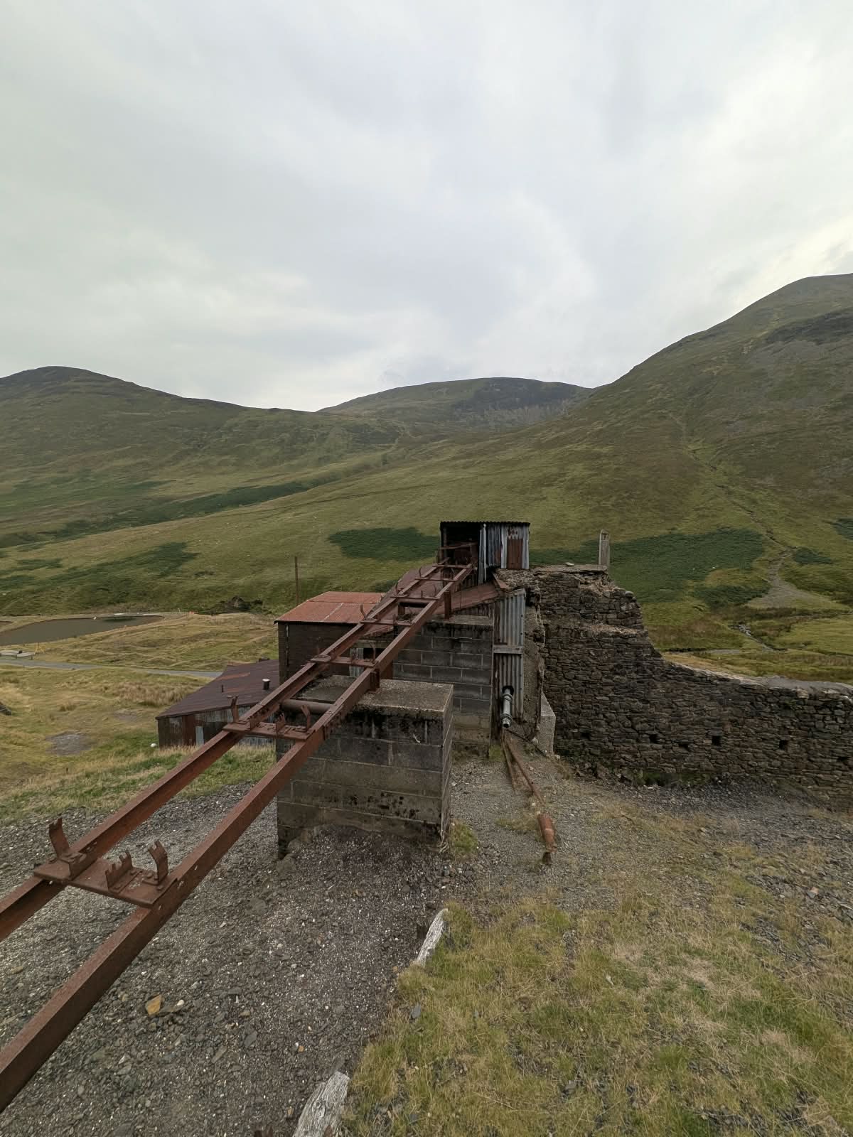
Rusted incline rails running down the hillside towards the buildings at Force Crag Mine
Incline rails running down to the mill.
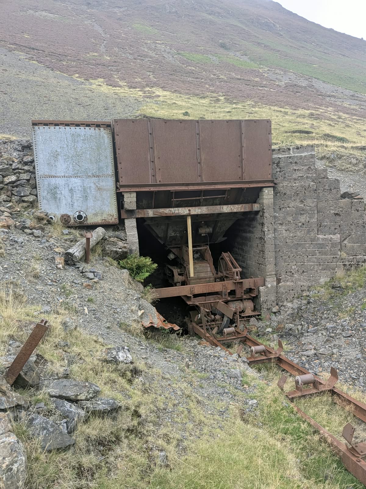
Rusted steel ore bin and machinery above a stone-lined opening, with rails in the foreground
Machinery left in place at the mine.

1939, and the end

Barytes became a strategic mineral in wartime, and Force Crag was expanded to suit. Tampimex Oil Products took the mine over in 1939; the mill, originally built in 1908–9, was redesigned in 1939–40, and in 1940 an aerial ropeway was built to bring ore down to it from the High Force track, some 740 feet above. By 1947 35,000 tons of barytes had been taken out. Laporte Chemicals worked the mine later.

Production stopped in 1990, after a collapse in Zero Level, and the mine was formally abandoned the following year. Both dates circulate and both are right — they describe two different things. The National Trust describes Force Crag as the last working metal ore mine in the Lake District.

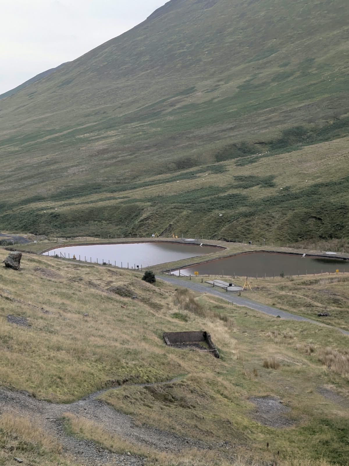
The ponds on the valley floor

The fenced ponds you pass are a water treatment scheme. Metals — principally zinc, cadmium and lead — drain out of the disused workings and spoil into Coledale Beck, and the scheme is there to take them out again. It was devised by Newcastle University with the Environment Agency, the National Trust and the body now operating as the Mining Remediation Authority. It matters downstream: Coledale Beck feeds into the Bassenthwaite Lake Special Area of Conservation.

Two fenced water treatment ponds on the valley floor below the fellside at Force Crag
The treatment ponds, part of the scheme cleaning metals out of Coledale Beck.

Be straight about this

Can you go inside?

Not on your own — though what you find on the ground is not quite what "abandoned mine" suggests, so it is worth describing properly.

The buildings are more secure than they look. Windows are barred, and doors and gates are sheeted over with metal. The main structures are effectively sealed.

What is open are the shed areas — and that is almost certainly what the warnings about roofs are there for. The danger is in the open parts, not the sealed ones. Take those signs at face value: they are about structural danger, not about keeping people off the site.

The mine itself is only accessible on one of the National Trust's guided open days — a small number each year.

We are deliberately not listing dates. They change from year to year and a date on a web page goes stale within months — check the National Trust's Borrowdale pages for the current ones.

National Trust — Borrowdale & Derwent Water
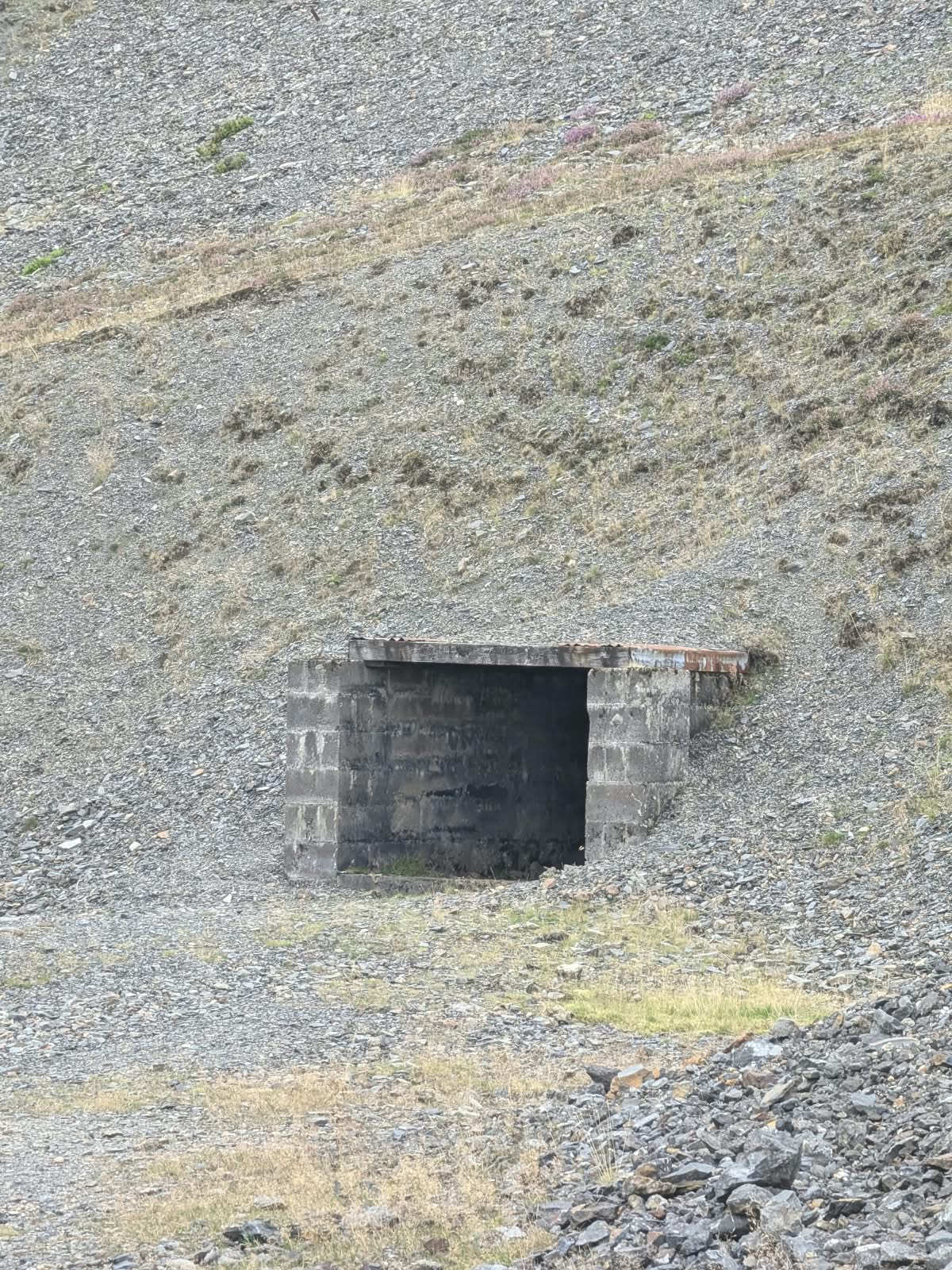
A blockwork mine entrance set into a slope of loose grey spoil
One of the sealed entrances — the buildings are not sealed, and the warnings about them are there for a reason.

Afterwards

Where to eat in Braithwaite

The walk finishes in the village, which is the right way round. Three places, all in Braithwaite itself.

Royal Oak

Pub · the finish point

The pub the route starts and ends at — you cross the bridge by it on the way out, and it is the obvious place to end up on the way back. Food and drink.

017683 92355

royaloak-braithwaite.com

Coledale Inn

Inn · dog friendly

A family-run inn above the village, taking its name from the valley you have just walked. Dog friendly, which matters if you have brought one up the track with you.

coledale-inn.co.uk

Braithwaite House

Village shop · tea room · rooms

The place to pick up supplies before you set off, and a tea room and rooms as well. The shop has traded in the village since the 1830s, by its own account.

braithwaitehouse.co.uk

Make a day of it

Whinlatter Forest is directly across the valley — England's only true mountain forest, with bike trails, Go Ape and family walks. If this walk is shorter than your day, that is the other half of it.

More walks nearby

Braithwaite is a couple of miles from Keswick. See walks around Keswick for the rest, or the full Lake District walks guide.

Common questions

Force Crag Mine, answered

Where is Force Crag Mine?
Force Crag Mine sits at the head of the Coledale valley, above the village of Braithwaite, about two miles west of Keswick. There is no road to it — the mine is reached on foot along its old access track. Walkers start from the informal parking pull-in on the Whinlatter road just outside Braithwaite, at ///jeeps.startles.hushed, and the track runs from there to the mine buildings at the valley head.
Is there a walk from Braithwaite to Force Crag Mine?
Yes. It is an out-and-back walk along the mine's own access track — roughly 8.3 km or 5.2 miles there and back from Braithwaite village, with around 240 m of ascent from the village and about 145 m if you start from the car park. Moving time is around 1 hour 40 minutes; allow 2 to 2.5 hours with time at the mine. The track is wide and well surfaced, and the only real climb comes in the first stretch. Full step-by-step route.
Where can I park for the Force Crag Mine walk?

The walk-start pull-in is an informal free gravel area off the Whinlatter road, at ///jeeps.startles.hushed, with the National Trust information board beside it. It holds five or six cars and fills early — local advice on a busy day is to arrive by around 7am — though it turns over reasonably quickly because most people here are on a short walk.

If it is full, Braithwaite CofE Primary School opens its grounds to parking at weekends and during school holidays only, never on a term-time weekday, for a suggested all-day donation payable by cash in the letterbox by the front door or online through the school's JustGiving page. No overnight stays or camping. Check the school's own site for the current amount.

There is also the old road across from the village, long used for free parking, but a new sign has appeared recently and the restriction is not clear — read the sign before you leave the car. More on parking.

How long is the Force Crag Mine walk?
Around 8.3 km or 5.2 miles out and back from Braithwaite village, with about 240 m of ascent. Moving time is roughly 1 hour 40 minutes, and 2 to 2.5 hours is a realistic allowance once you have spent time at the mine. Figures published elsewhere are often shorter because they are measured from the car park rather than the village — from the car park the ascent is nearer 145 m. It is worth checking which start point a figure refers to before you plan around it.
Can you go inside Force Crag Mine?
Not on your own. The buildings are more secure than they look — windows barred, doors and gates sheeted over with metal, the main structures effectively sealed. What is open are the shed areas, and that is almost certainly what the warnings about roofs are there for. Take those signs at face value: they concern structural danger rather than keeping people off the site. The mine itself is only accessible on one of the National Trust's guided open days, a small number each year. Dates change from year to year, so check the National Trust's Borrowdale pages for the current ones rather than relying on a date you read somewhere. More on access.
What is the history of Force Crag Mine?
Force Crag was worked for galena (lead), sphalerite (zinc) and baryte. Historic England records lead being mined from 1839 until 1865, and barytes and zinc intermittently from 1867; galena was identified when the site was first investigated in 1775. Output over its life came to roughly 60,000 tons of barytes, 1,248 tons of zinc and 624 tons of lead, plus silver. Tampimex Oil Products took the mine over in 1939, the mill was redesigned in 1939–40 and an aerial ropeway was built in 1940; 35,000 tons of barytes had been extracted by 1947, and Laporte Chemicals worked it later. Production stopped in 1990 after a collapse in Zero Level, and the mine was formally abandoned the following year. It is now a Scheduled Monument and a Site of Special Scientific Interest, owned by the National Trust, and a water treatment scheme on the site cleans metals out of Coledale Beck. More on the mine.