Blencathra in the Lake District
Northern Fells · Saddleback · 868 m

Blencathra

The great scalloped wall of fell that fills the windscreen as you drive the A66 — and the mountain behind one of the most serious ridge scrambles in England. Here is how to climb it, including the routes that skip Sharp Edge entirely.

868 m

Height · 2,848 ft

~5 miles

Sharp Edge circular

3.5–4 hrs

Blease Fell route

Hard

Grade 1 scramble on Sharp Edge

Saddleback · Northern Fells

The mountain everyone recognises from the A66

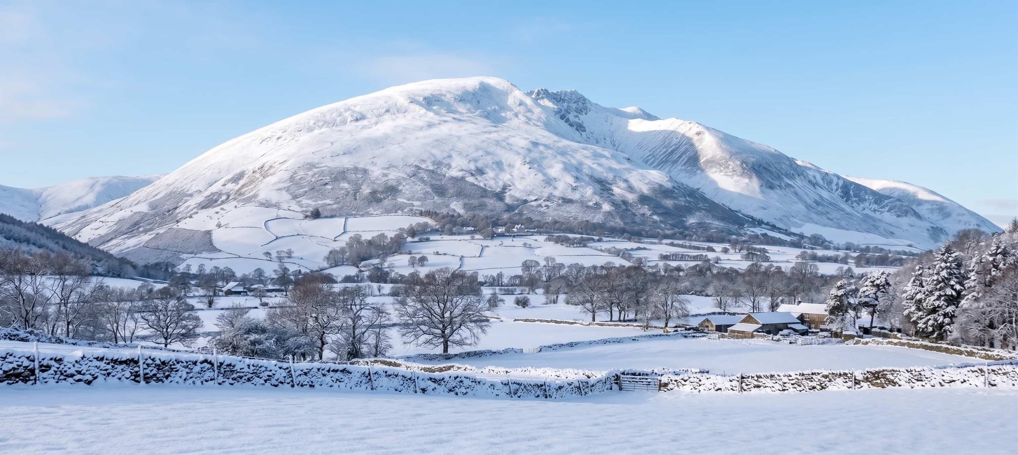
Blencathra rises to 868 m at the northern edge of the Lake District, straight up from the A66 between Keswick and Penrith. It is also known as Saddleback, after the dipped profile you see from the east, where the summit ridge sags between Hallsfell Top and Foule Crag.

Most people meet it from the south, and it is unforgettable: a row of steep, parallel ridges dropping in near-perfect symmetry to the valley at Threlkeld. Those ridges are the point of the mountain. Blencathra is not a fell you plod up one side of — it offers half a dozen genuinely different ways to the top, ranging from a straightforward if steep walk to one of the most serious ridge scrambles in England.

That range is also the problem. Blencathra's fame rests largely on Sharp Edge, and a lot of people arrive assuming Sharp Edge is the way up. It is not, and for most visitors it should not be. The sections below set out the honest choice first, then cover each route in turn.

Start here

Which route should you take?

Be honest with yourself about this one, because the gap between Blencathra's routes is unusually wide. The same summit can be a stiff hill walk or a committing scramble depending on the line you choose.

If you are a confident, experienced scrambler with a head for heights, and the rock is dry, Sharp Edge is a magnificent way onto the mountain. If any part of that sentence does not describe you and today's conditions, take one of the walking routes. You reach the identical summit and the identical view.

Blease Fell from Threlkeld

Moderate

~5 miles · 3.5–4 hrs · no scrambling

The honest answer for most visitors. Steep and unrelenting up grassy slopes, but a walk from start to finish with no hands-on sections and no exposure.

Scales Fell from Scales

Moderate

~5 miles · 4–5 hrs · no scrambling

The other walking line, and the easiest way down off the mountain. Often combined with a look at Scales Tarn without committing to the Edge above it.

Hall's Fell Ridge from Threlkeld

Hard

~4.5 miles · 4–5 hrs · hands needed

A superb narrow ridge that leads directly to the summit cairn. Easier and far less exposed than Sharp Edge, but still a step beyond a simple walk.

Sharp Edge circular from Scales

Hard

~5 miles · 5–6 hrs · Grade 1 scramble

Experienced scramblers, dry conditions only. Via Scales Tarn, across the Edge, then usually down Scales Fell or Hall's Fell.

Safety-critical

Sharp Edge

Sharp Edge is a Grade 1 scramble in summer conditions — a narrow arête of rock above Scales Tarn, with steep ground falling away on both sides. Under snow or ice it is not a scramble at all but a winter climb, requiring axe, crampons and the experience to use them on exposed ground.

Two things make it more serious than its short length suggests. The first is the rock: generations of boots have polished the crest to a shine, and when it is wet that polish becomes genuinely treacherous. Sharp Edge has a long-standing reputation for being greasy in the damp, and it is deserved. The second is the exit — the slabby step onto Foule Crag at the far end, which is where a lot of people find themselves committed and uncomfortable.

People are seriously injured on Sharp Edge, and fatalities do occur, most often in wet, windy or icy conditions. We are not going to put a number on that, because the number is not the useful part. The useful part is this: almost every incident follows the same shape — someone commits to the crossing in conditions that had already turned, or discovers partway across that they cannot reverse what they have climbed.

Check the mountain forecast before you commit, not the valley forecast. The Lake District Weatherline service gives a fell-top assessment for the northern fells and is the sensible last check before you leave the car.

Do not attempt Sharp Edge in wet, windy or icy conditions.

If the rock is wet, if the wind is strong enough to unbalance you, or if there is any snow or ice on the ground, do not start the crossing. Turn to Scales Fell or Blease Fell instead — both reach the same summit safely.

If you are already on the Edge and it feels wrong, it is always acceptable to reverse carefully back to Scales Tarn while you still can. Turning round is not a failure; being talked past your limit by the people behind you is how accidents happen.

Sharp Edge is not a suitable place for dogs, for children, or for anyone unsure about exposure.
The route most people should take

Climbing Blencathra without Sharp Edge

This is one of the most common things people search for about Blencathra, and it deserves a straight answer: yes — you can climb Blencathra with no scrambling whatsoever, and the walking routes are genuinely good days out rather than consolation prizes.

Blease Fell from Threlkeld is the most straightforward. Start from the small car park up Blease Road above the Blencathra Field Centre and climb the broad grassy shoulder directly. It is steep and it keeps being steep — there is no way to make 700 m of ascent gentle — but it is a walk the whole way, with no hands-on sections and no exposure. Around 5 miles round trip and 3.5–4 hours.

Scales Fell from Scales is the other option, starting from the A66 side. It is slightly longer, and it is the easiest descent from the summit, which is why so many Sharp Edge parties come down this way. You can also walk up to Scales Tarn and simply admire Sharp Edge from below without setting foot on it — an excellent half-day in its own right.

Both routes reach the same 868 m summit, with the same enormous view north over the Solway and south across the whole central Lake District.

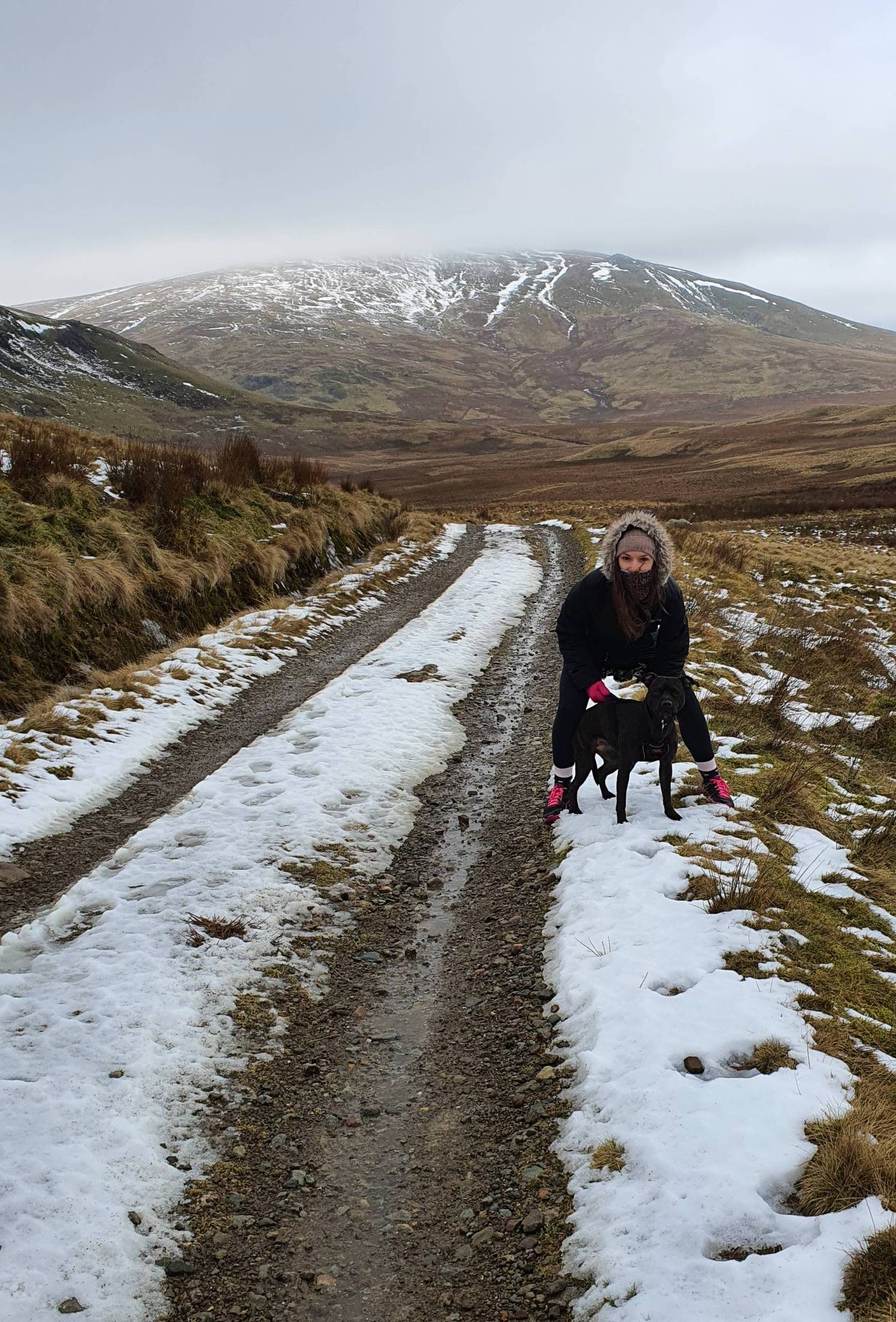
A walker and Cass the Staffordshire Bull Terrier on a snowy track below Blencathra, Lake District
Winter on the approach tracks below Blencathra — Cass the Staffordshire Bull Terrier leading the way. A photo by The Lakes Planner.

The connoisseur's walking line

Hall's Fell Ridge

Hall's Fell is the ridge that runs straight up from Threlkeld to the summit cairn — and it is widely regarded as one of the finest direct ascents in the Lake District, because it delivers you precisely at the top rather than onto a plateau.

It is airy, and you will want hands in a few places near the top where the crest narrows, but it is markedly easier and less exposed than Sharp Edge, with far more scope to pick an easier line just below the crest if the ridge itself feels too much.

Treat it as the middle ground: more than a walk, considerably less than Sharp Edge. In poor weather or high wind, the same caution applies — and Blease Fell sits right next door as the safe alternative.

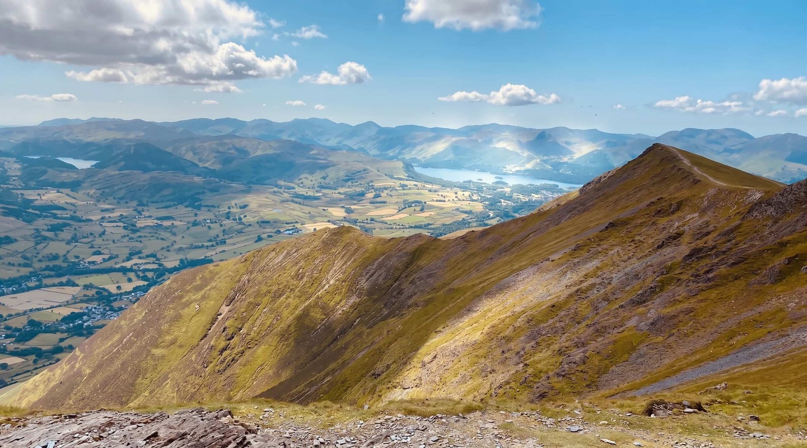
Looking down one of Blencathra's steep parallel ridges to Threlkeld and the valley, Lake District
Blencathra's ridges drop straight to Threlkeld — Hall's Fell runs up the crest to the summit. A photo by The Lakes Planner.

Logistics

Parking & getting there

Scales — for Sharp Edge, Scales Tarn and Scales Fell. There is a small free car park beside the White Horse Inn, plus lay-bys on the A66 near Scales. All of it is limited, and on a fine weekend it is gone early, so arrive at the start of the day rather than the middle. There is no bus stop at Scales itself.

Threlkeld — for Hall's Fell and Blease Fell. There is limited parking in the village, and a small car park up Blease Road above the Blencathra Field Centre. Please note there is no public parking at the Field Centre itself.

By bus — the X4 and X5 Keswick–Penrith services stop at the Horse and Farrier in Threlkeld, roughly hourly. That makes Blencathra one of the genuinely car-free big fells: bus to Threlkeld, up Blease Fell or Hall's Fell, and back down to the same stop.

The mountain's centrepiece

Scales Tarn

Scales Tarn sits at around 600 m in a deep glacial corrie directly beneath Sharp Edge — a dark circle of water enclosed by steep ground on three sides. It is the natural halfway point of the Scales approach and the best photograph on the mountain, with the Edge drawn in profile above it.

It is also the decision point. From the tarn you can see the full length of Sharp Edge and judge conditions with your own eyes: whether the rock is wet, how strong the wind is over the crest, how comfortable the parties already on it look. If the answer is no, Scales Fell climbs away to your right and gets you to the summit anyway.

Answered

Common questions

Is Sharp Edge dangerous?

Sharp Edge is a Grade 1 scramble with genuine exposure, and it deserves to be taken seriously. The ridge is narrow, the rock has been polished smooth by generations of boots, and it becomes notably slippery when wet. People are seriously injured here, and fatalities do occur — most often in wet, windy or icy conditions, or when walkers commit to the crossing and then find they cannot reverse it. It is not a walk with a bit of hands-on scrambling; it is a scramble with a long drop on either side. If you are unsure, Blencathra has excellent routes that avoid it entirely.

Can you climb Blencathra avoiding Sharp Edge?

Yes — and for most visitors that is the right choice. Blease Fell from Threlkeld is the most straightforward way up: steep and unrelenting, but a walk throughout with no scrambling at all. Scales Fell is the other good option and makes the easiest descent. You reach exactly the same 868 m summit and the same view; you simply skip the scramble.

How long does it take to climb Blencathra?

Allow 3.5–4 hours for the Blease Fell route from Threlkeld, around 5 miles there and back. The Sharp Edge circular from Scales is roughly 5 miles but takes 5–6 hours, because scrambling is slow and you should never rush it. Add time for stops, photographs and — on Sharp Edge — for waiting if the ridge is busy.

Where do you park for Blencathra?

For Sharp Edge, Scales Tarn and Scales Fell, there is a small free car park beside the White Horse Inn at Scales, plus lay-bys on the A66 nearby — all limited, so arrive early. For Hall's Fell and Blease Fell, use Threlkeld village or the small car park up Blease Road above the Blencathra Field Centre; there is no public parking at the Centre itself. The X4 and X5 Keswick–Penrith buses stop at the Horse and Farrier in Threlkeld, roughly hourly, which makes a genuine car-free ascent possible.

Is Sharp Edge harder than Striding Edge?

Most people who have done both consider Sharp Edge the more serious of the two. It is narrower, the rock is more polished and greasy when damp, and the awkward slabby exit onto Foule Crag catches people out. Striding Edge is longer and busier; Sharp Edge is shorter but less forgiving. If Striding Edge felt at your limit, treat Sharp Edge as a step up, not a like-for-like.

Keep exploring

More guides & nearby